How to get to Sea N Red Charters by bus?
Click on the bus route to see step by step directions with maps, line arrival times and updated time schedules.
From FG Auto Service, Cape Coral
95 minFrom Mariner High School, Cape Coral
112 minFrom STARBUCKS, Cape Coral
63 minFrom Boombalattis Sandwich Company, Mcgregor
57 minFrom Associates in Digestive Health, Cape Coral
60 minFrom Lee County Player Development Complex, Fort Myers
74 minFrom 1890 Pine Island Rd Parking, Cape Coral
63 minFrom Liberty Tax Service, Cape Coral
38 minFrom Lee County Fl Real Estate Homes Condos for Sale, Cape Coral
74 minFrom Saluscare, Fort Myers
39 min
Bus stops near Sea N Red Charters in Fort Myers
Bus lines to Sea N Red Charters in Fort Myers
What are the closest stations to Sea N Red Charters?
The closest stations to Sea N Red Charters are:
- Barkley Cir @ Matthew Dr is 245 yards away, 4 min walk.
- Colonial Blvd @ Tilton Ct is 308 yards away, 4 min walk.
- S Cleveland Ave @ D St-Sb1 is 652 yards away, 9 min walk.
Which bus lines stop near Sea N Red Charters?
These bus lines stop near Sea N Red Charters: 120, 130, 140.
What’s the nearest bus station to Sea N Red Charters in Fort Myers?
The nearest bus stations to Sea N Red Charters in Fort Myers are Barkley Cir @ Matthew Dr and Colonial Blvd @ Tilton Ct. The closest one is a 4 min walk away.
What time is the first bus to Sea N Red Charters in Fort Myers?
The 140 is the first bus that goes to Sea N Red Charters in Fort Myers. It stops nearby at 5:02 AM.
What time is the last bus to Sea N Red Charters in Fort Myers?
The 140 is the last bus that goes to Sea N Red Charters in Fort Myers. It stops nearby at 10:54 PM.
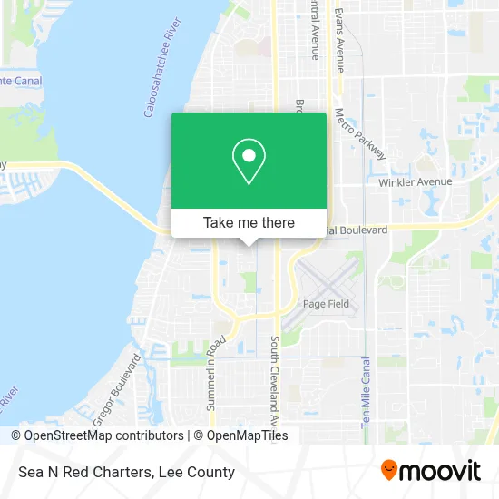
See Sea N Red Charters, Fort Myers, on the map
Public Transit to Sea N Red Charters in Fort Myers
Wondering how to get to Sea N Red Charters in Fort Myers? Moovit helps you find the best way to get to Sea N Red Charters with step-by-step directions from the nearest public transit station.
Moovit provides free maps and live directions to help you navigate through your city. View schedules, routes, timetables, and find out how long does it take to get to Sea N Red Charters in real time.
Looking for the nearest stop or station to Sea N Red Charters? Check out this list of stops closest to your destination: Barkley Cir @ Matthew Dr; Colonial Blvd @ Tilton Ct; S Cleveland Ave @ D St-Sb1.
Bus: 120, 130, 140.
Want to see if there’s another route that gets you there at an earlier time? Moovit helps you find alternative routes or times. Get directions from and directions to Sea N Red Charters easily from the Moovit App or Website.
We make riding to Sea N Red Charters easy, which is why over 1.5 million users, including users in Fort Myers, trust Moovit as the best app for public transit. You don’t need to download an individual bus app or train app, Moovit is your all-in-one transit app that helps you find the best bus time or train time available.
For information on prices of bus, costs and ride fares to Sea N Red Charters, please check the Moovit app.
Use the app to navigate to popular places including to the airport, hospital, stadium, grocery store, mall, coffee shop, school, college, and university.
Sea N Red Charters Address: 4640 Deleon St street in Fort Myers
- Southwest Florida College,
- Burlington Coat Factory,
- Osslin Agency Models & Talent,
- Par Counseling Services,
- Colonial Life,
- GSS Enterprise Network,
- Glam-R-US,
- Lindsay Moore Artistries,
- Family Universal Medical Center,
- Cryo Chill,
- Blue Bridge Therapy Center,
- Dedicated Senior Medical Center,
- Hotbins,
- Christ Centered Life Store,
- Amazon Locker-Neurology,
- Emma Rao Realtor,
- Malt Realty,
- Edison Institute,
- FedEx,
- Royal Palm Ministries
Places Near Sea N Red Charters (Fort Myers)
- Lee County Tax Collector, Cape Coral,
- I-75 & MLK (Exit 138), Fort Myers,
- Rosa Parks Transportation Center, Fort Myers,
- Pelican Landing Beach Shuttle, Bonita Springs,
- I-75 & Colonial (Exit 136), Fort Myers,
- Lehigh Acres, FL, Lehigh Acres,
- Bonita Springs, FL, Bonita Springs,
- Edison Mall, Fort Myers,
- U.S.-41 / Colonial Blvd. Intersection, Fort Myers,
- Amazon Warehouse Rsw5,
- Seminole Casino Hotel Immokalee,
- Walmart Supercenter, Fort Myers,
- Bonita Beach, Bonita Springs,
- Matlacha Nude Beach, Matlacha Isles-Matlacha Shores,
- Miromar Outlets, Estero,
- All About U Naples Escorts, Pine Ridge,
- Bonita Bay Private Beach Club, Bonita Springs,
- Ft Myers Airport RSW,
- Flixbus, Fort Myers,
- US-41, Fort Myers
How to get to popular places in Lee County with public transit
Get around Fort Myers by public transit!
Traveling around Fort Myers has never been so easy. See step by step directions as you travel to any attraction, street or major public transit station. View bus and train schedules, arrival times, service alerts and detailed routes on a map, so you know exactly how to get to anywhere in Fort Myers.
When traveling to any destination around Fort Myers use Moovit's Live Directions with Get Off Notifications to know exactly where and how far to walk, how long to wait for your line, and how many stops are left. Moovit will alert you when it's time to get off — no need to constantly re-check whether yours is the next stop.
Wondering how to use public transit in Fort Myers or how to pay for public transit in Fort Myers? Moovit public transit app can help you navigate your way with public transit easily, and at minimum cost. It includes public transit fees, ticket prices, and costs. Looking for a map of Fort Myers public transit lines? Moovit public transit app shows all public transit maps in Fort Myers with all bus routes and stops on an interactive map.
Lee County has 1 transit type(s), including: bus, operated by several transit agencies, including LeeTran, CAT and FlixBus-us