Directions to Sea Rogue Fishing Charters (Merrick) with public transportation
The following transit lines have routes that pass near Sea Rogue Fishing Charters
 Bus: N4, N40X.
- Train: BABYLON BRANCH.
How to get to Sea Rogue Fishing Charters by bus?
Click on the bus route to see step by step directions with maps, line arrival times and updated time schedules.
From Uniondale, NY, Uniondale
56 minFrom Valley Stream, NY, Valley Stream
71 minFrom Garden City, NY, Garden City
57 minFrom Roosevelt Field Mall Bus Terminal, East Garden City
69 minFrom Green Acres Mall-North, Valley Stream
77 minFrom Green Acres Mall, South Valley Stream
87 minFrom Walmart, Valley Stream
81 minFrom East Meadow, NY, East Meadow
70 minFrom Mercy Hospital, Rockville Centre
89 minFrom Plattduetsche Park, Franklin Square
82 min
How to get to Sea Rogue Fishing Charters by train?
Click on the train route to see step by step directions with maps, line arrival times and updated time schedules.
From Valley Stream, NY, Valley Stream
62 minFrom Garden City, NY, Garden City
91 minFrom Roosevelt Field Mall Bus Terminal, East Garden City
104 minFrom Green Acres Mall-North, Valley Stream
64 minFrom Green Acres Mall, South Valley Stream
70 minFrom Walmart, Valley Stream
63 minFrom Plattduetsche Park, Franklin Square
99 min
Train station near Sea Rogue Fishing Charters in Merrick
- Baldwin, 6 min walk,VIEW
What are the closest stations to Sea Rogue Fishing Charters?
The closest stations to Sea Rogue Fishing Charters are:
- Baldwin is 445 yards away, 6 min walk.
Which bus lines stop near Sea Rogue Fishing Charters?
These bus lines stop near Sea Rogue Fishing Charters: N4, N40X.
Which train line stops near Sea Rogue Fishing Charters?
BABYLON BRANCH (Babylon)
What’s the nearest train station to Sea Rogue Fishing Charters in Merrick?
The nearest train station to Sea Rogue Fishing Charters in Merrick is Baldwin. It’s a 6 min walk away.
What time is the first train to Sea Rogue Fishing Charters in Merrick?
The BABYLON BRANCH is the first train that goes to Sea Rogue Fishing Charters in Merrick. It stops nearby at 3:26 AM.
What time is the last train to Sea Rogue Fishing Charters in Merrick?
The BABYLON BRANCH is the last train that goes to Sea Rogue Fishing Charters in Merrick. It stops nearby at 3:32 AM.
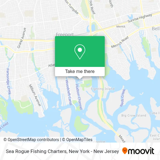
See Sea Rogue Fishing Charters, Merrick, on the map
Public Transit to Sea Rogue Fishing Charters in Merrick
Wondering how to get to Sea Rogue Fishing Charters in Merrick? Moovit helps you find the best way to get to Sea Rogue Fishing Charters with step-by-step directions from the nearest public transit station.
Moovit provides free maps and live directions to help you navigate through your city. View schedules, routes, timetables, and find out how long does it take to get to Sea Rogue Fishing Charters in real time.
Looking for the nearest stop or station to Sea Rogue Fishing Charters? Check out this list of stops closest to your destination: Baldwin.
Bus: N4, N40X.Train: BABYLON BRANCH.
Want to see if there’s another route that gets you there at an earlier time? Moovit helps you find alternative routes or times. Get directions from and directions to Sea Rogue Fishing Charters easily from the Moovit App or Website.
We make riding to Sea Rogue Fishing Charters easy, which is why over 1.5 million users, including users in Merrick, trust Moovit as the best app for public transit. You don’t need to download an individual bus app or train app, Moovit is your all-in-one transit app that helps you find the best bus time or train time available.
For information on prices of bus and train, costs and ride fares to Sea Rogue Fishing Charters, please check the Moovit app.
Use the app to navigate to popular places including to the airport, hospital, stadium, grocery store, mall, coffee shop, school, college, and university.
Sea Rogue Fishing Charters Address: 696 S Main St street in Merrick
- First Steps Daycare,
- Cow Meadow Park,
- East Coast Wreck Diving,
- Star Music Group,
- Randall Park,
- Cow Meadow Dog Park,
- Jac Sportfishing Charters,
- On the Water Boat Training,
- Freeport Resort,
- Msb Computers,
- Long Beach Board Walk,
- Ocean Marine,
- Carl J Cerruti Cpa,
- Nunzi's by the Water,
- Villa Lobos Tapas,
- Kingsborough Community College,
- Ngb Construction Inc.,
- Titan Junk Removal,
- John Vidas Marine Services,
- Freeport Charter Boats
Places Near Sea Rogue Fishing Charters (Merrick)
- San Gennaro Feast, Manhattan,
- 376 Hudson Street, Manhattan,
- Hudson Yards, Manhattan,
- Times Square, Manhattan,
- Bellevue Hospital, Manhattan,
- Mountainside Hospital, Glen Ridge,
- 3 Stone St, Manhattan,
- Rockefeller Center, Manhattan,
- 111 Centre New York City Supreme Court, Manhattan,
- 66 John Street, Manhattan,
- 911 Memorial, Manhattan,
- Katz's Deli, Manhattan,
- Wall Street, Manhattan,
- Queens Center Mall, Queens,
- Pier 83, Manhattan,
- qqqq, Manhattan,
- 26 Federal Plaza, Manhattan,
- Chinatown, Manhattan,
- SoHo, Manhattan,
- 1 Police Plaza, Manhattan
How to get to popular places in New York - New Jersey with public transit
Get around Merrick by public transit!
Traveling around Merrick has never been so easy. See step by step directions as you travel to any attraction, street or major public transit station. View bus and train schedules, arrival times, service alerts and detailed routes on a map, so you know exactly how to get to anywhere in Merrick.
When traveling to any destination around Merrick use Moovit's Live Directions with Get Off Notifications to know exactly where and how far to walk, how long to wait for your line, and how many stops are left. Moovit will alert you when it's time to get off — no need to constantly re-check whether yours is the next stop.
Wondering how to use public transit in Merrick or how to pay for public transit in Merrick? Moovit public transit app can help you navigate your way with public transit easily, and at minimum cost. It includes public transit fees, ticket prices, and costs. Looking for a map of Merrick public transit lines? Moovit public transit app shows all public transit maps in Merrick with all Bus, Train, Subway, Light Rail, Ferry and Cable Car routes and stops on an interactive map.
New York - New Jersey has 6 transit type(s), including: Bus, Train, Subway, Light Rail, Ferry and Cable Car, operated by several transit agencies, including MTA Subway, Metro-North Railroad, LIRR, PATH, MTA New York City Transit - Express routes, MTA Bus, NJ Transit, NYC Ferry, NICE bus, Bee-Line Bus, NJ Transit Rail, Norwalk Transit District, Hartford Line, River Valley Transit and HART