How to get to Sector 22 by bus?
Click on the bus route to see step by step directions with maps, line arrival times and updated time schedules.
From Atlas Copco India, Pune & Velhe
40 minFrom Pimpri-Chinchwad Bus Stand, Pune & Velhe
35 minFrom hinjewadi Phase 2, Paud
61 minFrom International Institute of Information Technology (I2IT | PPCRC), Paud
64 minFrom Rakshak Chowk, Pune & Velhe
51 minFrom Natsamarat Nilu Phule Rang Mandir, Pune & Velhe
65 minFrom Infosys Circle Phase 1 Hinjawadi, Paud
59 minFrom D Y Patil Medical College, Pune & Velhe
45 minFrom Vaishnodevi Mandir Pimpri, Pune & Velhe
37 minFrom Dudulgaon, Pune & Velhe
61 min
How to get to Sector 22 by train?
Click on the train route to see step by step directions with maps, line arrival times and updated time schedules.
Bus stops near Sector 22 in Pune & Velhe
Train station near Sector 22 in Pune & Velhe
- Akurdi, 22 min walk,VIEW
Bus lines to Sector 22 in Pune & Velhe
- N15, Nigdi,VIEW
- 34, Aundh Gaon - Nigdi,VIEW
- 303, Nigdi - Akurdi Railway Station,VIEW
- 305, Nigdi - Vadgaon Mawal,VIEW
- 319, Mukai Chowk Terminal (Kiwale) - Pimplegurav,VIEW
- 329, Sudumbre Siddhant College - Pimpri Road,VIEW
- 332, Nigdi - Bebadohal Tata Motors,VIEW
- 335, Sangwade Gaon - Nigdi Bhakti Shakti Terminal,VIEW
- 338, Pimpri Road - Bhandara Dongar,VIEW
- 341, Nigdi - Urse Gaon Vasudev Ashram,VIEW
- 342, Nigdi - Urse Gaon Vasudev Ashram,VIEW
- 363, Samir Lawns Ravet - Pimpri Road,VIEW
- 365, Nigdi - Mukai Chowk Terminal (Kiwale),VIEW
- 367, Bhosari (Gavhane Wasti) - Mukai Chowk Terminal Kiwale,VIEW
- 368, Nigdi - Lonavala Railway Station,VIEW
- 371, Nigdi - Bhoyaregaon (Takave),VIEW
- 374, Nigdi - Sai Nagar,VIEW
- 375, Neilsoft Company Infosys (Phase 3) - Nigdi,VIEW
- 303A, Nigdi - Gahunje Gaon,VIEW
- 305A, Nigdi - Greenbase Industrial Park Navlakh Umbre,VIEW
What are the closest stations to Sector 22?
The closest stations to Sector 22 are:
- Ankush Chowk is 17 meters away, 1 min walk.
- Bhakti Shakti Terminal is 549 meters away, 8 min walk.
- Akurdi is 1701 meters away, 22 min walk.
Which bus lines stop near Sector 22?
These bus lines stop near Sector 22: 149, 348, 372, 42, N15.
Which train lines stop near Sector 22?
These train lines stop near Sector 22: 99810, 99904.
What’s the nearest train station to Sector 22 in Pune & Velhe?
The nearest train station to Sector 22 in Pune & Velhe is Akurdi. It’s a 22 min walk away.
What’s the nearest bus station to Sector 22 in Pune & Velhe?
The nearest bus station to Sector 22 in Pune & Velhe is Ankush Chowk. It’s a 1 min walk away.
What time is the first train to Sector 22 in Pune & Velhe?
The 99804 is the first train that goes to Sector 22 in Pune & Velhe. It stops nearby at 5:09 AM.
What time is the last train to Sector 22 in Pune & Velhe?
The 99901 is the last train that goes to Sector 22 in Pune & Velhe. It stops nearby at 12:54 AM.
What time is the first bus to Sector 22 in Pune & Velhe?
The RATRANI 6 is the first bus that goes to Sector 22 in Pune & Velhe. It stops nearby at 3:18 AM.
What time is the last bus to Sector 22 in Pune & Velhe?
The RATRANI 6 is the last bus that goes to Sector 22 in Pune & Velhe. It stops nearby at 3:20 AM.
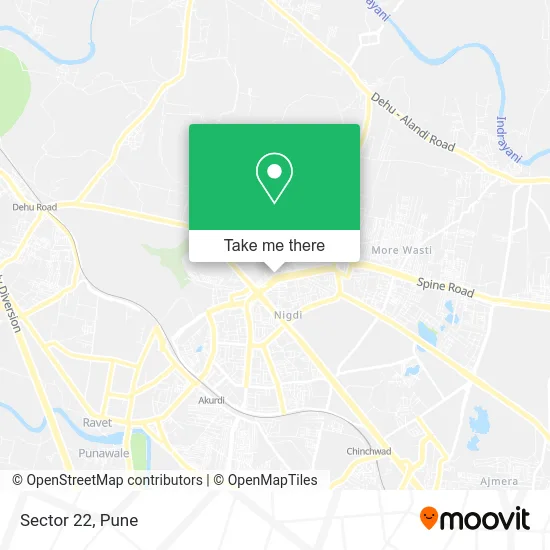
See Sector 22, Pune & Velhe, on the map
Public Transit to Sector 22 in Pune & Velhe
Wondering how to get to Sector 22 in Pune & Velhe? Moovit helps you find the best way to get to Sector 22 with step-by-step directions from the nearest public transit station.
Moovit provides free maps and live directions to help you navigate through your city. View schedules, routes, timetables, and find out how long does it take to get to Sector 22 in real time.
Looking for the nearest stop or station to Sector 22? Check out this list of stops closest to your destination: Ankush Chowk; Bhakti Shakti Terminal; Akurdi.
Bus: 149, 348, 372, 42, N15, 34, 303, 305, 319, 329, 43, 123, 139, 363E.Train: 99810, 99904, 99801, 99802, 99803, 99804, 99805.
Want to see if there’s another route that gets you there at an earlier time? Moovit helps you find alternative routes or times. Get directions from and directions to Sector 22 easily from the Moovit App or Website.
We make riding to Sector 22 easy, which is why over 1.5 million users, including users in Pune & Velhe, trust Moovit as the best app for public transit. You don’t need to download an individual bus app or train app, Moovit is your all-in-one transit app that helps you find the best bus time or train time available.
For information on prices of bus and train, costs and ride fares to Sector 22, please check the Moovit app.
Use the app to navigate to popular places including to the airport, hospital, stadium, grocery store, mall, coffee shop, school, college, and university.
Sector 22 Address: चिंचवाड 411044 MH street in Pune & Velhe
- Dr. Babasaheb Ambedkar Vasahat,
- Lok Shahir Anna Bhau Sathe Nagar,
- Tathagat,
- Ratnadeep Housing Society B-3,
- Bhimai CHS,
- Cremation Ground,
- Sant Nirankari Satsang Bhawan,
- Pcmc-Yamunanagar Maternity Home,
- Sulabh Shauchalaya,
- Sahityaratna Lokshahir Annabhau Sathe Nagar,
- Kalubai Mandir,
- Sant Nirankari Hospital-ER,
- Sahityaratna Lokshahir Anna Bhau Sathe Bus Terminal,
- Unireva Healthcare,
- Sahityratna Anna Bhau Sathe Smarak,
- Jindaram Guru Ka Trust,
- Mata Amritanandamayi Math माता अमृतानंदमयी मठ,
- M K Tyres Services,
- Ganesh Enterprise,
- Supti Lunch Home
Places Near Sector 22 (Pune & Velhe)
- BAPS Shri Swaminarayan Mandir, Pune & Velhe,
- Dagdusheth Halwai Ganpati Mandir, Pune & Velhe,
- Cognizant Deccan Campus (CDC), Paud,
- Laxmi Road, Pune & Velhe,
- Tulshibaug, Pune & Velhe,
- ISKCON Pune, Pune & Velhe,
- Westend Mall, Pune & Velhe,
- Vishwakarma Institute Of Technology (Vit), Pune & Velhe,
- Fc Road, Pune & Velhe,
- Pvr Icon - Pavilion Mall, Pune & Velhe,
- M G Road, Pune & Velhe,
- Symbiosis Lavale Bus Stop, Pune & Velhe,
- Swaminarayan Mandir, Pune & Velhe,
- Ion Digital Zone, Pune & Velhe,
- Chaturshringi Temple, Pune & Velhe,
- Senapati Bapat Road, Pune & Velhe,
- Pune Okayama Friendship Garden, Pune & Velhe,
- Dagadusheth Halwai Ganapati Temple, Pune & Velhe,
- Sarasbaug, Pune & Velhe,
- ISKCON Nvcc Temple, Pune & Velhe
How to get to popular places in Pune with public transit
Get around Pune & Velhe by public transit!
Traveling around Pune & Velhe has never been so easy. See step by step directions as you travel to any attraction, street or major public transit station. View bus and train schedules, arrival times, service alerts and detailed routes on a map, so you know exactly how to get to anywhere in Pune & Velhe.
When traveling to any destination around Pune & Velhe use Moovit's Live Directions with Get Off Notifications to know exactly where and how far to walk, how long to wait for your line, and how many stops are left. Moovit will alert you when it's time to get off — no need to constantly re-check whether yours is the next stop.
Wondering how to use public transit in Pune & Velhe or how to pay for public transit in Pune & Velhe? Moovit public transit app can help you navigate your way with public transit easily, and at minimum cost. It includes public transit fees, ticket prices, and costs. Looking for a map of Pune & Velhe public transit lines? Moovit public transit app shows all public transit maps in Pune & Velhe with all Bus, Train and Metro routes and stops on an interactive map.
Pune has 3 transit type(s), including: Bus, Train and Metro, operated by several transit agencies, including Pune Metro (Maha Metro), PMPML, PMPML Night Bus Service (Ratrani) and Central Railways (Indian Railways)