How to get to Secure Locksmith by bus?
Click on the bus route to see step by step directions with maps, line arrival times and updated time schedules.
From National Bank, Greenwood
59 minFrom Rural Street And Brookside Parkway, Indianapolis City (Balance)
61 minFrom THE BALT, Indianapolis City (Balance)
72 minFrom Outsourced Controllership Group CPA's, Indianapolis City (Balance)
32 minFrom Emerson Street and 16th Street, Indianapolis City (Balance)
64 minFrom 1152 North White River Parkway West Drive, Indianapolis
55 minFrom Kayla Shambarger, Indianapolis City (Balance)
75 minFrom White River State Park, Indianapolis City (Balance)
42 minFrom 1629 Roosevelt Ave Parking, Indianapolis City (Balance)
57 minFrom Tornado Bus Company, Indianapolis City (Balance)
49 min
Bus stops near Secure Locksmith in Beech Grove
What are the closest stations to Secure Locksmith?
The closest stations to Secure Locksmith are:
- Main St & 18th Ave is 370 yards away, 5 min walk.
- Main St & 10th Ave is 1134 yards away, 14 min walk.
Which bus line stops near Secure Locksmith?
13 (Transit Center)
What’s the nearest bus station to Secure Locksmith in Beech Grove?
The nearest bus station to Secure Locksmith in Beech Grove is Main St & 18th Ave. It’s a 5 min walk away.
What time is the first bus to Secure Locksmith in Beech Grove?
The 13 is the first bus that goes to Secure Locksmith in Beech Grove. It stops nearby at 4:40 AM.
What time is the last bus to Secure Locksmith in Beech Grove?
The 56 is the last bus that goes to Secure Locksmith in Beech Grove. It stops nearby at 10:03 PM.
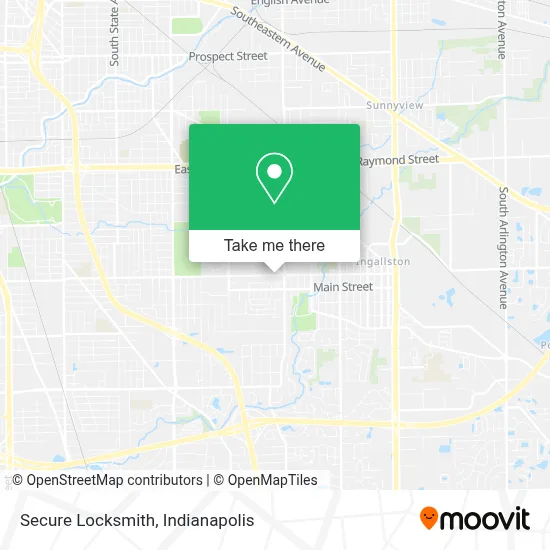
See Secure Locksmith, Beech Grove, on the map
Public Transit to Secure Locksmith in Beech Grove
Wondering how to get to Secure Locksmith in Beech Grove? Moovit helps you find the best way to get to Secure Locksmith with step-by-step directions from the nearest public transit station.
Moovit provides free maps and live directions to help you navigate through your city. View schedules, routes, timetables, and find out how long does it take to get to Secure Locksmith in real time.
Looking for the nearest stop or station to Secure Locksmith? Check out this list of stops closest to your destination: Main St & 18th Ave; Main St & 10th Ave.
Bus: 13, 56.
Want to see if there’s another route that gets you there at an earlier time? Moovit helps you find alternative routes or times. Get directions from and directions to Secure Locksmith easily from the Moovit App or Website.
We make riding to Secure Locksmith easy, which is why over 1.5 million users, including users in Beech Grove, trust Moovit as the best app for public transit. You don’t need to download an individual bus app or train app, Moovit is your all-in-one transit app that helps you find the best bus time or train time available.
For information on prices of bus, costs and ride fares to Secure Locksmith, please check the Moovit app.
Use the app to navigate to popular places including to the airport, hospital, stadium, grocery store, mall, coffee shop, school, college, and university.
Secure Locksmith Address: 1808 Albany St street in Beech Grove
- Community Clinic at Walgreens - Beech Grove,
- Sweet Scoop Market,
- Coinstar,
- Beech Grove Auto Lock Out,
- Metro by T-Mobile,
- T-Mobile,
- Holy Name Men's Club,
- United Healthcare,
- Saint Francis Medical Arts Leasing Office,
- Southeast Anesthesiologists,
- Select Medical,
- Victoria's Designs,
- Accessibility Tools,
- Saint Francis Hospital & Health Centers,
- Dl Appraisal Services,
- ABC's Maes Daycare,
- AA Beech Grove TRMT Pest CTRL,
- Big Top Creations,
- Beech Grove Place,
- Beech Grove Fire Department Station 56
Places Near Secure Locksmith (Beech Grove)
- Eskenazi Hospital, Indianapolis City (Balance),
- St. Vincent Hospital - Indianapolis, Indianapolis City (Balance),
- I-465 / I-65 Interchange, Indianapolis City (Balance),
- Gainbridge Fieldhouse, Indianapolis City (Balance),
- Indiana Convention Center, Indianapolis City (Balance),
- Indiana, Indianapolis City (Balance),
- Jersey Barn, Indianapolis City (Balance),
- Train Ride At Castleton Mall, Indianapolis City (Balance),
- Lilly Corporate Center (Eli Lilly & Co), Indianapolis City (Balance),
- Castleton Square Mall, Indianapolis,
- Cotter's Massage Parlor With Happy Endings, Indianapolis City (Balance),
- 119 W 19th St Parking, Indianapolis City (Balance),
- Methodist Hospital of Indianapolis, Indianapolis City (Balance),
- Indianapolis Motor Speedway, Speedway,
- St. Vincent entrance #1, Indianapolis City (Balance),
- Plainfield, IN, Plainfield,
- Indianapolis Airport Zone 2, Indianapolis City (Balance),
- THE BALT, Indianapolis City (Balance),
- Lucas Oil Stadium, Indianapolis City (Balance),
- I U Health Methodist Hospital, Indianapolis City (Balance)
How to get to popular places in Indianapolis with public transit
Get around Beech Grove by public transit!
Traveling around Beech Grove has never been so easy. See step by step directions as you travel to any attraction, street or major public transit station. View bus and train schedules, arrival times, service alerts and detailed routes on a map, so you know exactly how to get to anywhere in Beech Grove.
When traveling to any destination around Beech Grove use Moovit's Live Directions with Get Off Notifications to know exactly where and how far to walk, how long to wait for your line, and how many stops are left. Moovit will alert you when it's time to get off — no need to constantly re-check whether yours is the next stop.
Wondering how to use public transit in Beech Grove or how to pay for public transit in Beech Grove? Moovit public transit app can help you navigate your way with public transit easily, and at minimum cost. It includes public transit fees, ticket prices, and costs. Looking for a map of Beech Grove public transit lines? Moovit public transit app shows all public transit maps in Beech Grove with all bus routes and stops on an interactive map.
Indianapolis has 1 transit type(s), including: bus, operated by several transit agencies, including IndyGo, FlixBus-us and Greyhound-us