How to get to Sehit Samet by bus?
Click on the bus route to see step by step directions with maps, line arrival times and updated time schedules.
From Eyüp Belediyesi Nikah Salonu ve Kültür Merkezi, Eyüp
118 minFrom 500 Evler, Gaziosmanpasa
126 minFrom Eminönü - Eyüp Otobüsü, Eyüp
122 minFrom İKEA Bayrampaşa-Forum İstanbul, Bayrampasa
93 minFrom Fatih Çarşamba Pazarı, Fatih
94 minFrom Silivri Ceza İnfaz Kurumu, Sultangazi
142 minFrom Gaziosmanpasa Adliyesi, Gaziosmanpasa
119 minFrom Esenler Otogar, Esenler
86 minFrom Sultangazi Nikah Salonu, Sultangazi
133 minFrom Eyüp Park AVM, Eyüp
146 min
How to get to Sehit Samet by metro?
Click on the metro route to see step by step directions with maps, line arrival times and updated time schedules.
Bus stops near Sehit Samet in Bahçelievler
Dolmus & Minibus station near Sehit Samet in Bahçelievler
- İmam Mustafa Efendi Camii, 7 min walk,VIEW
Bus lines to Sehit Samet in Bahçelievler
- A31, İkitelli,VIEW
- A31, Fatih Mahallesi,VIEW
- A31, Şirinevler,VIEW
- A31, Halkalı ,VIEW
- A31, Bakırköy,VIEW
- HT13, Zeytinburnu-Bölge İdare Mahkemesi,VIEW
- 78ZB, Fenertepe Peronlar-Zeytinburnu,VIEW
- 97, 15 Temmuz Mahallesi Aile Sağlığı Merkezi-İtfaiye Okulu,VIEW
- 97E, Bölge İdare Mahkemesi-Kazlıçeşme Marmaray,VIEW
- 98A, Göztepe Mahallesi-Füruzan Sadıkoğlu Ortaokulu,VIEW
- 98M, İstoç-Altınbaş Üniversitesi,VIEW
- 97KZ, İmam Mustafa Efendi Camii-Zeytinburnu,VIEW
- A18, Mahmutbey,VIEW
- HT12, Yenibosna Metro-Basın Tesisleri Son Durak,VIEW
- 98E, Basın Tesisleri Son Durak-Bakırköy,VIEW
What are the closest stations to Sehit Samet?
The closest stations to Sehit Samet are:
- Liseler - Güneşli Yönü is 307 meters away, 5 min walk.
- İmam Mustafa Efendi Camii - Bahçelievler Yönü is 451 meters away, 6 min walk.
- İmam Mustafa Efendi Camii is 490 meters away, 7 min walk.
- Bağlar Mahallesi - Güneşli Yönü is 652 meters away, 9 min walk.
Which bus line stops near Sehit Samet?
97 (15 Temmuz Mahallesi Aile Sağlığı Merkezi-Selen Sokak)
Which metro lines stop near Sehit Samet?
These metro lines stop near Sehit Samet: M1B, M3.
Which Dolmus & Minibus line stops near Sehit Samet?
A31 (Bakırköy)
What’s the nearest bus station to Sehit Samet in Bahçelievler?
The nearest bus station to Sehit Samet in Bahçelievler is Liseler - Güneşli Yönü. It’s a 5 min walk away.
What’s the nearest Dolmus & Minibus station to Sehit Samet in Bahçelievler?
The nearest Dolmus & Minibus station to Sehit Samet in Bahçelievler is İmam Mustafa Efendi Camii. It’s a 7 min walk away.
What time is the first bus to Sehit Samet in Bahçelievler?
The 97 is the first bus that goes to Sehit Samet in Bahçelievler. It stops nearby at 5:44 AM.
What time is the last bus to Sehit Samet in Bahçelievler?
The 97 is the last bus that goes to Sehit Samet in Bahçelievler. It stops nearby at 1:01 AM.
What time is the first Dolmus & Minibus to Sehit Samet in Bahçelievler?
The A28 is the first Dolmus & Minibus that goes to Sehit Samet in Bahçelievler. It stops nearby at 5:46 AM.
What time is the last Dolmus & Minibus to Sehit Samet in Bahçelievler?
The A31 is the last Dolmus & Minibus that goes to Sehit Samet in Bahçelievler. It stops nearby at 2:08 AM.
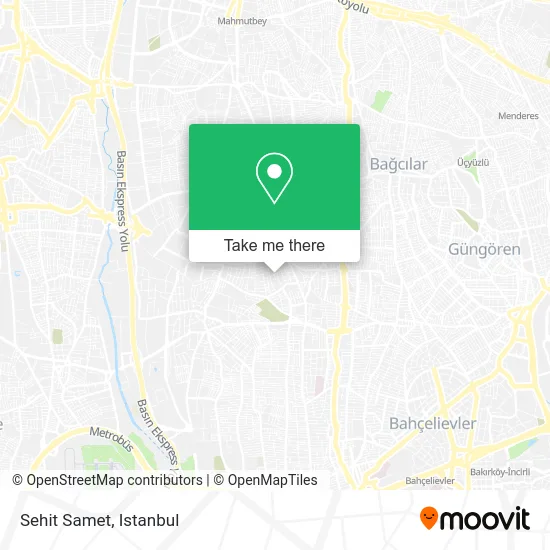
See Sehit Samet, Bahçelievler, on the map
Public Transit to Sehit Samet in Bahçelievler
Wondering how to get to Sehit Samet in Bahçelievler? Moovit helps you find the best way to get to Sehit Samet with step-by-step directions from the nearest public transit station.
Moovit provides free maps and live directions to help you navigate through your city. View schedules, routes, timetables, and find out how long does it take to get to Sehit Samet in real time.
Looking for the nearest stop or station to Sehit Samet? Check out this list of stops closest to your destination: Liseler - Güneşli Yönü; İmam Mustafa Efendi Camii - Bahçelievler Yönü; İmam Mustafa Efendi Camii; Bağlar Mahallesi - Güneşli Yönü.
Bus: 97, A31, A31, A31, A31, A31, 97KZ, A18, HT12, 98E.Metro: M1B, M3.Dolmus & Minibus: A31, A28, A28.
Want to see if there’s another route that gets you there at an earlier time? Moovit helps you find alternative routes or times. Get directions from and directions to Sehit Samet easily from the Moovit App or Website.
We make riding to Sehit Samet easy, which is why over 1.5 million users, including users in Bahçelievler, trust Moovit as the best app for public transit. You don’t need to download an individual bus app or train app, Moovit is your all-in-one transit app that helps you find the best bus time or train time available.
For information on prices of bus, Dolmus & Minibus, metro and Metrobus, costs and ride fares to Sehit Samet, please check the Moovit app.
Use the app to navigate to popular places including to the airport, hospital, stadium, grocery store, mall, coffee shop, school, college, and university.
Sehit Samet Address: Uzay Sokak, 34188 Kocasinan Merkez, İstanbul street in Bahçelievler
- Akpınar Apt,
- Göktaş Apt,
- Kocasinan Şehit Samet Kırbaş Mesleki ve Teknik Anadolu Lisesi,
- Şehit Samet Kırbaş Endüstri Meslek Lisesi,
- Mimar Sinan Anadolu İmam Hatip Lisesi,
- Kızılelma Cad. 16,
- mimar sinan imam hatip lisesi,
- Mimar Sinan Ortaokulu,
- Kocasinan Şehit Samet Kırbaş Teknin ve Endüstri Meslek Lisesi,
- Cantartıka,
- Kocasinan Arena Halı Saha Tesisleri,
- Niksar Turizm,
- Ahmet Sisman Anadolu Lısesı,
- Kocasinan Şehit Samet Kırbaş Bilişim Bölümü,
- Bahçelievler Özel Eğitim İş Uygulama Okulu,
- Ahmet Sisman Spor Salonu,
- Kocasinan Merkez Mahallesi,
- Ahmet Şişman Kız İmam Hatip Lisesi,
- Teyyare Sokak,
- Cuma Pazarı Mahmutbey
Places Near Sehit Samet (Bahçelievler)
- Topkule Kışlası 47.Komando Tugay Komutanlığı, Esenler,
- Hz. Yuşa Tepesi, Beykoz,
- 2 Nolu Minibüss, Beylikduzu,
- Tersane İstanbul, Beyoğlu,
- Beylikdüzü - 4 Nolu Minibüs Hattı, Beylikduzu,
- Mehmet Emin Tokadî Hz. Türbesi, Fatih,
- Gebze-Harem Minibüs Hattı, Gebze,
- Şehit Prof. Dr. İlhan Varank Eğitim Ve Araştırma Hastanesi, Sancaktepe,
- METROPOL IsTaNBuL, Ataşehir,
- İstanbul,
- Gebze Koop Durağı, Gebze,
- Hilltown AVM, Maltepe,
- Bakırköy Sosyete Pazarı, Bakirköy,
- VİALAND AVM, Eyüp,
- 41 Burda AVM, Kocaeli Merkezi,
- 212 AVM, Bagcilar,
- İstinye Park, Sariyer,
- Karaköy Genelevi, Karaköy, Beyoğlu,
- Mall Of İstanbul, Basaksehir,
- Başakşehir Çam Ve Sakura Şehir Hastanesi, Basaksehir
How to get to popular places in Istanbul with public transit
Get around Bahçelievler by public transit!
Traveling around Bahçelievler has never been so easy. See step by step directions as you travel to any attraction, street or major public transit station. View bus and train schedules, arrival times, service alerts and detailed routes on a map, so you know exactly how to get to anywhere in Bahçelievler.
When traveling to any destination around Bahçelievler use Moovit's Live Directions with Get Off Notifications to know exactly where and how far to walk, how long to wait for your line, and how many stops are left. Moovit will alert you when it's time to get off — no need to constantly re-check whether yours is the next stop.
Wondering how to use public transit in Bahçelievler or how to pay for public transit in Bahçelievler? Moovit public transit app can help you navigate your way with public transit easily, and at minimum cost. It includes public transit fees, ticket prices, and costs. Looking for a map of Bahçelievler public transit lines? Moovit public transit app shows all public transit maps in Bahçelievler with all Bus, Train, Metro, Tram, Ferry, Metrobus and Dolmus & Minibus routes and stops on an interactive map.
Istanbul has 7 transit type(s), including: Bus, Train, Metro, Tram, Ferry, Metrobus and Dolmus & Minibus, operated by several transit agencies, including Marmaray, Metro İstanbul, Metrobüs, UAB, İETT, İETT ÇIFT KATLI HATLAR, İETT BÖLGESEL HATLAR, TCDD, Şehir Hatları, Dentur Avrasya, Beyden, Turyol, Mavi Marmara, Havaist and Prenstur
