How to get to Seko Store by bus?
Click on the bus route to see step by step directions with maps, line arrival times and updated time schedules.
From Haseki Eğitim ve Araştırma Hastanesi, Fatih
62 minFrom Tarık Akan Konferans Salonu, Bakirköy
98 minFrom Acıbadem Atakent Hastanesi, Küçükçekmece
88 minFrom Kızılay Kağıthane Şubesi, Kagithane
87 minFrom Nişantaşı, Nişantaşı, Şişli
111 minFrom Sabiha Gökçe, Basaksehir
85 minFrom Cihangir, Beyoğlu
80 minFrom Sütlüce, Beyoğlu
63 min
How to get to Seko Store by metro?
Click on the metro route to see step by step directions with maps, line arrival times and updated time schedules.
Bus stops near Seko Store in Güngören
Dolmus & Minibus stations near Seko Store in Güngören
Bus lines to Seko Store in Güngören
- A30, Evren,VIEW
- A30, Bağcılar ,VIEW
- A41, Gaziosmanpaşa EAH,VIEW
- A41, Bağcılar,VIEW
- HT1, Çınar Mahallesi-Kanuni Sultan Süleyman,VIEW
- 92T, Bağcılar Devlet Hastanesi - Taksim / Ring,VIEW
- 98G, Giyimkent-Çamlık,VIEW
- 36CY, Cebeci Peronlar-Yenibosna Metro,VIEW
- A19, Otogar,VIEW
- A72, Giyimkent,VIEW
- 33B, Hz.Ali Camii-Giyimkent,VIEW
- 55Y, Sadabad Osmanlı Arşivi-Yenibosna Metro,VIEW
- 92M, Çınar Mahallesi-Mecidiyeköy Metrobüs,VIEW
- A19, Bakırköy,VIEW
- 92B, Yeni Mahalle Metro-Aksaray Ring,VIEW
- A26+A28, Bağcılar,VIEW
What are the closest stations to Seko Store?
The closest stations to Seko Store are:
- Doğanbey Caddesi - Esenler Yönü is 219 meters away, 3 min walk.
- Gençosman İmam Hatip Ortaokulu - Üçyüzlü-G.Gören Yönü is 348 meters away, 5 min walk.
- Nenehatun Mahallesi - Davutpaşa Yönü is 397 meters away, 6 min walk.
- Carrefour is 426 meters away, 6 min walk.
- Bağcılar Devlet Hastanesi - Güneşli Yönü is 649 meters away, 9 min walk.
- Bağcılar Devlet Hastanesi - Son Durak Yönü is 651 meters away, 9 min walk.
- Bağcılar Devlet Hastanesi is 773 meters away, 11 min walk.
Which bus lines stop near Seko Store?
These bus lines stop near Seko Store: 33B, 92C, 92M, 92T, HT1.
Which metro line stops near Seko Store?
M1B (Yenikapı→Kirazlı-Bağcılar)
Which Dolmus & Minibus lines stop near Seko Store?
These Dolmus & Minibus lines stop near Seko Store: A41, A72.
What’s the nearest bus station to Seko Store in Güngören?
The nearest bus station to Seko Store in Güngören is Doğanbey Caddesi - Esenler Yönü. It’s a 3 min walk away.
What’s the nearest Dolmus & Minibus station to Seko Store in Güngören?
The nearest Dolmus & Minibus station to Seko Store in Güngören is Carrefour. It’s a 6 min walk away.
What time is the first bus to Seko Store in Güngören?
The 92T is the first bus that goes to Seko Store in Güngören. It stops nearby at 5:40 AM.
What time is the last bus to Seko Store in Güngören?
The 92T is the last bus that goes to Seko Store in Güngören. It stops nearby at 12:19 AM.
What time is the first Dolmus & Minibus to Seko Store in Güngören?
The A30 is the first Dolmus & Minibus that goes to Seko Store in Güngören. It stops nearby at 6:00 AM.
What time is the last Dolmus & Minibus to Seko Store in Güngören?
The A29 is the last Dolmus & Minibus that goes to Seko Store in Güngören. It stops nearby at 1:08 AM.
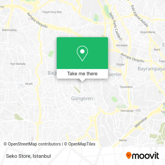
See Seko Store, Güngören, on the map
Public Transit to Seko Store in Güngören
Wondering how to get to Seko Store in Güngören? Moovit helps you find the best way to get to Seko Store with step-by-step directions from the nearest public transit station.
Moovit provides free maps and live directions to help you navigate through your city. View schedules, routes, timetables, and find out how long does it take to get to Seko Store in real time.
Looking for the nearest stop or station to Seko Store? Check out this list of stops closest to your destination: Doğanbey Caddesi - Esenler Yönü; Gençosman İmam Hatip Ortaokulu - Üçyüzlü-G.Gören Yönü; Nenehatun Mahallesi - Davutpaşa Yönü; Carrefour; Bağcılar Devlet Hastanesi - Güneşli Yönü; Bağcılar Devlet Hastanesi - Son Durak Yönü; Bağcılar Devlet Hastanesi.
Bus: 33B, 92C, 92M, 92T, HT1, A30, A30, A41, A41, 36CY, A19, A72, 55Y, A26+A28, A19, 92B.Metro: M1B.Dolmus & Minibus: A41, A72, A24.
Want to see if there’s another route that gets you there at an earlier time? Moovit helps you find alternative routes or times. Get directions from and directions to Seko Store easily from the Moovit App or Website.
We make riding to Seko Store easy, which is why over 1.7 million users, including users in Güngören, trust Moovit as the best app for public transit. You don’t need to download an individual bus app or train app, Moovit is your all-in-one transit app that helps you find the best bus time or train time available.
For information on prices of metro, bus, Dolmus & Minibus, tram, train and Metrobus, costs and ride fares to Seko Store, please check the Moovit app.
Use the app to navigate to popular places including to the airport, hospital, stadium, grocery store, mall, coffee shop, school, college, and university.
Seko Store Address: Dündar Sokak, 34165 Gençosman, İstanbul street in Güngören
- Cafe Masa Sandalye,
- vega display,
- Özel Güngören Rehabilitasyon Merkezi,
- Fz Sound,
- DEVELI SOFRASI GÜNGÖREN,
- Dilşah sokak,
- Doğancılar Sokak / Doğanbey Caddesi,
- Kocaeli Gebze,
- malatyalılar sosyal ve yardımlaşma derneği,
- güngören ek poliklinik,
- cinayet tepesi,
- Era-Med Medikal Bağcılar,
- Sağlık Bilimleri Üniversitesi Bağcılar Eğitim Araştırma Hastanesi,
- Gungoren Semt Poliklinigi,
- Mustafa Yaşar Caddesi,
- Bağcılar EAH Kadın Hastalıkları Ve Doğum Servisi,
- Bağcılar eğitim araştırma hastanesi kulak burun boğaz Polikliniği,
- Cemil Meriç Mesleki ve Teknik Anadolu Lisesi,
- Bağcılar Devlet Hastanesi Çocuk Acil Servisi,
- Bağcılar Eğitim ve Araştırma Hastanesi Güngören Ek Binası
Places Near Seko Store (Güngören)
- VİALAND AVM, Eyüp,
- Beylikdüzü - 4 Nolu Minibüs Hattı, Beylikduzu,
- İstanbul,
- Bakırköy Sosyete Pazarı, Bakirköy,
- Mehmet Emin Tokadî Hz. Türbesi, Fatih,
- İstinye Park, Sariyer,
- 41 Burda AVM, Kocaeli Merkezi,
- Gebze Koop Durağı, Gebze,
- Topkule Kışlası 47.Komando Tugay Komutanlığı, Esenler,
- Mall Of İstanbul, Basaksehir,
- 212 AVM, Bagcilar,
- METROPOL IsTaNBuL, Ataşehir,
- 2 Nolu Minibüss, Beylikduzu,
- Karaköy Genelevi, Karaköy, Beyoğlu,
- Başakşehir Çam Ve Sakura Şehir Hastanesi, Basaksehir,
- Hz. Yuşa Tepesi, Beykoz,
- Gebze-Harem Minibüs Hattı, Gebze,
- Tersane İstanbul, Beyoğlu,
- Hilltown AVM, Maltepe,
- Şehit Prof. Dr. İlhan Varank Eğitim Ve Araştırma Hastanesi, Sancaktepe
How to get to popular places in Istanbul with public transit
Get around Güngören by public transit!
Traveling around Güngören has never been so easy. See step by step directions as you travel to any attraction, street or major public transit station. View bus and train schedules, arrival times, service alerts and detailed routes on a map, so you know exactly how to get to anywhere in Güngören.
When traveling to any destination around Güngören use Moovit's Live Directions with Get Off Notifications to know exactly where and how far to walk, how long to wait for your line, and how many stops are left. Moovit will alert you when it's time to get off — no need to constantly re-check whether yours is the next stop.
Wondering how to use public transit in Güngören or how to pay for public transit in Güngören? Moovit public transit app can help you navigate your way with public transit easily, and at minimum cost. It includes public transit fees, ticket prices, and costs. Looking for a map of Güngören public transit lines? Moovit public transit app shows all public transit maps in Güngören with all Bus, Train, Metro, Tram, Ferry, Metrobus and Dolmus & Minibus routes and stops on an interactive map.
Istanbul has 7 transit type(s), including: Bus, Train, Metro, Tram, Ferry, Metrobus and Dolmus & Minibus, operated by several transit agencies, including Marmaray, Metro İstanbul, Metrobüs, UAB, İETT, İETT ÇIFT KATLI HATLAR, İETT BÖLGESEL HATLAR, TCDD, Şehir Hatları, Dentur Avrasya, Beyden, Turyol, Mavi Marmara, Havaist and Prenstur
