How to get to Select Security by bus?
Click on the bus route to see step by step directions with maps, line arrival times and updated time schedules.
From Staten Island Mall, Staten Island
239 minFrom Staten Island, NY, Staten Island
262 minFrom PNC Bank Arts Center, Holmdel
236 minFrom Perth Amboy, NJ, Perth Amboy
76 minFrom HUUHHHH??, Woodbridge
115 minFrom Baps Shri Swaminarayan Mandir, Edison, NJ, USA, Edison
147 minFrom Freehold, NJ, Freehold
148 minFrom Highland Park, NJ, Highland Park
143 minFrom Edison NJ, Edison
150 min
How to get to Select Security by train?
Click on the train route to see step by step directions with maps, line arrival times and updated time schedules.
Bus stop near Select Security in Matawan
- Ravine Dr at Main St#, 5 min walk,VIEW
Train station near Select Security in Matawan
- Hazlet, 60 min walk,VIEW
Bus lines to Select Security in Matawan
What are the closest stations to Select Security?
The closest stations to Select Security are:
- Ravine Dr at Main St# is 396 yards away, 5 min walk.
- Hazlet is 5063 yards away, 60 min walk.
Which bus line stops near Select Security?
817 (Campbells Jnct)
Which train line stops near Select Security?
NJCL (Bay Head)
What’s the nearest bus station to Select Security in Matawan?
The nearest bus station to Select Security in Matawan is Ravine Dr at Main St#. It’s a 5 min walk away.
What time is the first train to Select Security in Matawan?
The NJCL is the first train that goes to Select Security in Matawan. It stops nearby at 4:17 AM.
What time is the last train to Select Security in Matawan?
The NJCL is the last train that goes to Select Security in Matawan. It stops nearby at 2:11 AM.
What time is the first bus to Select Security in Matawan?
The 135 is the first bus that goes to Select Security in Matawan. It stops nearby at 6:09 AM.
What time is the last bus to Select Security in Matawan?
The 131 is the last bus that goes to Select Security in Matawan. It stops nearby at 9:41 PM.
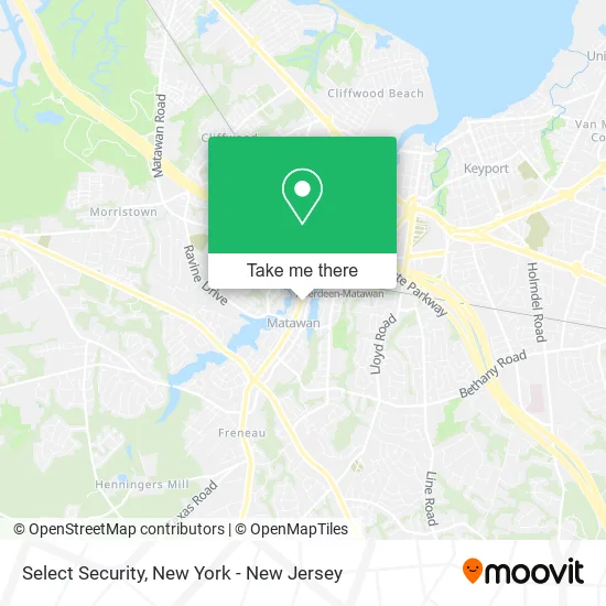
See Select Security, Matawan, on the map
Public Transit to Select Security in Matawan
Wondering how to get to Select Security in Matawan? Moovit helps you find the best way to get to Select Security with step-by-step directions from the nearest public transit station.
Moovit provides free maps and live directions to help you navigate through your city. View schedules, routes, timetables, and find out how long does it take to get to Select Security in real time.
Looking for the nearest stop or station to Select Security? Check out this list of stops closest to your destination: Ravine Dr at Main St#; Hazlet.
Bus: 817, 131, 135.Train: NJCL.
Want to see if there’s another route that gets you there at an earlier time? Moovit helps you find alternative routes or times. Get directions from and directions to Select Security easily from the Moovit App or Website.
We make riding to Select Security easy, which is why over 1.5 million users, including users in Matawan, trust Moovit as the best app for public transit. You don’t need to download an individual bus app or train app, Moovit is your all-in-one transit app that helps you find the best bus time or train time available.
For information on prices of bus, train and subway, costs and ride fares to Select Security, please check the Moovit app.
Use the app to navigate to popular places including to the airport, hospital, stadium, grocery store, mall, coffee shop, school, college, and university.
Select Security Address: 87 Main St Matawan, NJ 07747 street in Matawan
- Prime Home Care 24/7,
- Pure Therapy,
- Boheme,
- Brinks Home™,
- Lisamarie Hair,
- Sparkle Boutique - Book Appointment To Confirm,
- Allrj,
- Matawan Station,
- Sparkle- Gowns and Dresses- Book Appointment Today.,
- Lyons Mane Hair Co.,
- 10th & Vine Hair Co,
- Hello Princess Hair Salon,
- Sunrooms,
- Trek Bicycle Store,
- Kriegstein Financial Group LLC,
- Finra's Brokercheck,
- Berkshire Hathaway Homeservices Fox & Roach Realtors® the Kp Edgestone Realty Group,
- Rally Point Title Agency,
- One Flight Up,
- Riya Kaur, Realtor
Places Near Select Security (Matawan)
- 1 Police Plaza, Manhattan,
- Wall Street, Manhattan,
- qqqq, Manhattan,
- Pier 83, Manhattan,
- 911 Memorial, Manhattan,
- 66 John Street, Manhattan,
- 26 Federal Plaza, Manhattan,
- SoHo, Manhattan,
- Queens Center Mall, Queens,
- Chinatown, Manhattan,
- Times Square, Manhattan,
- Rockefeller Center, Manhattan,
- 376 Hudson Street, Manhattan,
- 111 Centre New York City Supreme Court, Manhattan,
- Hudson Yards, Manhattan,
- Bellevue Hospital, Manhattan,
- San Gennaro Feast, Manhattan,
- 3 Stone St, Manhattan,
- Katz's Deli, Manhattan,
- Mountainside Hospital, Glen Ridge
How to get to popular places in New York - New Jersey with public transit
Get around Matawan by public transit!
Traveling around Matawan has never been so easy. See step by step directions as you travel to any attraction, street or major public transit station. View bus and train schedules, arrival times, service alerts and detailed routes on a map, so you know exactly how to get to anywhere in Matawan.
When traveling to any destination around Matawan use Moovit's Live Directions with Get Off Notifications to know exactly where and how far to walk, how long to wait for your line, and how many stops are left. Moovit will alert you when it's time to get off — no need to constantly re-check whether yours is the next stop.
Wondering how to use public transit in Matawan or how to pay for public transit in Matawan? Moovit public transit app can help you navigate your way with public transit easily, and at minimum cost. It includes public transit fees, ticket prices, and costs. Looking for a map of Matawan public transit lines? Moovit public transit app shows all public transit maps in Matawan with all Bus, Train, Subway, Light Rail, Ferry and Cable Car routes and stops on an interactive map.
New York - New Jersey has 6 transit type(s), including: Bus, Train, Subway, Light Rail, Ferry and Cable Car, operated by several transit agencies, including MTA Subway, Metro-North Railroad, LIRR, PATH, MTA New York City Transit - Express routes, MTA Bus, NJ Transit, NYC Ferry, NICE bus, Bee-Line Bus, NJ Transit Rail, Norwalk Transit District, Hartford Line, River Valley Transit and HART