How to get to Semantics Paper Goods by bus?
Click on the bus route to see step by step directions with maps, line arrival times and updated time schedules.
From Physiocare Home Health Care Indianapolis, Indianapolis City (Balance)
46 minFrom Fastenal, Indianapolis City (Balance)
60 minFrom Shortridge Rd & Kickapoo Trail, Indianapolis City (Balance)
46 minFrom Mi Gente International Grocery, Indianapolis City (Balance)
48 minFrom 10th And Shadeland, Indianapolis City (Balance)
39 minFrom John E Krol MD, Indianapolis City (Balance)
35 minFrom Walmart Supercenter, Indianapolis City (Balance)
47 minFrom Bluestar Painting, Indianapolis City (Balance)
48 minFrom Credit Union 1, Indianapolis City (Balance)
52 minFrom H Spa, Indianapolis City (Balance)
46 min
Bus stops near Semantics Paper Goods in Indianapolis City (Balance)
Bus lines to Semantics Paper Goods in Indianapolis City (Balance)
What are the closest stations to Semantics Paper Goods?
The closest stations to Semantics Paper Goods are:
- Delaware St & 16th St is 161 yards away, 3 min walk.
- Capitol Ave & 14th St Station Nb is 184 yards away, 3 min walk.
- 16th St & Alabama St is 353 yards away, 5 min walk.
- 16th St & Meridian St is 427 yards away, 6 min walk.
- Central Ave & 16th St is 551 yards away, 7 min walk.
Which bus lines stop near Semantics Paper Goods?
These bus lines stop near Semantics Paper Goods: 11, 19, 25, 5, 90.
What’s the nearest bus station to Semantics Paper Goods in Indianapolis City (Balance)?
The nearest bus stations to Semantics Paper Goods in Indianapolis City (Balance) are Delaware St & 16th St and Capitol Ave & 14th St Station Nb. The closest one is a 3 min walk away.
What time is the first bus to Semantics Paper Goods in Indianapolis City (Balance)?
The 92 is the first bus that goes to Semantics Paper Goods in Indianapolis City (Balance). It stops nearby at 4:53 AM.
What time is the last bus to Semantics Paper Goods in Indianapolis City (Balance)?
The 90 is the last bus that goes to Semantics Paper Goods in Indianapolis City (Balance). It stops nearby at 12:48 AM.
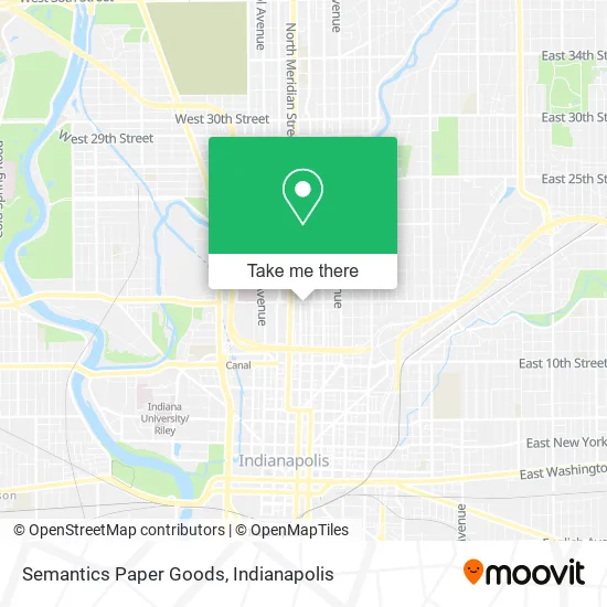
See Semantics Paper Goods, Indianapolis City (Balance), on the map
Public Transit to Semantics Paper Goods in Indianapolis City (Balance)
Wondering how to get to Semantics Paper Goods in Indianapolis City (Balance)? Moovit helps you find the best way to get to Semantics Paper Goods with step-by-step directions from the nearest public transit station.
Moovit provides free maps and live directions to help you navigate through your city. View schedules, routes, timetables, and find out how long does it take to get to Semantics Paper Goods in real time.
Looking for the nearest stop or station to Semantics Paper Goods? Check out this list of stops closest to your destination: Delaware St & 16th St; Capitol Ave & 14th St Station Nb; 16th St & Alabama St; 16th St & Meridian St; Central Ave & 16th St.
Bus: 11, 19, 25, 5, 90, 92, 4, 28.
Want to see if there’s another route that gets you there at an earlier time? Moovit helps you find alternative routes or times. Get directions from and directions to Semantics Paper Goods easily from the Moovit App or Website.
We make riding to Semantics Paper Goods easy, which is why over 1.5 million users, including users in Indianapolis City (Balance), trust Moovit as the best app for public transit. You don’t need to download an individual bus app or train app, Moovit is your all-in-one transit app that helps you find the best bus time or train time available.
For information on prices of bus, costs and ride fares to Semantics Paper Goods, please check the Moovit app.
Use the app to navigate to popular places including to the airport, hospital, stadium, grocery store, mall, coffee shop, school, college, and university.
Semantics Paper Goods Address: 111 E 16th St Indianapolis, IN 46202 street in Indianapolis City (Balance)
- Dream Palace Books + Coffee,
- Herron High School,
- Katelin Parkinson, ND,
- 1576 N Talbott St Parking,
- Telunique McQnications,
- Rotherwood Apartments,
- Joshua Kaufmann,
- Ponist Law,
- Chambers Law Office,
- Fleming Law,
- Indiana Recycling Coalition,
- YWCA,
- Handy Angels Home Care,
- Blade Family Martial Arts Academy - Karate,
- Jonathan Frey Photography & Film,
- Uxpertism Corporation,
- 1456 N Delaware St Parking,
- Hvac Company,
- Owens + Crawley,
- Sara B. Jewelry & Metalsmithing
Places Near Semantics Paper Goods (Indianapolis City (Balance))
- 119 W 19th St Parking, Indianapolis City (Balance),
- Lucas Oil Stadium, Indianapolis City (Balance),
- Jersey Barn, Indianapolis City (Balance),
- Lilly Corporate Center (Eli Lilly & Co), Indianapolis City (Balance),
- Plainfield, IN, Plainfield,
- I U Health Methodist Hospital, Indianapolis City (Balance),
- Castleton Square Mall, Indianapolis,
- Train Ride At Castleton Mall, Indianapolis City (Balance),
- THE BALT, Indianapolis City (Balance),
- I-465 / I-65 Interchange, Indianapolis City (Balance),
- Indianapolis Motor Speedway, Speedway,
- Cotter's Massage Parlor With Happy Endings, Indianapolis City (Balance),
- St. Vincent Hospital - Indianapolis, Indianapolis City (Balance),
- St. Vincent entrance #1, Indianapolis City (Balance),
- Indiana Convention Center, Indianapolis City (Balance),
- Gainbridge Fieldhouse, Indianapolis City (Balance),
- Methodist Hospital of Indianapolis, Indianapolis City (Balance),
- Indiana, Indianapolis City (Balance),
- Eskenazi Hospital, Indianapolis City (Balance),
- Indianapolis Airport Zone 2, Indianapolis City (Balance)
How to get to popular places in Indianapolis with public transit
Get around Indianapolis City (Balance) by public transit!
Traveling around Indianapolis City (Balance) has never been so easy. See step by step directions as you travel to any attraction, street or major public transit station. View bus and train schedules, arrival times, service alerts and detailed routes on a map, so you know exactly how to get to anywhere in Indianapolis City (Balance).
When traveling to any destination around Indianapolis City (Balance) use Moovit's Live Directions with Get Off Notifications to know exactly where and how far to walk, how long to wait for your line, and how many stops are left. Moovit will alert you when it's time to get off — no need to constantly re-check whether yours is the next stop.
Wondering how to use public transit in Indianapolis City (Balance) or how to pay for public transit in Indianapolis City (Balance)? Moovit public transit app can help you navigate your way with public transit easily, and at minimum cost. It includes public transit fees, ticket prices, and costs. Looking for a map of Indianapolis City (Balance) public transit lines? Moovit public transit app shows all public transit maps in Indianapolis City (Balance) with all bus routes and stops on an interactive map.
Indianapolis has 1 transit type(s), including: bus, operated by several transit agencies, including IndyGo, FlixBus-us and Greyhound-us