How to get to Semillas Botanas y Chitos by bus?
Click on the bus route to see step by step directions with maps, line arrival times and updated time schedules.
From ISSSTE, Tultitlán
31 minFrom Universidad Anáhuac México SUR, Miguel Hidalgo
46 minFrom Hospital Ángeles Lindavista, Gustavo A. Madero
57 minFrom Metro Mixcoac (Líneas 7 y 12), Miguel Hidalgo
29 minFrom Parque del Mestizaje, Gustavo A. Madero
52 minFrom Metro Oceanía, Gustavo A. Madero
62 minFrom Explanada de La Delegación Gustavo A. Madero, Gustavo A. Madero
55 minFrom Puerta 14 Autodromo Hermanos Rodriguez, Cuauhtémoc
53 minFrom Plaza Torres Lindavista, Tultitlán
65 minFrom Estadio Alfredo Harp Helu, Cuauhtémoc
63 min
How to get to Semillas Botanas y Chitos by metro?
Click on the metro route to see step by step directions with maps, line arrival times and updated time schedules.
From Universidad Anáhuac México SUR, Miguel Hidalgo
63 minFrom Hospital Ángeles Lindavista, Gustavo A. Madero
49 minFrom Metro Mixcoac (Líneas 7 y 12), Miguel Hidalgo
30 minFrom Parque del Mestizaje, Gustavo A. Madero
59 minFrom Metro Oceanía, Gustavo A. Madero
34 minFrom Explanada de La Delegación Gustavo A. Madero, Gustavo A. Madero
53 minFrom Puerta 14 Autodromo Hermanos Rodriguez, Cuauhtémoc
49 minFrom Plaza Torres Lindavista, Tultitlán
64 minFrom Estadio Alfredo Harp Helu, Cuauhtémoc
38 min
Bus stops near Semillas Botanas y Chitos in Azcapotzalco
- Avenida Maestro José Vasconcelos #18444, 3 min walk,VIEW
- Circuito Interior Maestro José Vasconcelos #1522, 3 min walk,VIEW
- Avenida Maestro José Vasconcelos #36574, 4 min walk,VIEW
- Avenida Maestro José Vasconcelos #18476, 4 min walk,VIEW
- José Vazconcelos - Avenida Chapultepec, 4 min walk,VIEW
- Gandhi., 5 min walk,VIEW
- Paseo de La Reforma - Gandhi, 5 min walk,VIEW
- Avenida Paseo de La Reforma #12062, 6 min walk,VIEW
- Avenida Chapultepec #21144, 7 min walk,VIEW
- Avenida Maestro José Vasconcelos #36713, 7 min walk,VIEW
- Chapultepec, 8 min walk,VIEW
- José Vasconcelos 678, 9 min walk,VIEW
Metro stations near Semillas Botanas y Chitos in Azcapotzalco
Cable Car station near Semillas Botanas y Chitos in Azcapotzalco
- Los Pinos / Constituyentes, 19 min walk,VIEW
Bus lines to Semillas Botanas y Chitos in Azcapotzalco
- 2, Chapultepec ,VIEW
- 1, Pantitlán - Chapultepec,VIEW
- 76, La Pila ,VIEW
- 76, Chapultepec - Acopilco,VIEW
- 76, Atlapulco-Potrero,VIEW
- 2, Chapultepec,VIEW
- 200, Circuito Interior - Manuel Carpio,VIEW
- 18A, Valle Dorado - Chapultepec,VIEW
- 18B, 1ro de Mayo - Chapultepec,VIEW
- 18C, Valle Dorado - Insurgentes,VIEW
- 18D, Satélite - Chapultepec,VIEW
- 7, Garibaldi - Campo Marte,VIEW
- 8A, Chapultepec - Bosques,VIEW
- 8B, Chapultepec - Palmas,VIEW
- 8D, Chapultepec - Tecamachalco,VIEW
- 114, Chapultepec - Contadero,VIEW
- 24, Observatorio,VIEW
- 76, Salazar,VIEW
- 13A, Ingenieros Militares - Chapultepec,VIEW
- 13B, Av.Homero - Chapultepec,VIEW
What are the closest stations to Semillas Botanas y Chitos?
The closest stations to Semillas Botanas y Chitos are:
- Avenida Maestro José Vasconcelos #18444 is 145 meters away, 3 min walk.
- Circuito Interior Maestro José Vasconcelos #1522 is 153 meters away, 3 min walk.
- Avenida Maestro José Vasconcelos #36574 is 213 meters away, 4 min walk.
- Avenida Maestro José Vasconcelos #18476 is 229 meters away, 4 min walk.
- José Vazconcelos - Avenida Chapultepec is 276 meters away, 4 min walk.
- Gandhi. is 347 meters away, 5 min walk.
- Paseo de La Reforma - Gandhi is 368 meters away, 5 min walk.
- Avenida Paseo de La Reforma #12062 is 445 meters away, 6 min walk.
- Avenida Chapultepec #21144 is 469 meters away, 7 min walk.
- Avenida Maestro José Vasconcelos #36713 is 505 meters away, 7 min walk.
- Chapultepec is 577 meters away, 8 min walk.
- José Vasconcelos 678 is 663 meters away, 9 min walk.
- Los Pinos / Constituyentes is 1409 meters away, 19 min walk.
- Auditorio is 1964 meters away, 26 min walk.
Which bus lines stop near Semillas Botanas y Chitos?
These bus lines stop near Semillas Botanas y Chitos: 19C, 20A, 21B, 7, 76, 7D.
Which metro line stops near Semillas Botanas y Chitos?
1 (Dirección Observatorio)
What’s the nearest metro station to Semillas Botanas y Chitos in Azcapotzalco?
The nearest metro station to Semillas Botanas y Chitos in Azcapotzalco is Chapultepec. It’s a 11 min walk away.
What’s the nearest bus station to Semillas Botanas y Chitos in Azcapotzalco?
The nearest bus stations to Semillas Botanas y Chitos in Azcapotzalco are Avenida Maestro José Vasconcelos #18444 and Circuito Interior Maestro José Vasconcelos #1522. The closest one is a 3 min walk away.
What’s the nearest cable car station to Semillas Botanas y Chitos in Azcapotzalco?
The nearest cable car station to Semillas Botanas y Chitos in Azcapotzalco is Los Pinos / Constituyentes. It’s a 19 min walk away.
What time is the first metro to Semillas Botanas y Chitos in Azcapotzalco?
The 1 is the first metro that goes to Semillas Botanas y Chitos in Azcapotzalco. It stops nearby at 5:06 AM.
What time is the last metro to Semillas Botanas y Chitos in Azcapotzalco?
The 7 is the last metro that goes to Semillas Botanas y Chitos in Azcapotzalco. It stops nearby at 12:19 AM.
What time is the first bus to Semillas Botanas y Chitos in Azcapotzalco?
The 7 is the first bus that goes to Semillas Botanas y Chitos in Azcapotzalco. It stops nearby at 4:16 AM.
What time is the last bus to Semillas Botanas y Chitos in Azcapotzalco?
The 200 is the last bus that goes to Semillas Botanas y Chitos in Azcapotzalco. It stops nearby at 4:56 AM.
What time is the first cable car to Semillas Botanas y Chitos in Azcapotzalco?
The L3 is the first cable car that goes to Semillas Botanas y Chitos in Azcapotzalco. It stops nearby at 5:00 AM.
What time is the last cable car to Semillas Botanas y Chitos in Azcapotzalco?
The L3 is the last cable car that goes to Semillas Botanas y Chitos in Azcapotzalco. It stops nearby at 11:15 PM.
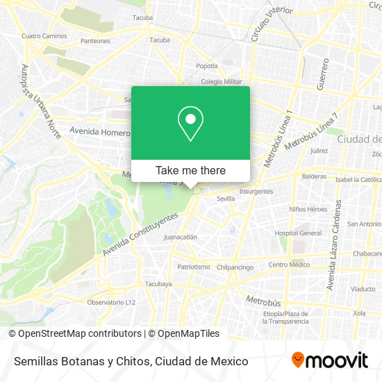
See Semillas Botanas y Chitos, Azcapotzalco, on the map
Public Transit to Semillas Botanas y Chitos in Azcapotzalco
Wondering how to get to Semillas Botanas y Chitos in Azcapotzalco? Moovit helps you find the best way to get to Semillas Botanas y Chitos with step-by-step directions from the nearest public transit station.
Moovit provides free maps and live directions to help you navigate through your city. View schedules, routes, timetables, and find out how long does it take to get to Semillas Botanas y Chitos in real time.
Looking for the nearest stop or station to Semillas Botanas y Chitos? Check out this list of stops closest to your destination: Avenida Maestro José Vasconcelos #18444; Circuito Interior Maestro José Vasconcelos #1522; Avenida Maestro José Vasconcelos #36574; Avenida Maestro José Vasconcelos #18476; José Vazconcelos - Avenida Chapultepec; Gandhi.; Paseo de La Reforma - Gandhi; Avenida Paseo de La Reforma #12062; Avenida Chapultepec #21144; Avenida Maestro José Vasconcelos #36713; Chapultepec; José Vasconcelos 678; Los Pinos / Constituyentes; Auditorio.
Bus: 19C, 20A, 21B, 7, 76, 7D, 2, 1.Metro: 1, 7.Cable Car: L3.
Want to see if there’s another route that gets you there at an earlier time? Moovit helps you find alternative routes or times. Get directions from and directions to Semillas Botanas y Chitos easily from the Moovit App or Website.
We make riding to Semillas Botanas y Chitos easy, which is why over 1.5 million users, including users in Azcapotzalco, trust Moovit as the best app for public transit. You don’t need to download an individual bus app or train app, Moovit is your all-in-one transit app that helps you find the best bus time or train time available.
For information on prices of metro and bus, costs and ride fares to Semillas Botanas y Chitos, please check the Moovit app.
Use the app to navigate to popular places including to the airport, hospital, stadium, grocery store, mall, coffee shop, school, college, and university.
Semillas Botanas y Chitos Address: Calzada Mahatma Gandhi, Bosque de Chapultepec I Sección, 11580 Miguel Hidalgo, Ciudad de México street in Azcapotzalco
- Frituras y Dulces Regionales,
- Gorras y Sombreros,
- Juguetes y Burbujas,
- Lentes Sombrillas y Bromas,
- PASEO DE LA REFORMA Y GANDHI S / N,
- Altar A Los Defensores De La Patria,
- Gorras y Cinturones de Seguridad,
- Monumento A Los Niños Héroes,
- Altar a la Patria,
- Monumento a los Niños Héroes de Chapultepec,
- Heroico Colegio Militar,
- Avenida Heroico Colegio Militar,
- Bromas y Alambre en Artesania,
- Kiosco Chapultepec,
- Lugar 24 Modulo 5,
- Venta de Chicharrón y Refrescos,
- Venta de Botanas y Frituras,
- Huarache Artesanal Sombrilla y Juguete,
- Joyeria de Fantasia Bolsas y Artesania en Madera,
- Calzada Mahatma Gandhi
Places Near Semillas Botanas y Chitos (Azcapotzalco)
- Instituto Nacional de Neurologia y Neurocirugia "Manuel Velasco Suarez", Alvaro Obregón,
- Central de Abasto de la Ciudad de México, Cuauhtémoc,
- BUCARELI 134 COL CENTRO DELEG CUAUHTEMOC D F, Azcapotzalco,
- Hospital Regional Lic. Adolfo López Mateos, Miguel Hidalgo,
- Monumental Plaza de Toros México, Miguel Hidalgo,
- Deportivo Los Galeana, Gustavo A. Madero,
- Hospital Magdalena de las Salinas, Gustavo A. Madero,
- Clínica 29 Imss, Gustavo A. Madero,
- Hospital Gabriel Mancera - Urgencias, Miguel Hidalgo,
- Antara Polanco (Antara Polanco-Puerta 1), Naucalpan De Juárez,
- Zona de Hospitales Tlalpan, Alvaro Obregón,
- Centro Banamex (Centro Citibanamex), Naucalpan De Juárez,
- HAMBURGO 213, Azcapotzalco,
- CECyT 6 Miguel Othón de Mendizábal, Azcapotzalco,
- World Trade Center Ciudad de México, Miguel Hidalgo,
- Hospital Juarez de México, Gustavo A. Madero,
- Plaza Parque Tezontle, Iztapalapa,
- Parque Las Antenas, Iztapalapa,
- Plaza Tepeyac, Gustavo A. Madero,
- Plaza Galerias De Las Estrellas, Azcapotzalco
How to get to popular places in Ciudad de Mexico with public transit
Get around Azcapotzalco by public transit!
Traveling around Azcapotzalco has never been so easy. See step by step directions as you travel to any attraction, street or major public transit station. View bus and train schedules, arrival times, service alerts and detailed routes on a map, so you know exactly how to get to anywhere in Azcapotzalco.
When traveling to any destination around Azcapotzalco use Moovit's Live Directions with Get Off Notifications to know exactly where and how far to walk, how long to wait for your line, and how many stops are left. Moovit will alert you when it's time to get off — no need to constantly re-check whether yours is the next stop.
Wondering how to use public transit in Azcapotzalco or how to pay for public transit in Azcapotzalco? Moovit public transit app can help you navigate your way with public transit easily, and at minimum cost. It includes public transit fees, ticket prices, and costs. Looking for a map of Azcapotzalco public transit lines? Moovit public transit app shows all public transit maps in Azcapotzalco with all Bus, Train, Metro, Cable Car and Gondola routes and stops on an interactive map.
Ciudad de Mexico has 5 transit type(s), including: Bus, Train, Metro, Cable Car and Gondola, operated by several transit agencies, including STC (Metro CDMX), Metrobús, RTP, Trolebús elevado, Trolebús, Tren El Insurgente, Tren Ligero, Cablebús, Corredores Concesionados, Ferrocarriles Suburbanos, Mexibus, Mexicable, Puma Bus and Potrobús