How to get to Sen3c by bus?
Click on the bus route to see step by step directions with maps, line arrival times and updated time schedules.
From IKEA, Sindelfingen (Stadt)
73 minFrom Breuningerland, Sindelfingen (Stadt)
96 minFrom Kliniken Schmieder Stuttgart-Gerlingen, Gerlingen
87 minFrom Stuttgart, Stuttgart West (Leonberg), Leonberg
46 minFrom HORNBACH, Sindelfingen (Stadt)
84 minFrom Erospark, Sindelfingen (Stadt)
84 minFrom 71120, Grafenau
76 minFrom Goldberg, Sindelfingen (Stadt)
86 minFrom Hofmeister Wohnzentrum Sindelfingen, Sindelfingen (Stadt)
105 minFrom Mercedes-Benz Factory Plant Tour, Sindelfingen (Stadt)
80 min
How to get to Sen3c by train?
Click on the train route to see step by step directions with maps, line arrival times and updated time schedules.
Bus stops near Sen3c in Renningen
S-Bahn station near Sen3c in Renningen
- Renningen, 11 min walk,VIEW
Light Rail stations near Sen3c in Renningen
- Renningen Gleis 3, 11 min walk,VIEW
Train stations near Sen3c in Renningen
- Renningen, 11 min walk,VIEW
Bus lines to Sen3c in Renningen
What are the closest stations to Sen3c?
The closest stations to Sen3c are:
- Renningen Keltenstraße is 320 meters away, 5 min walk.
- Renningen is 808 meters away, 11 min walk.
- Renningen Bf is 841 meters away, 11 min walk.
- Renningen Gleis 3 is 843 meters away, 11 min walk.
- Renningen Bf (Industriestr.) is 851 meters away, 11 min walk.
- Renningen Bf (Industriestr.) Pos 1 is 888 meters away, 12 min walk.
Which bus lines stop near Sen3c?
These bus lines stop near Sen3c: 637, 747.
Which train lines stop near Sen3c?
These train lines stop near Sen3c: S6, S60.
Which light rail lines stop near Sen3c?
These light rail lines stop near Sen3c: S6, S60.
Which S-Bahn lines stop near Sen3c?
These S-Bahn lines stop near Sen3c: S6, S60.
What’s the nearest light rail station to Sen3c in Renningen?
The nearest light rail station to Sen3c in Renningen is Renningen Gleis 3. It’s a 11 min walk away.
What’s the nearest train station to Sen3c in Renningen?
The nearest train station to Sen3c in Renningen is Renningen. It’s a 11 min walk away.
What’s the nearest bus station to Sen3c in Renningen?
The nearest bus station to Sen3c in Renningen is Renningen Keltenstraße. It’s a 5 min walk away.
What’s the nearest S-Bahn station to Sen3c in Renningen?
The nearest S-Bahn station to Sen3c in Renningen is Renningen. It’s a 11 min walk away.
What time is the first light rail to Sen3c in Renningen?
The S6 is the first light rail that goes to Sen3c in Renningen. It stops nearby at 3:56 AM.
What time is the last light rail to Sen3c in Renningen?
The S6 is the last light rail that goes to Sen3c in Renningen. It stops nearby at 1:22 AM.
What time is the first train to Sen3c in Renningen?
The S6 is the first train that goes to Sen3c in Renningen. It stops nearby at 3:56 AM.
What time is the last train to Sen3c in Renningen?
The S6 is the last train that goes to Sen3c in Renningen. It stops nearby at 1:22 AM.
What time is the first bus to Sen3c in Renningen?
The 762 is the first bus that goes to Sen3c in Renningen. It stops nearby at 4:55 AM.
What time is the last bus to Sen3c in Renningen?
The 636 is the last bus that goes to Sen3c in Renningen. It stops nearby at 10:55 PM.
What time is the first S-Bahn to Sen3c in Renningen?
The S6 is the first S-Bahn that goes to Sen3c in Renningen. It stops nearby at 3:56 AM.
What time is the last S-Bahn to Sen3c in Renningen?
The S6 is the last S-Bahn that goes to Sen3c in Renningen. It stops nearby at 1:22 AM.
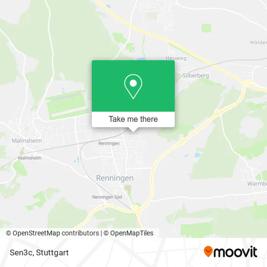
See Sen3c, Renningen, on the map
Public Transit to Sen3c in Renningen
Wondering how to get to Sen3c in Renningen? Moovit helps you find the best way to get to Sen3c with step-by-step directions from the nearest public transit station.
Moovit provides free maps and live directions to help you navigate through your city. View schedules, routes, timetables, and find out how long does it take to get to Sen3c in real time.
Looking for the nearest stop or station to Sen3c? Check out this list of stops closest to your destination: Renningen Keltenstraße; Renningen; Renningen Bf; Renningen Gleis 3; Renningen Bf (Industriestr.); Renningen Bf (Industriestr.) Pos 1.
Bus: 637, 747.Train: S6, S60, RB76, RB76.Light Rail: S6, S60.S-Bahn: S6, S60.
Want to see if there’s another route that gets you there at an earlier time? Moovit helps you find alternative routes or times. Get directions from and directions to Sen3c easily from the Moovit App or Website.
We make riding to Sen3c easy, which is why over 1.5 million users, including users in Renningen, trust Moovit as the best app for public transit. You don’t need to download an individual bus app or train app, Moovit is your all-in-one transit app that helps you find the best bus time or train time available.
For information on prices of bus, S-Bahn, light rail and train, costs and ride fares to Sen3c, please check the Moovit app.
Use the app to navigate to popular places including to the airport, hospital, stadium, grocery store, mall, coffee shop, school, college, and university.
Sen3c Address: Helvetierweg 2 71272 Renningen street in Renningen
- Ralf Weygand Changingmoves,
- Bürgerstiftung Renningen,
- Ingo Wilhelm Claussen Dipl.-ingenieur,
- A2bau Immobilien,
- Plmone,
- Fatima Merkt,
- Gear Capital,
- Corinna Eckert,
- Signal Iduna Versicherung Karin-Susan Kapp,
- Alemannenstraße 81,
- Michalak Desi,
- Tanzsportclub Renningen Malmsheim,
- Cip Pharmatraining,
- Zahnarztpraxis Renningen,
- Gamasche,
- Yoga-Studio Renningen,
- Echter See - Döner & Pizza,
- Lisa Sluyterman van Langeweyde Friseurbetrieb,
- Zu Wirbelfit,
- Coiffure Velly
Places Near Sen3c (Renningen)
- Porsche Museum, Zuffenhausen,
- Gasometer Pforzheim, Pforzheim,
- Hauptbahnhof Stuttgart, Stuttgart-Mitte,
- Wilhelma (U-Bahn Wilhelma), Bad Cannstatt,
- Mettingen Eros-Center Puff Laufhaus, Esslingen Am Neckar,
- Pariser Platz Stuttgart, Stuttgart-Mitte,
- Marmorsaal Im Weissenburgpark, Stuttgart-Süd,
- Geilhaus Haus 33a, Reutlingen-Betzingen,
- Mercedes-Benz Museum, Bad Cannstatt,
- FlixBus Haltestelle, Stuttgart,
- Hanns-Martin-Schleyer-Halle (Stuttgart Hans-Martin-Schleyerhalle), Bad Cannstatt,
- Waldfriedhof, Degerloch,
- SI-Centrum, Möhringen,
- Porsche-Arena, Bad Cannstatt,
- Schleyerhalle, Bad Cannstatt,
- Im Wizemann (Halle), Bad Cannstatt,
- Gleis 101/102 (tief), Stuttgart-Mitte,
- Hanns-Martin-Schleyer-Halle, Bad Cannstatt,
- Klinikum Stuttgart - Katharinenhospital, Stuttgart-Mitte,
- Mercedes-Benz Museum (Mercedes Museum Stuttgart), Bad Cannstatt
How to get to popular places in Stuttgart with public transit
Get around Renningen by public transit!
Traveling around Renningen has never been so easy. See step by step directions as you travel to any attraction, street or major public transit station. View bus and train schedules, arrival times, service alerts and detailed routes on a map, so you know exactly how to get to anywhere in Renningen.
When traveling to any destination around Renningen use Moovit's Live Directions with Get Off Notifications to know exactly where and how far to walk, how long to wait for your line, and how many stops are left. Moovit will alert you when it's time to get off — no need to constantly re-check whether yours is the next stop.
Wondering how to use public transit in Renningen or how to pay for public transit in Renningen? Moovit public transit app can help you navigate your way with public transit easily, and at minimum cost. It includes public transit fees, ticket prices, and costs. Looking for a map of Renningen public transit lines? Moovit public transit app shows all public transit maps in Renningen with all Bus, Train, Subway, Light Rail, Ferry, S-Bahn and Funicular routes and stops on an interactive map.
Stuttgart has 7 transit type(s), including: Bus, Train, Subway, Light Rail, Ferry, S-Bahn and Funicular, operated by several transit agencies, including SSB - Stadtbahn, SSB, SSB - Seilbahn / Zacke, S-Bahn Stuttgart, Rhein-Neckar-Verkehr GmbH (rnv), Karlsruher Verkehrsverbund, DB AG, DB Regiobus BW, Arverio Baden-Württemberg GmbH, DB RegioNetz Verkehrs GmbH Westfrankenbahn, DB Regio AG Baden-Württemberg, Südwestdeutsche Verkehrs-AG, DB Regio AG Mitte Region Hessen, DB and Bodensee-Oberschwaben-Bahn