Senter & Needles (N) stop - Thursday schedule
| Line | Direction | Time |
|---|---|---|
| 73 | Downtown San Jose via Senter | 5:37 AM |
| 73 | Downtown San Jose via Senter | 5:59 AM |
| 73 | Downtown San Jose via Senter | 6:21 AM |
| 73 | Downtown San Jose via Senter | 6:36 AM |
| 73 | Downtown San Jose via Senter | 6:50 AM |
| 73 | Downtown San Jose via Senter | 7:09 AM |
| 73 | Downtown San Jose via Senter | 7:25 AM |
| 73 | Downtown San Jose via Senter | 7:39 AM |
| 73 | Downtown San Jose via Senter | 7:54 AM |
| 73 | Downtown San Jose via Senter | 8:09 AM |
| 73 | Downtown San Jose via Senter | 8:25 AM |
| 73 | Downtown San Jose via Senter | 8:39 AM |
| 73 | Downtown San Jose via Senter | 8:54 AM |
| 73 | Downtown San Jose via Senter | 9:09 AM |
| 73 | Downtown San Jose via Senter | 9:24 AM |
| 73 | Downtown San Jose via Senter | 9:39 AM |
| 73 | Downtown San Jose via Senter | 9:55 AM |
| 73 | Downtown San Jose via Senter | 10:10 AM |
| 73 | Downtown San Jose via Senter | 10:25 AM |
| 73 | Downtown San Jose via Senter | 10:40 AM |
| 73 | Downtown San Jose via Senter | 10:54 AM |
| 73 | Downtown San Jose via Senter | 11:10 AM |
| 73 | Downtown San Jose via Senter | 11:25 AM |
| 73 | Downtown San Jose via Senter | 11:41 AM |
| 73 | Downtown San Jose via Senter | 11:56 AM |
Directions to Senter & Needles stop (San Jose) with public transit
The following transit lines have routes that pass near Senter & Needles
 Bus: 73.
- Train: LOCAL WEEKDAY, SOUTH COUNTY CONNECTOR, WEEKEND LOCAL.
How to get to Senter & Needles stop by bus?
Click on the bus route to see step by step directions with maps, line arrival times and updated time schedules.
How to get to Senter & Needles stop by train?
Click on the train route to see step by step directions with maps, line arrival times and updated time schedules.
Bus stops near Senter & Needles stop in San Jose
- Senter & Needles (S), 2 min walk,
Train stations near Senter & Needles station in San Jose
- Tamien, 24 min walk,
Light Rail stations near Senter & Needles station in San Jose
- Tamien Station, 24 min walk,
- Convention Center Station, 46 min walk,
Bus lines to Senter & Needles stop in San Jose
- 73, Downtown San Jose via Senter,
What are the closest stations to Senter & Needles?
The closest stations to Senter & Needles are:
- Senter & Needles (S) is 147 yards away, 2 min walk.
- Tamien is 1966 yards away, 24 min walk.
- Tamien Station is 2012 yards away, 24 min walk.
- Convention Center Station is 3872 yards away, 46 min walk.
Which bus line stops near Senter & Needles?
73 (Senter & Monterey via Senter)
Which train line stops near Senter & Needles?
LOCAL WEEKDAY (Tamien)
What’s the nearest light rail station to Senter & Needles in San Jose?
The nearest light rail station to Senter & Needles in San Jose is Tamien Station. It’s a 24 min walk away.
What’s the nearest train station to Senter & Needles in San Jose?
The nearest train station to Senter & Needles in San Jose is Tamien. It’s a 24 min walk away.
What’s the nearest bus station to Senter & Needles in San Jose?
The nearest bus station to Senter & Needles in San Jose is Senter & Needles (S). It’s a 2 min walk away.
What time is the first light rail to Senter & Needles in San Jose?
The BLUE LINE is the first light rail that goes to Senter & Needles in San Jose. It stops nearby at 4:41 AM.
What time is the last light rail to Senter & Needles in San Jose?
The BLUE LINE is the last light rail that goes to Senter & Needles in San Jose. It stops nearby at 1:31 AM.
What time is the first train to Senter & Needles in San Jose?
The LOCAL WEEKDAY is the first train that goes to Senter & Needles in San Jose. It stops nearby at 4:37 AM.
What time is the last train to Senter & Needles in San Jose?
The LOCAL WEEKDAY is the last train that goes to Senter & Needles in San Jose. It stops nearby at 1:28 AM.
What time is the first bus to Senter & Needles in San Jose?
The 73 is the first bus that goes to Senter & Needles in San Jose. It stops nearby at 5:35 AM.
What time is the last bus to Senter & Needles in San Jose?
The 73 is the last bus that goes to Senter & Needles in San Jose. It stops nearby at 11:35 PM.
Senter & Needles station
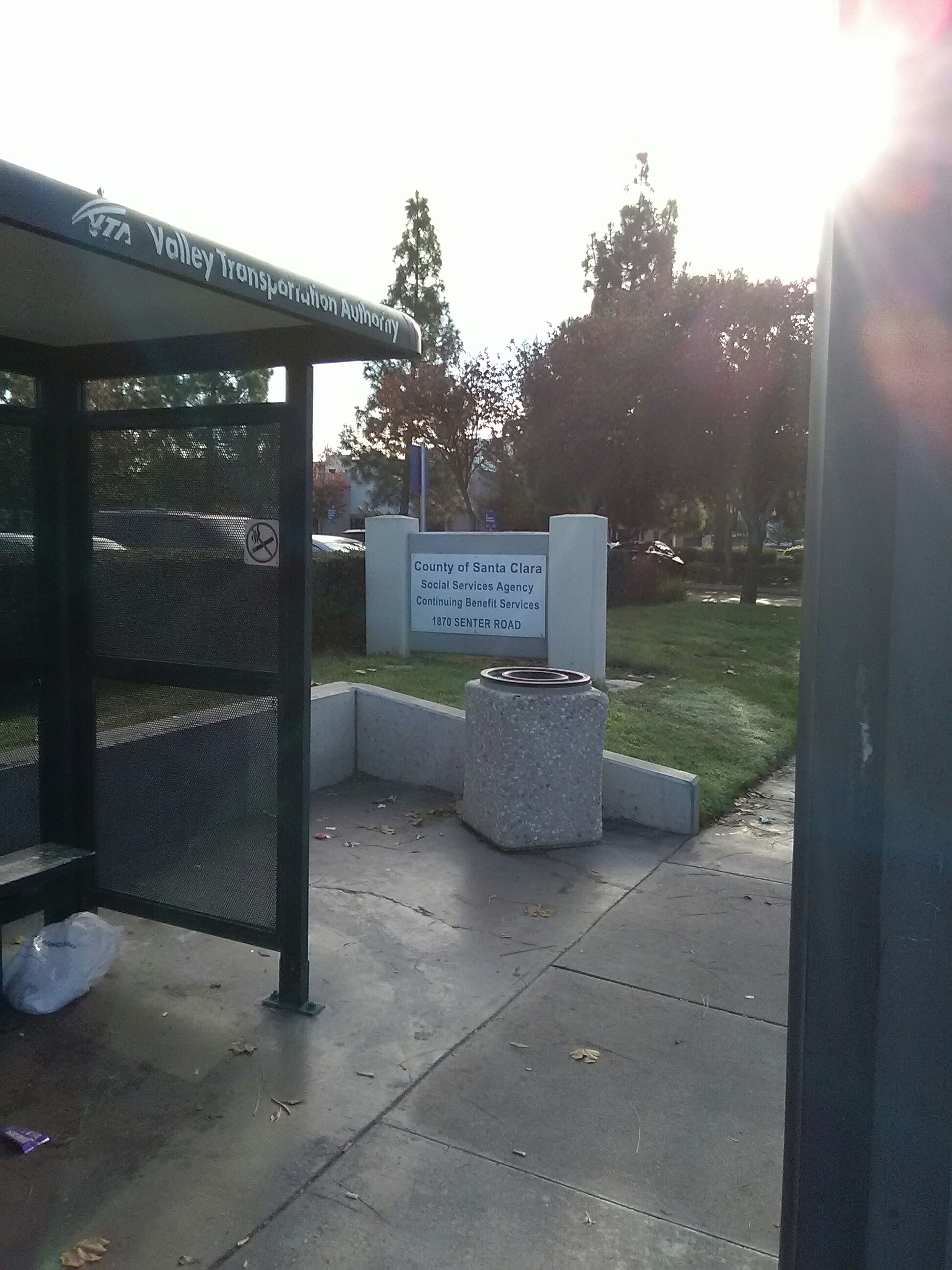 Taken by Dale T.
See Senter & Needles stop, San Jose, on the map
Public transit to Senter & Needles (N) stop (ID: 63792) in San Jose
Looking for directions to Senter & Needles in San Jose, United States?
Download the Moovit App to find the current schedule and step-by-step directions for Bus or Train routes that pass through Senter & Needles.
Looking for the nearest stops closest to Senter & Needles ? Check out this list of closest stops to your destination: Senter & Needles (S); Tamien; Tamien Station; Convention Center Station.
Bus: 73.Train: LOCAL WEEKDAY, SOUTH COUNTY CONNECTOR, WEEKEND LOCAL.
We make riding on public transit to Senter & Needles easy, which is why over 1.7 million users, including users in San Jose trust Moovit as the best app for public transit.
Use the app to navigate to popular places including to the airport, hospital, stadium, grocery store, mall, coffee shop, school, college, and university.
Senter & Needles (N) stop’s code is 63792
The first line to this stop is 73, at 5:37 AM, and the last line is 73 at 10:18 PM.
This stop serves VTA’s lines
- Senter & Needles (S)
Bus stop near Senter & Needles (N) stop
- Tamien
Train station near Senter & Needles (N) station
- Tamien Station,
- Convention Center Station
Light Rail stations near Senter & Needles (N) station
- Capitol & Aborn (N),
- Santa Teresa Station,
- Washington & Newhall (S),
- Pinole Valley Shopping Center,
- Newell Ave and S Main St,
- Mission St & 14th St,
- 19th Ave & Junipero Serra Blvd,
- Hillside Blvd & Brunswick St,
- Lincoln Way & 35th Ave,
- Alum Rock & Jackson (E),
- Noriega St & 39th Ave,
- Tamien Station (N),
- Bollinger & Miller (W),
- N Milpitas Blvd & Jacklin St,
- 3rd St & Carroll Ave,
- Lincoln Ave & Mission Ave,
- Owens Street and Gene Friend Way,
- Steiner St & Vallejo St,
- Eastmoor Ave & Sullivan Ave,
- Martin Luther King Jr Way & 29th St
Popular public transit stations in San Jose
Get around San Jose by public transit!
Traveling around San Jose has never been so easy. See step by step directions as you travel to any attraction, street or major public transit station. View bus and train schedules, arrival times, service alerts and detailed routes on a map, so you know exactly how to get to anywhere in San Jose.
When traveling to any destination around San Jose use Moovit's Live Directions with Get Off Notifications to know exactly where and how far to walk, how long to wait for your line, and how many stops are left. Moovit will alert you when it's time to get off — no need to constantly re-check whether yours is the next stop.
Wondering how to use public transit in San Jose or how to pay for public transit in San Jose? Moovit public transit app can help you navigate your way with public transit easily, and at minimum cost. It includes public transit fees, ticket prices, and costs. Looking for a map of San Jose public transit lines? Moovit public transit app shows all public transit maps in San Jose with all Bus, Train, BART, Light Rail, Ferry and Cable Car routes and stops on an interactive map.
San Francisco - San Jose, CA has 6 transit type(s), including: Bus, Train, BART, Light Rail, Ferry and Cable Car, operated by several transit agencies, including BART, Muni Metro, Caltrain, VTA, Capitol Corridor, Sonoma Marin Area Rail Transit, MUNI, SF Cable Car, AC Transit , AC Transit, Dumbarton Express, Golden Gate Transit, County Connection, SamTrans and SamTrans / City of Menlo Park