How to get to Sentinel Autolocksmith by bus?
Click on the bus route to see step by step directions with maps, line arrival times and updated time schedules.
From Clyde's of Gallery Place, Washington
88 minFrom DC to Rehoboth Beach, Washington
86 minFrom Lincoln Memorial, Washington
86 minFrom Trinity Washington University, Washington
90 minFrom Residence Inn-Washington, Washington
76 minFrom Franklin Park, Washington
73 minFrom Hillwood Estate, Museum & Gardens, Washington
71 minFrom Federal Bureau Of Investigation - J. Edgar Hoover Building, Washington
84 minFrom Gallery Place, Washington
88 minFrom 901 F St NW, Washington
89 min
How to get to Sentinel Autolocksmith by metro?
Click on the metro route to see step by step directions with maps, line arrival times and updated time schedules.
From Clyde's of Gallery Place, Washington
65 minFrom DC to Rehoboth Beach, Washington
70 minFrom Residence Inn-Washington, Washington
71 minFrom Franklin Park, Washington
70 minFrom Federal Bureau Of Investigation - J. Edgar Hoover Building, Washington
72 minFrom Gallery Place, Washington
68 minFrom 901 F St NW, Washington
68 min
Bus stop near Sentinel Autolocksmith in Montgomery County
- Sangamore Rd & Sentinel Dr, 9 min walk,VIEW
Metro station near Sentinel Autolocksmith in Montgomery County
- Tenleytown Metro Station, 60 min walk,VIEW
Bus lines to Sentinel Autolocksmith in Montgomery County
- 23, Sibley Hospital,VIEW
What are the closest stations to Sentinel Autolocksmith?
The closest stations to Sentinel Autolocksmith are:
- Sangamore Rd & Sentinel Dr is 670 yards away, 9 min walk.
- Tenleytown Metro Station is 5045 yards away, 60 min walk.
Which bus line stops near Sentinel Autolocksmith?
23 (Sibley Hospital)
Which metro line stops near Sentinel Autolocksmith?
RED (Shady Grove)
What’s the nearest bus station to Sentinel Autolocksmith in Montgomery County?
The nearest bus station to Sentinel Autolocksmith in Montgomery County is Sangamore Rd & Sentinel Dr. It’s a 9 min walk away.
What time is the first metro to Sentinel Autolocksmith in Montgomery County?
The RED is the first metro that goes to Sentinel Autolocksmith in Montgomery County. It stops nearby at 5:21 AM.
What time is the last metro to Sentinel Autolocksmith in Montgomery County?
The RED is the last metro that goes to Sentinel Autolocksmith in Montgomery County. It stops nearby at 12:19 AM.
What time is the first bus to Sentinel Autolocksmith in Montgomery County?
The 23 is the first bus that goes to Sentinel Autolocksmith in Montgomery County. It stops nearby at 5:35 AM.
What time is the last bus to Sentinel Autolocksmith in Montgomery County?
The 23 is the last bus that goes to Sentinel Autolocksmith in Montgomery County. It stops nearby at 10:37 PM.
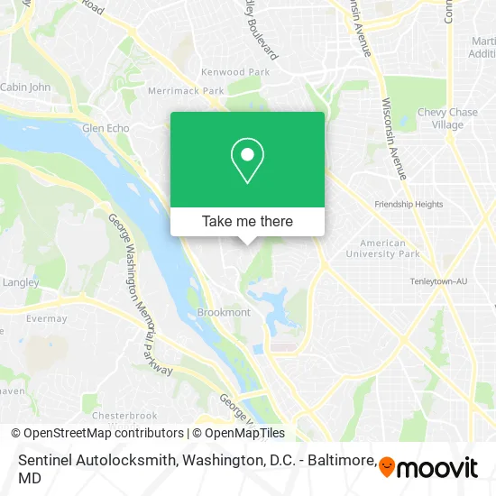
See Sentinel Autolocksmith, Montgomery County, on the map
Public Transit to Sentinel Autolocksmith in Montgomery County
Wondering how to get to Sentinel Autolocksmith in Montgomery County? Moovit helps you find the best way to get to Sentinel Autolocksmith with step-by-step directions from the nearest public transit station.
Moovit provides free maps and live directions to help you navigate through your city. View schedules, routes, timetables, and find out how long does it take to get to Sentinel Autolocksmith in real time.
Looking for the nearest stop or station to Sentinel Autolocksmith? Check out this list of stops closest to your destination: Sangamore Rd & Sentinel Dr; Tenleytown Metro Station.
Bus: 23.Metro: RED.
Want to see if there’s another route that gets you there at an earlier time? Moovit helps you find alternative routes or times. Get directions from and directions to Sentinel Autolocksmith easily from the Moovit App or Website.
We make riding to Sentinel Autolocksmith easy, which is why over 1.5 million users, including users in Montgomery County, trust Moovit as the best app for public transit. You don’t need to download an individual bus app or train app, Moovit is your all-in-one transit app that helps you find the best bus time or train time available.
For information on prices of bus and metro, costs and ride fares to Sentinel Autolocksmith, please check the Moovit app.
Use the app to navigate to popular places including to the airport, hospital, stadium, grocery store, mall, coffee shop, school, college, and university.
Sentinel Autolocksmith Address: 4986 Sentinel Dr Bethesda, MD 20816 street in Montgomery County
- Chiropractic Auto Accidents Treatment,
- Treats From Home,
- Engineer Agency for Resourc es,
- Allure Technical Services,
- Alan G Kline DDS,
- Northeast Plumbing,
- Sharron Cochran,
- Peyton's Dreams,
- Tammy Gruner Durbin, Realtor,
- Homes & Loan,
- Pam K. Bambini Children's Boutique,
- Round Rock Investments,
- Hill Slowinski, Realtor,
- Gogo Access,
- Case Architects & Remodelers,
- Westwood Pet Center,
- STARBUCKS,
- F45 Training Bethesda South,
- Raymond Chen,
- The Shops at Sumner Place
Places Near Sentinel Autolocksmith (Montgomery County)
- Basilica of the National Shrine, Washington,
- Rock Creek Tennis Center, Washington,
- Westfield Montgomery Mall, Montgomery County,
- Warner Theatre, Washington,
- The Anthem, Washington,
- M&T Bank Stadium, Baltimore,
- Marriott Marquis Washington, DC, Washington,
- Museum Of The Bible, Washington,
- National Theatre, Washington,
- Washington National Cathedral, Washington,
- National Zoo, Washington,
- National Museum of African American History and Culture, Washington,
- Pennsylvania Ave NW (3rd st and pennsylvania), Washington,
- Amazon Hq2, Arlington County,
- Capital One Arena, Washington,
- Georgetown, Washington,
- Sibley Memorial Hospital, Washington,
- PG Mall, Prince George's County,
- Washington DC VA Medical Center, Washington,
- Camden Yards, Baltimore
How to get to popular places in Washington, D.C. - Baltimore, MD with public transit
Get around Montgomery County by public transit!
Traveling around Montgomery County has never been so easy. See step by step directions as you travel to any attraction, street or major public transit station. View bus and train schedules, arrival times, service alerts and detailed routes on a map, so you know exactly how to get to anywhere in Montgomery County.
When traveling to any destination around Montgomery County use Moovit's Live Directions with Get Off Notifications to know exactly where and how far to walk, how long to wait for your line, and how many stops are left. Moovit will alert you when it's time to get off — no need to constantly re-check whether yours is the next stop.
Wondering how to use public transit in Montgomery County or how to pay for public transit in Montgomery County? Moovit public transit app can help you navigate your way with public transit easily, and at minimum cost. It includes public transit fees, ticket prices, and costs. Looking for a map of Montgomery County public transit lines? Moovit public transit app shows all public transit maps in Montgomery County with all Bus, Train, Metro, Light Rail and Ferry routes and stops on an interactive map.
Washington, D.C. - Baltimore, MD has 5 transit type(s), including: Bus, Train, Metro, Light Rail and Ferry, operated by several transit agencies, including WMATA, Montgomery County Ride On, Fairfax Connector, TheBus, PRTC, DASH - Alexandria, Arlington Transit (ART), RTA of Central Maryland, MDOT MTA, MDOT MTA Light RailLink, MDOT MTA Commuter Bus, MDOT MTA Local Bus, FXBGO!, Virginia Railway Express (VRE) and MARC