Directions to Sentry Electronics Group (Accomack County) with public transportation
The following transit lines have routes that pass near Sentry Electronics Group
 Bus: GREYHOUND US0355, BLUE, GOLD, SILVER.
How to get to Sentry Electronics Group by bus?
Click on the bus route to see step by step directions with maps, line arrival times and updated time schedules.
Bus stops near Sentry Electronics Group in Accomack County
Bus lines to Sentry Electronics Group in Accomack County
What are the closest stations to Sentry Electronics Group?
The closest stations to Sentry Electronics Group are:
- Oak Hall Post Office is 205 yards away, 4 min walk.
- Horsey Rd/Rt 13 is 750 yards away, 10 min walk.
Which bus line stops near Sentry Electronics Group?
GREYHOUND US0355 (Norfolk)
What’s the nearest bus station to Sentry Electronics Group in Accomack County?
The nearest bus station to Sentry Electronics Group in Accomack County is Oak Hall Post Office. It’s a 4 min walk away.
What time is the first bus to Sentry Electronics Group in Accomack County?
The GOLD is the first bus that goes to Sentry Electronics Group in Accomack County. It stops nearby at 8:12 AM.
What time is the last bus to Sentry Electronics Group in Accomack County?
The BLUE is the last bus that goes to Sentry Electronics Group in Accomack County. It stops nearby at 5:50 PM.
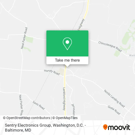
See Sentry Electronics Group, Accomack County, on the map
Public Transit to Sentry Electronics Group in Accomack County
Wondering how to get to Sentry Electronics Group in Accomack County? Moovit helps you find the best way to get to Sentry Electronics Group with step-by-step directions from the nearest public transit station.
Moovit provides free maps and live directions to help you navigate through your city. View schedules, routes, timetables, and find out how long does it take to get to Sentry Electronics Group in real time.
Looking for the nearest stop or station to Sentry Electronics Group? Check out this list of stops closest to your destination: Oak Hall Post Office; Horsey Rd/Rt 13.
Bus: GREYHOUND US0355, BLUE, GOLD, SILVER.
Want to see if there’s another route that gets you there at an earlier time? Moovit helps you find alternative routes or times. Get directions from and directions to Sentry Electronics Group easily from the Moovit App or Website.
We make riding to Sentry Electronics Group easy, which is why over 1.5 million users, including users in Accomack County, trust Moovit as the best app for public transit. You don’t need to download an individual bus app or train app, Moovit is your all-in-one transit app that helps you find the best bus time or train time available.
For information on prices of bus, costs and ride fares to Sentry Electronics Group, please check the Moovit app.
Use the app to navigate to popular places including to the airport, hospital, stadium, grocery store, mall, coffee shop, school, college, and university.
Sentry Electronics Group Address: 8131 Lankford Hwy Oak Hall, VA 23416 street in Accomack County
- Post Office,
- T's Cleaners,
- Arcadia High,
- Badger Vocational Education Center - North,
- Daniel Makas MD,
- Eastern Shore Rural Health Systems,
- Tri-Meta Wellness Center,
- Arcadia Middle School,
- Arcadia Middle School,
- T's Corner,
- Budget Truck Rental,
- Branscome,
- Chaney Enterprises - Oak Hall, VA Concrete Plant,
- Blue Marsh Shoreliners,
- Allen Clark Construction,
- Oak Hall Materials,
- PNC Bank,
- AC Cycle Service,
- Alcoholic Beverage Control Department Retail Liquor Stores,
- Credit Union 1
Places Near Sentry Electronics Group (Accomack County)
- Sibley Memorial Hospital, Washington,
- National Museum of African American History and Culture, Washington,
- Camden Yards, Baltimore,
- PG Mall, Prince George's County,
- National Zoo, Washington,
- Museum Of The Bible, Washington,
- Amazon Hq2, Arlington County,
- M&T Bank Stadium, Baltimore,
- Pennsylvania Ave NW (3rd st and pennsylvania), Washington,
- Georgetown, Washington,
- Warner Theatre, Washington,
- Rock Creek Tennis Center, Washington,
- National Theatre, Washington,
- Washington National Cathedral, Washington,
- Washington DC VA Medical Center, Washington,
- The Anthem, Washington,
- Capital One Arena, Washington,
- Westfield Montgomery Mall, Montgomery County,
- Basilica of the National Shrine, Washington,
- Marriott Marquis Washington, DC, Washington
How to get to popular places in Washington, D.C. - Baltimore, MD with public transit
Get around Accomack County by public transit!
Traveling around Accomack County has never been so easy. See step by step directions as you travel to any attraction, street or major public transit station. View bus and train schedules, arrival times, service alerts and detailed routes on a map, so you know exactly how to get to anywhere in Accomack County.
When traveling to any destination around Accomack County use Moovit's Live Directions with Get Off Notifications to know exactly where and how far to walk, how long to wait for your line, and how many stops are left. Moovit will alert you when it's time to get off — no need to constantly re-check whether yours is the next stop.
Wondering how to use public transit in Accomack County or how to pay for public transit in Accomack County? Moovit public transit app can help you navigate your way with public transit easily, and at minimum cost. It includes public transit fees, ticket prices, and costs. Looking for a map of Accomack County public transit lines? Moovit public transit app shows all public transit maps in Accomack County with all Bus, Train, Metro, Light Rail and Ferry routes and stops on an interactive map.
Washington, D.C. - Baltimore, MD has 5 transit type(s), including: Bus, Train, Metro, Light Rail and Ferry, operated by several transit agencies, including WMATA, Montgomery County Ride On, Fairfax Connector, TheBus, PRTC, DASH - Alexandria, Arlington Transit (ART), RTA of Central Maryland, MDOT MTA, MDOT MTA Light RailLink, MDOT MTA Commuter Bus, MDOT MTA Local Bus, FXBGO!, Virginia Railway Express (VRE) and MARC