How to get to Sepulveda & Assoc PC by bus?
Click on the bus route to see step by step directions with maps, line arrival times and updated time schedules.
Bus stops near Sepulveda & Assoc PC in Boston
What are the closest stations to Sepulveda & Assoc PC?
The closest stations to Sepulveda & Assoc PC are:
- Fletcher St & North Rd is 209 yards away, 3 min walk.
- Billerica Rd & Wilson St is 511 yards away, 7 min walk.
Which bus lines stop near Sepulveda & Assoc PC?
These bus lines stop near Sepulveda & Assoc PC: 15, 16.
What’s the nearest bus station to Sepulveda & Assoc PC in Boston?
The nearest bus station to Sepulveda & Assoc PC in Boston is Fletcher St & North Rd. It’s a 3 min walk away.
What time is the first bus to Sepulveda & Assoc PC in Boston?
The 15 is the first bus that goes to Sepulveda & Assoc PC in Boston. It stops nearby at 7:06 AM.
What time is the last bus to Sepulveda & Assoc PC in Boston?
The 16 is the last bus that goes to Sepulveda & Assoc PC in Boston. It stops nearby at 7:52 PM.
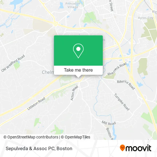
See Sepulveda & Assoc PC, Boston, on the map
Public Transit to Sepulveda & Assoc PC in Boston
Wondering how to get to Sepulveda & Assoc PC in Boston? Moovit helps you find the best way to get to Sepulveda & Assoc PC with step-by-step directions from the nearest public transit station.
Moovit provides free maps and live directions to help you navigate through your city. View schedules, routes, timetables, and find out how long does it take to get to Sepulveda & Assoc PC in real time.
Looking for the nearest stop or station to Sepulveda & Assoc PC? Check out this list of stops closest to your destination: Fletcher St & North Rd; Billerica Rd & Wilson St.
Bus: 15, 16.
Want to see if there’s another route that gets you there at an earlier time? Moovit helps you find alternative routes or times. Get directions from and directions to Sepulveda & Assoc PC easily from the Moovit App or Website.
We make riding to Sepulveda & Assoc PC easy, which is why over 1.7 million users, including users in Boston, trust Moovit as the best app for public transit. You don’t need to download an individual bus app or train app, Moovit is your all-in-one transit app that helps you find the best bus time or train time available.
For information on prices of bus and train, costs and ride fares to Sepulveda & Assoc PC, please check the Moovit app.
Use the app to navigate to popular places including to the airport, hospital, stadium, grocery store, mall, coffee shop, school, college, and university.
Sepulveda & Assoc PC Address: 9 North Rd Chelmsford, MA 01824 street in Boston
- Center for Plastic Sur,
- The Joy of Paint at the Cca,
- Little Acorn Preschool Ma,
- Simplicity,
- Shake-O-Holic,
- Village Square Beauty Shoppe,
- Expert Electrology & Laser LLC,
- Glam Beauty Lounge,
- Chelmsford Sub Shoppe,
- Village Electric,
- Christine Hayes, MD,
- Bradford P Fortin Attorney,
- FedEx,
- Covid-19 Testing Site: Quest Diagnostics - Chelmsford,
- Melissa Michelon, MD,
- Helen Raynham, MD, PHD,
- Paul Bostrom, MD, Faad,
- Mill Street Hvac,
- Maureen Howe, Realtor,
- CITGO
Places Near Sepulveda & Assoc PC (Boston)
- Boston Medical Center, Boston,
- Seaport District, Boston,
- Cheers, Boston,
- Td Garden, Boston,
- North End, Boston,
- Mgm Music Hall, Boston,
- Boston Children's Hospital, Boston,
- Leader Bank Pavilion (Leader Bank Pavillion), Boston,
- Boston Convention & Exhibition Center, Boston,
- Museum Of Science, Boston,
- Faneuil Hall, Boston,
- Castle Island, Boston,
- Wilbur Theatre, Boston,
- Prudential Center, Boston,
- Wang Theater, Boston,
- Quincy Market, Boston,
- Isabella Stewart Gardner Museum, Boston,
- House Of Blues, Boston,
- Massachusetts General Hospital, Boston,
- Boston Common, Boston
How to get to popular places in Boston with public transit
Get around Boston by public transit!
Traveling around Boston has never been so easy. See step by step directions as you travel to any attraction, street or major public transit station. View bus and train schedules, arrival times, service alerts and detailed routes on a map, so you know exactly how to get to anywhere in Boston.
When traveling to any destination around Boston use Moovit's Live Directions with Get Off Notifications to know exactly where and how far to walk, how long to wait for your line, and how many stops are left. Moovit will alert you when it's time to get off — no need to constantly re-check whether yours is the next stop.
Wondering how to use public transit in Boston or how to pay for public transit in Boston? Moovit public transit app can help you navigate your way with public transit easily, and at minimum cost. It includes public transit fees, ticket prices, and costs. Looking for a map of Boston public transit lines? Moovit public transit app shows all public transit maps in Boston with all Bus, Train, Subway and Ferry routes and stops on an interactive map.
Boston has 4 transit type(s), including: Bus, Train, Subway and Ferry, operated by several transit agencies, including MBTA, Southeastern Regional Transit Authority, MetroWest Regional Transit Authority, Rhode Island Public Transit Authority, WRTA, Lowell Regional Transit Authority, Merrimack Valley Transit, Montachusett Regional Transit Authority, Cape Cod Regional Transit Authority, Brockton Area Transit Authority, Martha's Vineyard Transit Authority, the WAVE - Nantucket Regional Transit Authority, GATRA, Cape Ann Transportation Authority and Massport