How to get to Serra-Chapa by bus?
Click on the bus route to see step by step directions with maps, line arrival times and updated time schedules.
From São Bento, Figueiró (Santiago e Santa Cristina)
106 minFrom Amarante, Amarante (São Gonçalo), Madalena, Cepelos e Gatão
77 minFrom Universidade - Escola Superior de Tecnologia e Gestão de Felgueiras, Margaride (Santa Eulália), Várzea, Lagares, Varziela e Moure
85 minFrom Ecopista do Tâmega, Amarante (São Gonçalo), Madalena, Cepelos e Gatão
69 minFrom CPCJ de Felgueiras, Margaride (Santa Eulália), Várzea, Lagares, Varziela e Moure
143 minFrom Rio Tâmega, Amarante (São Gonçalo), Madalena, Cepelos e Gatão
77 minFrom Amarante, Amarante (São Gonçalo), Madalena, Cepelos e Gatão
71 minFrom Pingo Doce Amarante, Amarante
63 minFrom Felgueiras, Margaride (Santa Eulália), Várzea, Lagares, Varziela e Moure
146 minFrom ESTGF - Auditório Prof. Luís Soares, Margaride (Santa Eulália), Várzea, Lagares, Varziela e Moure
84 min
Bus stop near Serra-Chapa in Vila Garcia, Aboim e Chapa
- Travessa da Serra, 2 min walk,VIEW
Bus lines to Serra-Chapa in Vila Garcia, Aboim e Chapa
What are the closest stations to Serra-Chapa?
The closest stations to Serra-Chapa are:
- Travessa da Serra is 107 meters away, 2 min walk.
Which bus lines stop near Serra-Chapa?
These bus lines stop near Serra-Chapa: C-2011, C-2013, N3, U1.
What’s the nearest bus station to Serra-Chapa in Vila Garcia, Aboim e Chapa?
The nearest bus station to Serra-Chapa in Vila Garcia, Aboim e Chapa is Travessa da Serra. It’s a 2 min walk away.
What time is the first bus to Serra-Chapa in Vila Garcia, Aboim e Chapa?
The N4 is the first bus that goes to Serra-Chapa in Vila Garcia, Aboim e Chapa. It stops nearby at 7:27 AM.
What time is the last bus to Serra-Chapa in Vila Garcia, Aboim e Chapa?
The N4 is the last bus that goes to Serra-Chapa in Vila Garcia, Aboim e Chapa. It stops nearby at 7:02 PM.
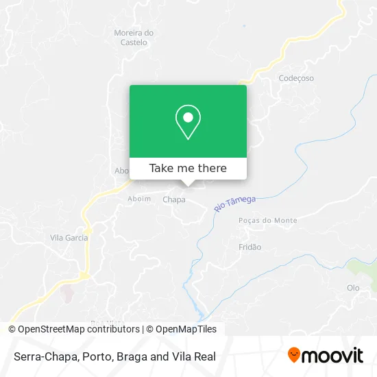
See Serra-Chapa, Vila Garcia, Aboim e Chapa, on the map
Public Transit to Serra-Chapa in Vila Garcia, Aboim e Chapa
Wondering how to get to Serra-Chapa in Vila Garcia, Aboim e Chapa? Moovit helps you find the best way to get to Serra-Chapa with step-by-step directions from the nearest public transit station.
Moovit provides free maps and live directions to help you navigate through your city. View schedules, routes, timetables, and find out how long does it take to get to Serra-Chapa in real time.
Looking for the nearest stop or station to Serra-Chapa? Check out this list of stops closest to your destination: Travessa da Serra.
Bus: C-2011, C-2013, N3, U1, N4.
Want to see if there’s another route that gets you there at an earlier time? Moovit helps you find alternative routes or times. Get directions from and directions to Serra-Chapa easily from the Moovit App or Website.
We make riding to Serra-Chapa easy, which is why over 1.5 million users, including users in Vila Garcia, Aboim e Chapa, trust Moovit as the best app for public transit. You don’t need to download an individual bus app or train app, Moovit is your all-in-one transit app that helps you find the best bus time or train time available.
For information on prices of bus, costs and ride fares to Serra-Chapa, please check the Moovit app.
Use the app to navigate to popular places including to the airport, hospital, stadium, grocery store, mall, coffee shop, school, college, and university.
Serra-Chapa Address: Amarante, street in Vila Garcia, Aboim e Chapa
- Aguilhão,
- Rua de Estação,
- Campo de Futebol de Chapa Em Amarante,
- Lota Marisqueira & Bar,
- Rua Teixeira de Pascoaes,
- Ecopista do Tâmega - Estação da Chapa,
- Antiga Estação Ferróviária de Chapa,
- Chapa,
- Aboim,
- Flávio Jorge Moreira de Moura,
- Abointur - Investimentos e Serviços Unipessoal Lda,
- Sociedade de Construções Maria da Luz Teixeira,
- Santuário do Vinho Verde,
- Aboim,
- eucalipto,
- Cemitério de Fridão,
- Ribeira de Santa Natália,
- Filhos de Moura - Adega Regional,
- Igreja Matriz de Aboim - S. Pedro,
- Unlock Thoughts S.a
Places Near Serra-Chapa (Vila Garcia, Aboim e Chapa)
- Leça da Palmeira, Matosinhos e Leça da Palmeira,
- Hospital Santos Silva, Vila Nova De Gaia,
- Exponor, Matosinhos e Leça da Palmeira,
- Maia, Maia,
- Zoo Santo Inácio, Vila Nova De Gaia,
- Senhor de Matosinhos, Matosinhos e Leça da Palmeira,
- Canidelo, Vila Nova De Gaia,
- Acesso ao Shopping Parque Nascente, Campanhã,
- Arrábida Shopping, Santa Marinha e São Pedro da Afurada,
- VILA do CONDE PORTO FASHION OUTLET, Modivas,
- Rua Calouste Gulbenkian, Lordelo do Ouro e Massarelos,
- MAR Shopping, Matosinhos e Leça da Palmeira,
- Hospital da Prelada, Ramalde,
- El Corte Inglés de Gaia, Mafamude e Vilar do Paraíso,
- Palácio de Cristal, Lordelo do Ouro e Massarelos,
- Avintes, Vila Nova De Gaia,
- Valongo, Valongo,
- Espinho, Espinho,
- Parque Aquatico Amarante - Aqua Aventura, Amarante,
- Hospital de Santo António, Cedofeita, Santo Ildefonso, Sé, Miragaia, São Nicolau e Vitória
How to get to popular places in Porto, Braga and Vila Real with public transit
Get around Vila Garcia, Aboim e Chapa by public transit!
Traveling around Vila Garcia, Aboim e Chapa has never been so easy. See step by step directions as you travel to any attraction, street or major public transit station. View bus and train schedules, arrival times, service alerts and detailed routes on a map, so you know exactly how to get to anywhere in Vila Garcia, Aboim e Chapa.
When traveling to any destination around Vila Garcia, Aboim e Chapa use Moovit's Live Directions with Get Off Notifications to know exactly where and how far to walk, how long to wait for your line, and how many stops are left. Moovit will alert you when it's time to get off — no need to constantly re-check whether yours is the next stop.
Wondering how to use public transit in Vila Garcia, Aboim e Chapa or how to pay for public transit in Vila Garcia, Aboim e Chapa? Moovit public transit app can help you navigate your way with public transit easily, and at minimum cost. It includes public transit fees, ticket prices, and costs. Looking for a map of Vila Garcia, Aboim e Chapa public transit lines? Moovit public transit app shows all public transit maps in Vila Garcia, Aboim e Chapa with all Bus, Train, Metro, Ferry, Funicular and Gondola routes and stops on an interactive map.
Porto, Braga and Vila Real has 6 transit type(s), including: Bus, Train, Metro, Ferry, Funicular and Gondola, operated by several transit agencies, including Metro do Porto, Metro do Porto - Metrobus, CP - Comboios de Portugal, STCP, UNIR Mobilidade da Area Metropolitana do Porto, Getbus - Aerobus, Mobiave, Valpibus, TUB - Transportes Urbanos de Braga, TuViana, Guimabus, Ave Mobilidade, Cávado Mobilidade, Transdev and Câmara Municipal de Santo Tirso