How to get to Service by bus?
Click on the bus route to see step by step directions with maps, line arrival times and updated time schedules.
From Aéroport du Bourget, Le Bourget
38 minFrom Rue Proudhon, Saint-Denis
73 minFrom Villepinte, Villepinte
23 minFrom Aéroville, Tremblay-En-France
52 minFrom Orange Stadium, Saint-Denis
63 minFrom Cimetière Parisien, Pantin
71 minFrom EDF Cap Ampère, Saint-Denis
64 minFrom Studio 217, Aubervilliers
71 minFrom La Plaine Saint-Denis, Saint-Denis
70 minFrom Le Millénaire, Aubervilliers
69 min
Bus stops near Service in Gonesse
Bus lines to Service in Gonesse
- 23, Centre Commercial O'Parinor - Louis Armand,VIEW
- 36, Rond-Point de Bonneuil,VIEW
- 37, Gare de Villiers-Le-Bel Gonesse Arnouville,VIEW
- 11, Marché de Saint-Denis,VIEW
- 250, Fort D'Aubervilliers,VIEW
- 9502, Gare de Sarcelles - Saint-Brice,VIEW
- FILÉO SAR, Gare de Roissypole - Aéroport Cdg1 (B4),VIEW
- 11.5, Le Moulin,VIEW
What are the closest stations to Service?
The closest stations to Service are:
- Saint Nicolas is 48 meters away, 1 min walk.
- Rond-Point de Bonneuil is 258 meters away, 4 min walk.
- Chemin du Moulin D'Etif is 450 meters away, 6 min walk.
- Jean Jaurès is 562 meters away, 8 min walk.
- Rue D'Aulnay is 571 meters away, 8 min walk.
- Collège Philippe Auguste is 599 meters away, 8 min walk.
Which bus lines stop near Service?
These bus lines stop near Service: 11, 23, 250.
What’s the nearest bus station to Service in Gonesse?
The nearest bus station to Service in Gonesse is Saint Nicolas. It’s a 1 min walk away.
What time is the first bus to Service in Gonesse?
The FILÉO SAR is the first bus that goes to Service in Gonesse. It stops nearby at 3:18 AM.
What time is the last bus to Service in Gonesse?
The FILÉO SAR is the last bus that goes to Service in Gonesse. It stops nearby at 3:18 AM.
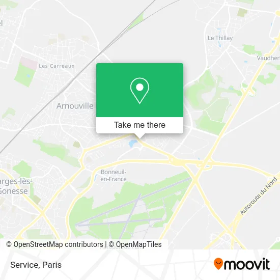
See Service, Gonesse, on the map
Public Transit to Service in Gonesse
Wondering how to get to Service in Gonesse? Moovit helps you find the best way to get to Service with step-by-step directions from the nearest public transit station.
Moovit provides free maps and live directions to help you navigate through your city. View schedules, routes, timetables, and find out how long does it take to get to Service in real time.
Looking for the nearest stop or station to Service? Check out this list of stops closest to your destination: Saint Nicolas; Rond-Point de Bonneuil; Chemin du Moulin D'Etif; Jean Jaurès; Rue D'Aulnay; Collège Philippe Auguste.
Bus: 11, 23, 250, 36, 37, 9502, FILÉO SAR, 11.5.
Want to see if there’s another route that gets you there at an earlier time? Moovit helps you find alternative routes or times. Get directions from and directions to Service easily from the Moovit App or Website.
We make riding to Service easy, which is why over 1.5 million users, including users in Gonesse, trust Moovit as the best app for public transit. You don’t need to download an individual bus app or train app, Moovit is your all-in-one transit app that helps you find the best bus time or train time available.
For information on prices of bus, RER and metro, costs and ride fares to Service, please check the Moovit app.
Use the app to navigate to popular places including to the airport, hospital, stadium, grocery store, mall, coffee shop, school, college, and university.
Service Address: 370 Rue Nungesser et Coli 95500 Gonesse street in Gonesse
- Route nationale 370,
- Wash,
- Lyra-Diag,
- 2 Rond-Point Bonneuil,
- Espace Godard,
- KFC,
- Rond-Point de la Laïcité,
- 2 Rue Nungesser et Coli,
- Rue Nungesser et Coli,
- Le Château 95,
- Gonesse Food,
- Restaurant le Royal Coreen,
- 10 Rue d'Aulnay,
- Power Dot,
- Courtepaille Gonesse,
- 12 Bis Rue de Paris,
- Notaires Goness,
- La Cuisse ou l'Aile,
- Café de la Poste,
- 1 Rtp de la Croix Saint-Benoît
Places Near Service (Gonesse)
- 29 Rue Manin, Paris,
- Centre Hospitalier des 15/20, Paris,
- Beaugrenelle, Paris,
- Hôpital Beaujon, Clichy,
- Hôpital Necker, Paris,
- Théâtre Mogador, Paris,
- Gare Routière Flixbus, Paris,
- Hopital Foch, Suresnes,
- Atelier Des Lumieres, Paris,
- Créteil Soleil, Creteil,
- Hôpital Saint-Joseph, Paris,
- Hôpital Pitié Salpêtrière, Paris,
- Hopital Lariboisière, Paris,
- Hôpital Cochin, Paris,
- Marché Saint-Pierre, Paris,
- Galeries Lafayette, Paris,
- Hôpital Henri Mondor, Creteil,
- Galeries Lafayette Haussmann, Paris,
- Fondation Louis Vuitton, Paris,
- Hôpital de la Pitié-Salpêtrière, Paris
How to get to popular places in Paris with public transit
Get around Gonesse by public transit!
Traveling around Gonesse has never been so easy. See step by step directions as you travel to any attraction, street or major public transit station. View bus and train schedules, arrival times, service alerts and detailed routes on a map, so you know exactly how to get to anywhere in Gonesse.
When traveling to any destination around Gonesse use Moovit's Live Directions with Get Off Notifications to know exactly where and how far to walk, how long to wait for your line, and how many stops are left. Moovit will alert you when it's time to get off — no need to constantly re-check whether yours is the next stop.
Wondering how to use public transit in Gonesse or how to pay for public transit in Gonesse? Moovit public transit app can help you navigate your way with public transit easily, and at minimum cost. It includes public transit fees, ticket prices, and costs. Looking for a map of Gonesse public transit lines? Moovit public transit app shows all public transit maps in Gonesse with all Bus, Train, Metro, Light Rail, RER, Funicular and Gondola routes and stops on an interactive map.
Paris has 7 transit type(s), including: Bus, Train, Metro, Light Rail, RER, Funicular and Gondola, operated by several transit agencies, including RATP, RER, RER Bus de remplacement, Train, Train Bus de remplacement, Tramway Bus de remplacement, TER, ADP, Magical Shuttle, Argenteuil - Boucles de Seine, Autocars Dominique, Bièvre, Brie et 2 Morin, Le Bus - C.C. du Clermontois and Cœur d’Essonne