How to get to Service Net Paysage by bus?
Click on the bus route to see step by step directions with maps, line arrival times and updated time schedules.
From Le Raincy, Le Raincy
87 minFrom Marché, Sevran
55 minFrom Conforama Bondy, Bondy
91 minFrom Musée de l'Air et de l'Espace, Dugny
84 minFrom Ikea Paris Nord, Sarcelles
54 minFrom Consulat d'Algerie, Bobigny
85 minFrom IKEA Roissy-Paris Nord 2, Roissy-En-France
78 minFrom Hopital De Gonesse, Gonesse
67 minFrom Aéroville, Tremblay-En-France
29 minFrom Gonesse, Gonesse
70 min
Bus stops near Service Net Paysage in Mitry-Mory
RER station near Service Net Paysage in Mitry-Mory
- Villeparisis - Mitry-Le-Neuf, 12 min walk,VIEW
Bus lines to Service Net Paysage in Mitry-Mory
- 2116, Maison Des Associations / Compans,VIEW
- 2122, Institut Fénelon,VIEW
- 2176, Gare de Villeparisis - Mitry-Le-Neuf,VIEW
- FILÉO RS, Laroche,VIEW
- 3S, Cité Scolaire,VIEW
- SOIR, Gare de Villeparisis - Mitry-Le-Neuf,VIEW
- 2123, Collège Gérard Philipe,VIEW
- 2127, Gare de Villeparisis - Mitry-Le-Neuf,VIEW
- 2171, La Villette Aux Aulnes,VIEW
What are the closest stations to Service Net Paysage?
The closest stations to Service Net Paysage are:
- Martyrs de Châteaubriant is 153 meters away, 3 min walk.
- Cimetière de Mitry-Mory is 256 meters away, 4 min walk.
- Pasteur is 293 meters away, 4 min walk.
- Collège Erik Satie is 339 meters away, 5 min walk.
- Villeparisis - Mitry-Le-Neuf is 916 meters away, 12 min walk.
Which bus lines stop near Service Net Paysage?
These bus lines stop near Service Net Paysage: 1, 148, 2123, 39, 615, 620.
Which light rail line stops near Service Net Paysage?
T4 (Aulnay-Sous-Bois)
What’s the nearest bus station to Service Net Paysage in Mitry-Mory?
The nearest bus station to Service Net Paysage in Mitry-Mory is Martyrs de Châteaubriant. It’s a 3 min walk away.
What’s the nearest RER station to Service Net Paysage in Mitry-Mory?
The nearest RER station to Service Net Paysage in Mitry-Mory is Villeparisis - Mitry-Le-Neuf. It’s a 12 min walk away.
What time is the first bus to Service Net Paysage in Mitry-Mory?
The FILÉO RS is the first bus that goes to Service Net Paysage in Mitry-Mory. It stops nearby at 3:02 AM.
What time is the last bus to Service Net Paysage in Mitry-Mory?
The FILÉO RS is the last bus that goes to Service Net Paysage in Mitry-Mory. It stops nearby at 3:02 AM.
What time is the first RER to Service Net Paysage in Mitry-Mory?
The B is the first RER that goes to Service Net Paysage in Mitry-Mory. It stops nearby at 4:50 AM.
What time is the last RER to Service Net Paysage in Mitry-Mory?
The B is the last RER that goes to Service Net Paysage in Mitry-Mory. It stops nearby at 1:18 AM.
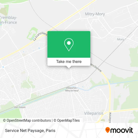
See Service Net Paysage, Mitry-Mory, on the map
Public Transit to Service Net Paysage in Mitry-Mory
Wondering how to get to Service Net Paysage in Mitry-Mory? Moovit helps you find the best way to get to Service Net Paysage with step-by-step directions from the nearest public transit station.
Moovit provides free maps and live directions to help you navigate through your city. View schedules, routes, timetables, and find out how long does it take to get to Service Net Paysage in real time.
Looking for the nearest stop or station to Service Net Paysage? Check out this list of stops closest to your destination: Martyrs de Châteaubriant; Cimetière de Mitry-Mory; Pasteur; Collège Erik Satie; Villeparisis - Mitry-Le-Neuf.
RER: B.Bus: 1, 148, 2123, 39, 615, 620, 2116, 2122, 2176, FILÉO RS, 3S, SOIR, 2127, 2171.Light Rail: T4.
Want to see if there’s another route that gets you there at an earlier time? Moovit helps you find alternative routes or times. Get directions from and directions to Service Net Paysage easily from the Moovit App or Website.
We make riding to Service Net Paysage easy, which is why over 1.5 million users, including users in Mitry-Mory, trust Moovit as the best app for public transit. You don’t need to download an individual bus app or train app, Moovit is your all-in-one transit app that helps you find the best bus time or train time available.
For information on prices of bus and light rail, costs and ride fares to Service Net Paysage, please check the Moovit app.
Use the app to navigate to popular places including to the airport, hospital, stadium, grocery store, mall, coffee shop, school, college, and university.
Service Net Paysage Address: 34 Rue Pierre Curie 77290 Mitry-Mory street in Mitry-Mory
- Nouveau Cimetière,
- Cimetière,
- Commissariat,
- Mitry Mory,
- Metal-D,
- Anatole France,
- Dan Coiff,
- Aux Mille et une Douceurs,
- Sarl le Craquant,
- Elisa Beauté,
- Hadj Abdelkader Jamal,
- Atelier d'Etyope - Valérie Brizard,
- Axeo Services,
- Artison Boulanger,
- Ccs Formation,
- Fabrice Mingo,
- Mitry Mory,
- Agr Btp,
- Sit,
- Loc'Hiam
Places Near Service Net Paysage (Mitry-Mory)
- Galeries Lafayette Haussmann, Paris,
- Hopital Lariboisière, Paris,
- Hôpital Saint-Joseph, Paris,
- Hôpital de la Pitié-Salpêtrière, Paris,
- Gare Routière Flixbus, Paris,
- Hôpital Cochin, Paris,
- 29 Rue Manin, Paris,
- Hôpital Pitié Salpêtrière, Paris,
- Fondation Louis Vuitton, Paris,
- Hopital Foch, Suresnes,
- Théâtre Mogador, Paris,
- Atelier Des Lumieres, Paris,
- Centre Hospitalier des 15/20, Paris,
- Hôpital Necker, Paris,
- Marché Saint-Pierre, Paris,
- Hôpital Beaujon, Clichy,
- Hôpital Henri Mondor, Creteil,
- Créteil Soleil, Creteil,
- Galeries Lafayette, Paris,
- Beaugrenelle, Paris
How to get to popular places in Paris with public transit
Get around Mitry-Mory by public transit!
Traveling around Mitry-Mory has never been so easy. See step by step directions as you travel to any attraction, street or major public transit station. View bus and train schedules, arrival times, service alerts and detailed routes on a map, so you know exactly how to get to anywhere in Mitry-Mory.
When traveling to any destination around Mitry-Mory use Moovit's Live Directions with Get Off Notifications to know exactly where and how far to walk, how long to wait for your line, and how many stops are left. Moovit will alert you when it's time to get off — no need to constantly re-check whether yours is the next stop.
Wondering how to use public transit in Mitry-Mory or how to pay for public transit in Mitry-Mory? Moovit public transit app can help you navigate your way with public transit easily, and at minimum cost. It includes public transit fees, ticket prices, and costs. Looking for a map of Mitry-Mory public transit lines? Moovit public transit app shows all public transit maps in Mitry-Mory with all Bus, Train, Metro, Light Rail, RER, Funicular and Gondola routes and stops on an interactive map.
Paris has 7 transit type(s), including: Bus, Train, Metro, Light Rail, RER, Funicular and Gondola, operated by several transit agencies, including RATP, RER, RER Bus de remplacement, Train, Train Bus de remplacement, Tramway Bus de remplacement, TER, ADP, Magical Shuttle, Argenteuil - Boucles de Seine, Autocars Dominique, Bièvre, Brie et 2 Morin, Le Bus - C.C. du Clermontois and Cœur d’Essonne
Public transit lines with stations closest to Service Net Paysage in Mitry-Mory
Bus lines with stations closest to Service Net Paysage in Mitry-Mory
Martyrs de Châteaubriant
 2116Gare De Villeparisis - Mitry-Le-Neuf - Gare De Mitry - Claye
- 2122Gare De Dammartin - Juilly - Saint-Mard - Gare De Mitry - Claye
- 2176Collège Langevin - Lycée Balzac - Parc Corbrion
- FILÉO RSPlace Jacques Chirac - Gare - Gare De Roissypôle - Aéroport Cdg1 (g1)
- 3SCité Scolaire - Gare De Mitry - Claye