How to get to Service d'Investigation Educative by bus?
Click on the bus route to see step by step directions with maps, line arrival times and updated time schedules.
From Chemin du Mas de Campagne, Nîmes
44 minFrom Sept Médical, Saint-Gilles
59 minFrom Marguerittes, Marguerittes
44 minFrom BDS 503 RT, Nîmes
40 minFrom Chemin de la Capitelle Pointue 1627, Nîmes
29 minFrom Collège De Clarensac, Clarensac
48 minFrom Aéroport de Nîmes Alès Camargue Cévennes, Saint-Gilles
65 minFrom Base Aéronavale de Nîmes-Garons, Saint-Gilles
51 minFrom Cabinet Dentair, Garons
52 min
Bus stops near Service d'Investigation Educative in Nimes
Bus lines to Service d'Investigation Educative in Nimes
What are the closest stations to Service d'Investigation Educative?
The closest stations to Service d'Investigation Educative are:
- Placette is 293 meters away, 4 min walk.
- Bouquerie is 377 meters away, 5 min walk.
- Arènes is 378 meters away, 5 min walk.
Which bus lines stop near Service d'Investigation Educative?
These bus lines stop near Service d'Investigation Educative: 14, 51, 70, T1.
What’s the nearest bus station to Service d'Investigation Educative in Nimes?
The nearest bus station to Service d'Investigation Educative in Nimes is Placette. It’s a 4 min walk away.
What time is the first bus to Service d'Investigation Educative in Nimes?
The T1 is the first bus that goes to Service d'Investigation Educative in Nimes. It stops nearby at 5:32 AM.
What time is the last bus to Service d'Investigation Educative in Nimes?
The T1 is the last bus that goes to Service d'Investigation Educative in Nimes. It stops nearby at 12:52 AM.
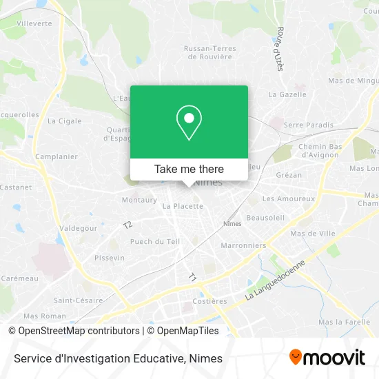
See Service d'Investigation Educative, Nimes, on the map
Public Transit to Service d'Investigation Educative in Nimes
Wondering how to get to Service d'Investigation Educative in Nimes? Moovit helps you find the best way to get to Service d'Investigation Educative with step-by-step directions from the nearest public transit station.
Moovit provides free maps and live directions to help you navigate through your city. View schedules, routes, timetables, and find out how long does it take to get to Service d'Investigation Educative in real time.
Looking for the nearest stop or station to Service d'Investigation Educative? Check out this list of stops closest to your destination: Placette; Bouquerie; Arènes.
Bus: 14, 51, 70, T1, 16, 9, 10, 7, 71, 75, 86.
Want to see if there’s another route that gets you there at an earlier time? Moovit helps you find alternative routes or times. Get directions from and directions to Service d'Investigation Educative easily from the Moovit App or Website.
We make riding to Service d'Investigation Educative easy, which is why over 1.5 million users, including users in Nimes, trust Moovit as the best app for public transit. You don’t need to download an individual bus app or train app, Moovit is your all-in-one transit app that helps you find the best bus time or train time available.
For information on prices of bus, costs and ride fares to Service d'Investigation Educative, please check the Moovit app.
Use the app to navigate to popular places including to the airport, hospital, stadium, grocery store, mall, coffee shop, school, college, and university.
Service d'Investigation Educative Address: 3 Place Questel 30900 Nîmes street in Nimes
- Softub Languedoc,
- Chambre Syndicale Fnaim,
- Mma Nimes Victor Hugo Maison Carrée,
- Singer,
- Nogarede Guilhem,
- Bnp Paribas Banque Privée-Espace Nîmes,
- Aoudia Khadija,
- Hassanaly Avocat,
- Boutique Nîmes Olympique,
- BANQUE DUPUY, DE PARSEVAL,
- Lh Chocolaterie,
- Sg,
- Dr. Nizard Valérie,
- Le Napo,
- Deleuze Daniel Medecin,
- Carrée Maison de Ventes,
- Fidanza et Sidjilani,
- SMC,
- Barback Nîmes,
- Le Comptoir à Hot Dog
Places Near Service d'Investigation Educative (Nimes)
- Polyclinique Du Grand Sud,
- Saint-Césaire,
- Clinique Franciscaine,
- Geant Casino,
- Rond-Point Kilomètre Delta, Nîmes,
- Jardins de la Fontaine,
- La Galerie - Cap Costières,
- Les 7 Collines,
- CHU de Nîmes - Hôpital universitaire Carémeau,
- Kinepolis,
- E.Leclerc,
- Carrefour Nîmes Sud,
- Le Parnasse, Nîmes,
- Aire De Covoiturage Nîmes Ouest,
- Rue Gilles Roberval 285,
- Hôpital Privé Les Franciscaines,
- Centre hospitalier Caremeau,
- VILLE ACTIVE, Nîmes,
- Parc Kennedy,
- École Nationale De Police
How to get to popular places in Nimes with public transit
Get around Nimes by public transit!
Traveling around Nimes has never been so easy. See step by step directions as you travel to any attraction, street or major public transit station. View bus and train schedules, arrival times, service alerts and detailed routes on a map, so you know exactly how to get to anywhere in Nimes.
When traveling to any destination around Nimes use Moovit's Live Directions with Get Off Notifications to know exactly where and how far to walk, how long to wait for your line, and how many stops are left. Moovit will alert you when it's time to get off — no need to constantly re-check whether yours is the next stop.
Wondering how to use public transit in Nimes or how to pay for public transit in Nimes? Moovit public transit app can help you navigate your way with public transit easily, and at minimum cost. It includes public transit fees, ticket prices, and costs. Looking for a map of Nimes public transit lines? Moovit public transit app shows all public transit maps in Nimes with all bus routes and stops on an interactive map.
Nimes has 1 transit type(s), including: bus, operated by several transit agencies, including TANGO