How to get to Serviceking by bus?
Click on the bus route to see step by step directions with maps, line arrival times and updated time schedules.
From Mcnally High School, Edmonton
46 minFrom Blue Quill Pharmacy, Edmonton
41 minFrom St. Margaret's Anglican Church, Edmonton
58 minFrom Hope City Church - Kingsway Campus, Edmonton
33 minFrom Potters Green, Edmonton
42 minFrom Global Cleaning, Edmonton
85 minFrom Travelodge by Wyndham, Edmonton
52 minFrom Theboldunicorn, Edmonton
77 minFrom Sobeys Distribution Centre, Edmonton
83 minFrom Blackmud Creek, Edmonton
61 min
Bus stops near Serviceking in Edmonton
Light Rail stations near Serviceking in Edmonton
- Mckernan Belgravia Station, 9 min walk,VIEW
Bus lines to Serviceking in Edmonton
What are the closest stations to Serviceking?
The closest stations to Serviceking are:
- 114 Street & 74 Avenue is 233 meters away, 4 min walk.
- 113 Street & 76 Avenue is 372 meters away, 5 min walk.
- Mckernan Belgravia Station is 624 meters away, 9 min walk.
Which bus lines stop near Serviceking?
These bus lines stop near Serviceking: 004, 009, 702.
Which light rail line stops near Serviceking?
METRO (Century Park)
What’s the nearest light rail station to Serviceking in Edmonton?
The nearest light rail station to Serviceking in Edmonton is Mckernan Belgravia Station. It’s a 9 min walk away.
What’s the nearest bus station to Serviceking in Edmonton?
The nearest bus station to Serviceking in Edmonton is 114 Street & 74 Avenue. It’s a 4 min walk away.
What time is the first light rail to Serviceking in Edmonton?
The METRO is the first light rail that goes to Serviceking in Edmonton. It stops nearby at 5:48 AM.
What time is the last light rail to Serviceking in Edmonton?
The METRO is the last light rail that goes to Serviceking in Edmonton. It stops nearby at 12:25 AM.
What time is the first bus to Serviceking in Edmonton?
The 004 is the first bus that goes to Serviceking in Edmonton. It stops nearby at 3:17 AM.
What time is the last bus to Serviceking in Edmonton?
The 004 is the last bus that goes to Serviceking in Edmonton. It stops nearby at 3:20 AM.
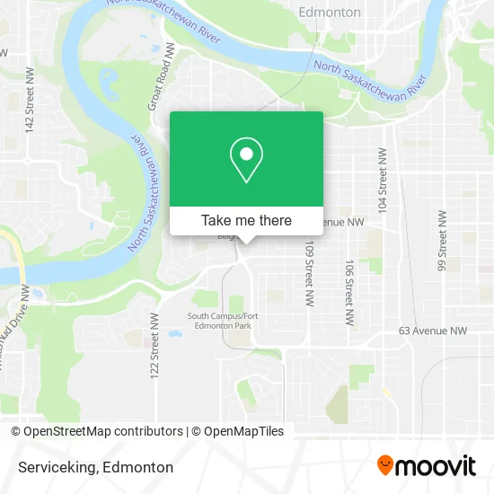
See Serviceking, Edmonton, on the map
Public Transit to Serviceking in Edmonton
Wondering how to get to Serviceking in Edmonton? Moovit helps you find the best way to get to Serviceking with step-by-step directions from the nearest public transit station.
Moovit provides free maps and live directions to help you navigate through your city. View schedules, routes, timetables, and find out how long does it take to get to Serviceking in real time.
Looking for the nearest stop or station to Serviceking? Check out this list of stops closest to your destination: 114 Street & 74 Avenue; 113 Street & 76 Avenue; Mckernan Belgravia Station.
Bus: 004, 009, 702, 654.Light Rail: METRO.
Want to see if there’s another route that gets you there at an earlier time? Moovit helps you find alternative routes or times. Get directions from and directions to Serviceking easily from the Moovit App or Website.
We make riding to Serviceking easy, which is why over 1.5 million users, including users in Edmonton, trust Moovit as the best app for public transit. You don’t need to download an individual bus app or train app, Moovit is your all-in-one transit app that helps you find the best bus time or train time available.
For information on prices of bus and light rail, costs and ride fares to Serviceking, please check the Moovit app.
Use the app to navigate to popular places including to the airport, hospital, stadium, grocery store, mall, coffee shop, school, college, and university.
Serviceking Address: 73 Ave NW Edmonton, AB T6G street in Edmonton
- L&L Snow Removal,
- Mckernan Park,
- Global Property Inspections,
- Edmonton Catholic Schools Fresh Start Outreach High School & Jr High Programs South,
- Neil Crawford Centre,
- LRT-McKernan & Belgravia,
- Redefine Laser Hair Removal & Electrolysis,
- Traamici Cafe,
- J. G. O' Donoghue Building,
- BMG Music Canada Inc,
- Krystal Koven,
- McKernan Child Development Center,
- 6950 113 Street Northwest,
- Belgravia Out of School Centre,
- Alberta Adaptabilities Assn,
- McKernan Baptist Young Adults,
- Mckernan Baptist Church,
- Christ Family Fellowship,
- You&Me Imports,
- Ukrainian Language Education Centre (Ulec)
Places Near Serviceking (Edmonton)
- Northgate Centre, Edmonton,
- Grey Nuns Community Hospital, Edmonton,
- Royal Alexandra Hospital, Edmonton,
- MacEwan University, Edmonton,
- Edmonton Commonwealth Stadium, Edmonton,
- Alberta Legislature Building, Edmonton,
- Edmonton Valley Zoo, Edmonton,
- Fort Edmonton Park, Edmonton,
- Borden Park, Edmonton,
- Kingsway Mall, Edmonton,
- Whyte Avenue, Edmonton,
- Cross Cancer Institute, Edmonton,
- Londonderry Mall, Edmonton,
- Edmonton VIA Rail Station, Edmonton,
- Kaye Edmonton Clinic, Edmonton,
- University of Alberta, Edmonton,
- Edmonton EXPO Centre, Edmonton,
- West Edmonton Mall, Edmonton,
- Canada Place Service Canada Centre, Edmonton,
- Rogers Place, Edmonton
How to get to popular places in Edmonton with public transit
Get around Edmonton by public transit!
Traveling around Edmonton has never been so easy. See step by step directions as you travel to any attraction, street or major public transit station. View bus and train schedules, arrival times, service alerts and detailed routes on a map, so you know exactly how to get to anywhere in Edmonton.
When traveling to any destination around Edmonton use Moovit's Live Directions with Get Off Notifications to know exactly where and how far to walk, how long to wait for your line, and how many stops are left. Moovit will alert you when it's time to get off — no need to constantly re-check whether yours is the next stop.
Wondering how to use public transit in Edmonton or how to pay for public transit in Edmonton? Moovit public transit app can help you navigate your way with public transit easily, and at minimum cost. It includes public transit fees, ticket prices, and costs. Looking for a map of Edmonton public transit lines? Moovit public transit app shows all public transit maps in Edmonton with all Bus and Light Rail routes and stops on an interactive map.
Edmonton has 2 transit type(s), including: Bus and Light Rail, operated by several transit agencies, including ETS LRT, ETS, Strathcona County Transit, St. Albert Transit, Spruce Grove Transit, Fort Saskatchewan Transit, Beaumont Transit and Leduc Transit