How to get to Ses Space & Defense by bus?
Click on the bus route to see step by step directions with maps, line arrival times and updated time schedules.
From Dulles Expo Center, Fairfax County
81 minFrom Oakton, Virginia, Fairfax County
80 minFrom Freddie Mac, Fairfax County
72 minFrom Walmart, Fairfax County
60 minFrom Chantilly, VA, Fairfax County
74 minFrom Fairfax County Government Center, Fairfax County
61 minFrom Arabx Com Inc, Fairfax County
71 minFrom Leesburg VA-684, Fairfax County
57 minFrom Hollywood Casino at Charles Town Races, Fairfax County
35 minFrom Navy Federal Credit Union, Fairfax County
96 min
How to get to Ses Space & Defense by metro?
Click on the metro route to see step by step directions with maps, line arrival times and updated time schedules.
Bus stops near Ses Space & Defense in Fairfax County
Metro station near Ses Space & Defense in Fairfax County
- Reston Town Center, 41 min walk,VIEW
Bus lines to Ses Space & Defense in Fairfax County
What are the closest stations to Ses Space & Defense?
The closest stations to Ses Space & Defense are:
- Sunset Hills Rd @ American Dream Wa is 162 yards away, 2 min walk.
- Sunset Hills Rd @ Reston Pkwy is 423 yards away, 6 min walk.
- Sunrise Valley Dr @ Colts Neck Rd is 525 yards away, 7 min walk.
- Sunrise Valley Dr @ Indian Ridge Rd is 588 yards away, 8 min walk.
- Reston Pkwy @ Hopper St is 970 yards away, 12 min walk.
- Reston Town Center is 3481 yards away, 41 min walk.
Which bus lines stop near Ses Space & Defense?
These bus lines stop near Ses Space & Defense: 574, 605, RIBS1.
Which metro line stops near Ses Space & Defense?
SILVER (Ashburn)
What’s the nearest bus station to Ses Space & Defense in Fairfax County?
The nearest bus station to Ses Space & Defense in Fairfax County is Sunset Hills Rd @ American Dream Wa. It’s a 2 min walk away.
What time is the first metro to Ses Space & Defense in Fairfax County?
The SILVER is the first metro that goes to Ses Space & Defense in Fairfax County. It stops nearby at 5:00 AM.
What time is the last metro to Ses Space & Defense in Fairfax County?
The SILVER is the last metro that goes to Ses Space & Defense in Fairfax County. It stops nearby at 12:55 AM.
What time is the first bus to Ses Space & Defense in Fairfax County?
The RIBS2 is the first bus that goes to Ses Space & Defense in Fairfax County. It stops nearby at 4:49 AM.
What time is the last bus to Ses Space & Defense in Fairfax County?
The RIBS1 is the last bus that goes to Ses Space & Defense in Fairfax County. It stops nearby at 12:31 AM.
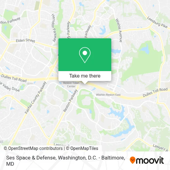
See Ses Space & Defense, Fairfax County, on the map
Public Transit to Ses Space & Defense in Fairfax County
Wondering how to get to Ses Space & Defense in Fairfax County? Moovit helps you find the best way to get to Ses Space & Defense with step-by-step directions from the nearest public transit station.
Moovit provides free maps and live directions to help you navigate through your city. View schedules, routes, timetables, and find out how long does it take to get to Ses Space & Defense in real time.
Looking for the nearest stop or station to Ses Space & Defense? Check out this list of stops closest to your destination: Sunset Hills Rd @ American Dream Wa; Sunset Hills Rd @ Reston Pkwy; Sunrise Valley Dr @ Colts Neck Rd; Sunrise Valley Dr @ Indian Ridge Rd; Reston Pkwy @ Hopper St; Reston Town Center.
Bus: 574, 605, RIBS1, RIBS2, 952, RIBS5, RIBS3.Metro: SILVER.
Want to see if there’s another route that gets you there at an earlier time? Moovit helps you find alternative routes or times. Get directions from and directions to Ses Space & Defense easily from the Moovit App or Website.
We make riding to Ses Space & Defense easy, which is why over 1.7 million users, including users in Fairfax County, trust Moovit as the best app for public transit. You don’t need to download an individual bus app or train app, Moovit is your all-in-one transit app that helps you find the best bus time or train time available.
For information on prices of bus and metro, costs and ride fares to Ses Space & Defense, please check the Moovit app.
Use the app to navigate to popular places including to the airport, hospital, stadium, grocery store, mall, coffee shop, school, college, and university.
Ses Space & Defense Address: 11790 Sunrise Valley Dr street in Fairfax County
- The Westin Reston Heights,
- Sheraton,
- Sheraton Reston,
- Brain Balance Center Of Northern Virginia,
- Dulles Corridor Rail Association,
- Dr. Yash Mehta,
- Dr. Terry A. Garvert M.D.,
- Centuria Corporation,
- Blink,
- Datasync Technologies,
- Appleone Technical Staffing Dc Metro,
- Farhan Ahmad - the Realtor,
- Connex2,
- Alliance Virtual Offices,
- Davinci Meeting Rooms,
- Cityscape Metro Group,
- Bright Horizons at Reston Plaza America + Back-Up Care,
- Amazon Counter at Whole Foods Market,
- Belmont Country Club,
- Berry & Berry, Pllc
Places Near Ses Space & Defense (Fairfax County)
- Pennsylvania Ave NW (3rd st and pennsylvania), Washington,
- Warner Theatre, Washington,
- Washington DC VA Medical Center, Washington,
- Westfield Montgomery Mall, Montgomery County,
- Capital One Arena, Washington,
- Museum Of The Bible, Washington,
- Camden Yards, Baltimore,
- Georgetown, Washington,
- Amazon Hq2, Arlington County,
- Washington National Cathedral, Washington,
- Basilica of the National Shrine, Washington,
- National Theatre, Washington,
- Sibley Memorial Hospital, Washington,
- M&T Bank Stadium, Baltimore,
- The Anthem, Washington,
- National Museum of African American History and Culture, Washington,
- National Zoo, Washington,
- Marriott Marquis Washington, DC, Washington,
- PG Mall, Prince George's County,
- Rock Creek Tennis Center, Washington
How to get to popular places in Washington, D.C. - Baltimore, MD with public transit
Get around Fairfax County by public transit!
Traveling around Fairfax County has never been so easy. See step by step directions as you travel to any attraction, street or major public transit station. View bus and train schedules, arrival times, service alerts and detailed routes on a map, so you know exactly how to get to anywhere in Fairfax County.
When traveling to any destination around Fairfax County use Moovit's Live Directions with Get Off Notifications to know exactly where and how far to walk, how long to wait for your line, and how many stops are left. Moovit will alert you when it's time to get off — no need to constantly re-check whether yours is the next stop.
Wondering how to use public transit in Fairfax County or how to pay for public transit in Fairfax County? Moovit public transit app can help you navigate your way with public transit easily, and at minimum cost. It includes public transit fees, ticket prices, and costs. Looking for a map of Fairfax County public transit lines? Moovit public transit app shows all public transit maps in Fairfax County with all Bus, Train, Metro, Light Rail and Ferry routes and stops on an interactive map.
Washington, D.C. - Baltimore, MD has 5 transit type(s), including: Bus, Train, Metro, Light Rail and Ferry, operated by several transit agencies, including WMATA, Montgomery County Ride On, Fairfax Connector, TheBus, PRTC, DASH - Alexandria, Arlington Transit (ART), RTA of Central Maryland, MDOT MTA, MDOT MTA Light RailLink, MDOT MTA Commuter Bus, MDOT MTA Local Bus, FXBGO!, Virginia Railway Express (VRE) and MARC