How to get to Set'Em Up by bus?
Click on the bus route to see step by step directions with maps, line arrival times and updated time schedules.
From Suncoast Community High School, Riviera Beach
210 minFrom US-1, Fort Pierce
35 minFrom William T. Dwyer High School, Jupiter
196 minFrom Suncoast High School, Riviera Beach
205 minFrom Stuart, Florida, Stuart
59 minFrom Donald Ross Rd / Military Trl, Jupiter
182 minFrom Clover Park, Port St. Lucie
106 minFrom Indian River State College, Fort Pierce
94 minFrom Hca Florida Lawnwood Hospital, Fort Pierce
76 minFrom Tradition Park, Port St. Lucie
144 min
Bus stop near Set'Em Up in Port St. Lucie
- US Hwy 1 & SE Jennings Rd W, 4 min walk,VIEW
Bus lines to Set'Em Up in Port St. Lucie
What are the closest stations to Set'Em Up?
The closest stations to Set'Em Up are:
- US Hwy 1 & SE Jennings Rd W is 235 yards away, 4 min walk.
Which bus lines stop near Set'Em Up?
These bus lines stop near Set'Em Up: 1, 4.
What’s the nearest bus station to Set'Em Up in Port St. Lucie?
The nearest bus station to Set'Em Up in Port St. Lucie is US Hwy 1 & SE Jennings Rd W. It’s a 4 min walk away.
What time is the first bus to Set'Em Up in Port St. Lucie?
The 1 is the first bus that goes to Set'Em Up in Port St. Lucie. It stops nearby at 6:07 AM.
What time is the last bus to Set'Em Up in Port St. Lucie?
The 1 is the last bus that goes to Set'Em Up in Port St. Lucie. It stops nearby at 7:50 PM.
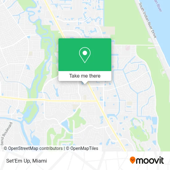
See Set'Em Up, Port St. Lucie, on the map
Public Transit to Set'Em Up in Port St. Lucie
Wondering how to get to Set'Em Up in Port St. Lucie? Moovit helps you find the best way to get to Set'Em Up with step-by-step directions from the nearest public transit station.
Moovit provides free maps and live directions to help you navigate through your city. View schedules, routes, timetables, and find out how long does it take to get to Set'Em Up in real time.
Looking for the nearest stop or station to Set'Em Up? Check out this list of stops closest to your destination: US Hwy 1 & SE Jennings Rd W.
Bus: 1, 4.
Want to see if there’s another route that gets you there at an earlier time? Moovit helps you find alternative routes or times. Get directions from and directions to Set'Em Up easily from the Moovit App or Website.
We make riding to Set'Em Up easy, which is why over 1.5 million users, including users in Port St. Lucie, trust Moovit as the best app for public transit. You don’t need to download an individual bus app or train app, Moovit is your all-in-one transit app that helps you find the best bus time or train time available.
For information on prices of bus, costs and ride fares to Set'Em Up, please check the Moovit app.
Get to Set'Em Up with public transit and pay for the ride in the Moovit app. In addition to all info you may need for your trip to Set'Em Up, including live directions, real-time arrivals and fare prices, you can also buy public transit passes for your rides. No need for cash or paper tickets to get to Set'Em Up - everything you need is accessible in the app with a click of the button.
Use the app to navigate to popular places including to the airport, hospital, stadium, grocery store, mall, coffee shop, school, college, and university.
Set'Em Up Address: 10097 S US Highway 1 Port St Lucie, FL 34952 street in Port St. Lucie
- Amazon Locker-Lentil,
- Ace Beauty Supply,
- Planet Fitness,
- Honeybee Hollow,
- Florida Food Life,
- Winner Winner Breakfast for Dinner,
- Huong Thi Thuy Gallagher Beauty Salon,
- Da Litt Dragon,
- Planes Dental Arts,
- Payday Loans Port St. Lucie Fl,
- The National Navy Seal Museum,
- Pslprintandgraphics,
- Fastsigns,
- Aegis Communications Group,
- Alexander Michael Jay Agt-Alexander, Michael Jay Agt,
- General Dentistry in Port St Lucie Fl,
- A R Gonzalez,
- Academies of Cosmetology,
- Skin Fixation,
- Cleanpro Services
Places Near Set'Em Up (Port St. Lucie)
- Dolphin Mall Bus, Miami,
- Hard Rock Stadium, Miami Gardens,
- Little Havana, Miami,
- Zoo Miami, Miami,
- Miami Freedom Park, Miami,
- Aventura Mall, Miami,
- Miami VA Hospital, Miami,
- Aventura Mall, Miami Beach,
- Bayside Marketplace, Miami,
- Richard E. Gerstein Justice Building, Miami,
- Sawgrass Mall, Miami,
- Dolphin Mall, Miami,
- Keiser University Flagship Campus, West Palm Beach,
- Brickell City Centre, Miami,
- Sawgrass mall ( FL ), Miami Beach,
- Wynwood, Miami,
- Port of Miami Cruise Terminal, Miami,
- Miami-Dade County Courthouse, Miami,
- Miami Design District, Miami,
- Marlins Park, Miami
How to get to popular places in Miami with public transit
Get around Port St. Lucie by public transit!
Traveling around Port St. Lucie has never been so easy. See step by step directions as you travel to any attraction, street or major public transit station. View bus and train schedules, arrival times, service alerts and detailed routes on a map, so you know exactly how to get to anywhere in Port St. Lucie.
When traveling to any destination around Port St. Lucie use Moovit's Live Directions with Get Off Notifications to know exactly where and how far to walk, how long to wait for your line, and how many stops are left. Moovit will alert you when it's time to get off — no need to constantly re-check whether yours is the next stop.
Wondering how to use public transit in Port St. Lucie or how to pay for public transit in Port St. Lucie? Moovit public transit app can help you navigate your way with public transit easily, and at minimum cost. It includes public transit fees, ticket prices, and costs. Looking for a map of Port St. Lucie public transit lines? Moovit public transit app shows all public transit maps in Port St. Lucie with all Bus, Train, Light Rail and Ferry routes and stops on an interactive map.
Miami has 4 transit type(s), including: Bus, Train, Light Rail and Ferry, operated by several transit agencies, including Broward County Transit, Miami-Dade Transit, Metrorail, Palm Tran, Tri-Rail, Brightline, MARTY, City of Homestead Trolley, Key West Transit, Treasure Coast Connector, GoLine IRT, Amtrak, Greyhound-us, FlixBus-us and Aventura Express Shuttle Bus