How to get to Setaregan Institute by bus?
Click on the bus route to see step by step directions with maps, line arrival times and updated time schedules.
From Maryland Live! Casino, Anne Arundel County
66 minFrom MD Live Casino Arundel Mills, Anne Arundel County
62 minFrom Elkridge, MD, Howard County
56 minFrom Lincoln Tech, Howard County
57 minFrom Walmart, Baltimore County
84 minFrom Arundel Mills, Anne Arundel County
64 minFrom Social Security Administration (Robert M. Ball Building), Baltimore County
119 minFrom I-695 @ Exit 17 (Security Blvd/MD 122), Baltimore County
120 minFrom University Of Maryland Baltimore (Umbc), Baltimore County
133 minFrom Guinness Open Gate Brewery & Barrel House, Baltimore County
148 min
Bus stops near Setaregan Institute in Howard County
Bus lines to Setaregan Institute in Howard County
What are the closest stations to Setaregan Institute?
The closest stations to Setaregan Institute are:
- Old Annapolis Rd / Bendix Rd is 328 yards away, 4 min walk.
- Lightning View Rd / Weatherside Run is 502 yards away, 6 min walk.
Which bus lines stop near Setaregan Institute?
These bus lines stop near Setaregan Institute: 501, 505.
What’s the nearest bus station to Setaregan Institute in Howard County?
The nearest bus station to Setaregan Institute in Howard County is Old Annapolis Rd / Bendix Rd. It’s a 4 min walk away.
What time is the first bus to Setaregan Institute in Howard County?
The 501 is the first bus that goes to Setaregan Institute in Howard County. It stops nearby at 6:04 AM.
What time is the last bus to Setaregan Institute in Howard County?
The 403 is the last bus that goes to Setaregan Institute in Howard County. It stops nearby at 9:25 PM.
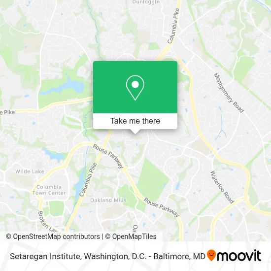
See Setaregan Institute, Howard County, on the map
Public Transit to Setaregan Institute in Howard County
Wondering how to get to Setaregan Institute in Howard County? Moovit helps you find the best way to get to Setaregan Institute with step-by-step directions from the nearest public transit station.
Moovit provides free maps and live directions to help you navigate through your city. View schedules, routes, timetables, and find out how long does it take to get to Setaregan Institute in real time.
Looking for the nearest stop or station to Setaregan Institute? Check out this list of stops closest to your destination: Old Annapolis Rd / Bendix Rd; Lightning View Rd / Weatherside Run.
Bus: 501, 505, 403.
Want to see if there’s another route that gets you there at an earlier time? Moovit helps you find alternative routes or times. Get directions from and directions to Setaregan Institute easily from the Moovit App or Website.
We make riding to Setaregan Institute easy, which is why over 1.7 million users, including users in Howard County, trust Moovit as the best app for public transit. You don’t need to download an individual bus app or train app, Moovit is your all-in-one transit app that helps you find the best bus time or train time available.
For information on prices of bus and train, costs and ride fares to Setaregan Institute, please check the Moovit app.
Get to Setaregan Institute with public transit and pay for the ride in the Moovit app. In addition to all info you may need for your trip to Setaregan Institute, including live directions, real-time arrivals and fare prices, you can also buy public transit passes for your rides. No need for cash or paper tickets to get to Setaregan Institute - everything you need is accessible in the app with a click of the button.
Use the app to navigate to popular places including to the airport, hospital, stadium, grocery store, mall, coffee shop, school, college, and university.
Setaregan Institute Address: 9357 Mellenbrook Rd street in Howard County
- Thunder Hill Pond,
- Chase Brexton Health Services,
- Grassroots Crisis Intervention,
- DoubleTree by Hilton Hotel Columbia,
- By Your Side in Home Assistant Service,
- Combustion Science & Engineering,
- Route 29 exit Rt 108 west,
- Entrance US-29 S,
- Robert Turner Wedding Officiant,
- Phelps Luck Elementary School,
- Cheryl MS Krissoff CCC-A,
- Endodontics Of Maryland,
- Great Harvest Bread Company,
- 8860 Columbia 100 Pkwy,
- Columbia 100 Dental,
- Juray Diane - Juray, Diane,
- Centre Park Dr Columbia Pkwy,
- Johns Hopkins Community Physicians - Columbia North,
- Howard High School,
- Blandair Park
Places Near Setaregan Institute (Howard County)
- National Zoo, Washington,
- Warner Theatre, Washington,
- Pennsylvania Ave NW (3rd st and pennsylvania), Washington,
- Museum Of The Bible, Washington,
- Washington DC VA Medical Center, Washington,
- Amazon Hq2, Arlington County,
- Washington National Cathedral, Washington,
- Sibley Memorial Hospital, Washington,
- Camden Yards, Baltimore,
- The Anthem, Washington,
- Marriott Marquis Washington, DC, Washington,
- Westfield Montgomery Mall, Montgomery County,
- M&T Bank Stadium, Baltimore,
- PG Mall, Prince George's County,
- Basilica of the National Shrine, Washington,
- Rock Creek Tennis Center, Washington,
- National Theatre, Washington,
- National Museum of African American History and Culture, Washington,
- Capital One Arena, Washington,
- Georgetown, Washington
How to get to popular places in Washington, D.C. - Baltimore, MD with public transit
Get around Howard County by public transit!
Traveling around Howard County has never been so easy. See step by step directions as you travel to any attraction, street or major public transit station. View bus and train schedules, arrival times, service alerts and detailed routes on a map, so you know exactly how to get to anywhere in Howard County.
When traveling to any destination around Howard County use Moovit's Live Directions with Get Off Notifications to know exactly where and how far to walk, how long to wait for your line, and how many stops are left. Moovit will alert you when it's time to get off — no need to constantly re-check whether yours is the next stop.
Wondering how to use public transit in Howard County or how to pay for public transit in Howard County? Moovit public transit app can help you navigate your way with public transit easily, and at minimum cost. It includes public transit fees, ticket prices, and costs. Looking for a map of Howard County public transit lines? Moovit public transit app shows all public transit maps in Howard County with all Bus, Train, Metro, Light Rail and Ferry routes and stops on an interactive map.
Washington, D.C. - Baltimore, MD has 5 transit type(s), including: Bus, Train, Metro, Light Rail and Ferry, operated by several transit agencies, including WMATA, Montgomery County Ride On, Fairfax Connector, TheBus, PRTC, DASH - Alexandria, Arlington Transit (ART), RTA of Central Maryland, MDOT MTA, MDOT MTA Light RailLink, MDOT MTA Commuter Bus, MDOT MTA Local Bus, FXBGO!, Virginia Railway Express (VRE) and MARC