Directions to Sev (Richmond) with public transportation
The following transit lines have routes that pass near Sev
 Bus: 18, BRT, 19, 76, 79.
- Train: CAROLINIAN, FLORIDIAN, NORTHEAST REGIONAL, PALMETTO, SILVER METEOR.
How to get to Sev by bus?
Click on the bus route to see step by step directions with maps, line arrival times and updated time schedules.
From Potomac Mills Mall, Prince William County
221 minFrom Rose Gaming Resort, Prince William County
246 minFrom Busch Gardens Williamsburg (Employee Parking Lot), James City County
162 minFrom Lorton, VA - Amtrak Auto Train Station (LOR), Fairfax County
236 minFrom Lorton, VA, Fairfax County
230 minFrom UVA Hospital Medical Center, Charlottesville
310 minFrom Woodbridge, VA, Prince William County
165 minFrom Amazon Fulfillment Center-Ric3, Richmond
75 min
Bus stops near Sev in Richmond
Train station near Sev in Richmond
- Richmond Staples Mill Road Amtrak Station, 46 min walk,VIEW
Bus lines to Sev in Richmond
What are the closest stations to Sev?
The closest stations to Sev are:
- Staples Mill & Radford is 165 yards away, 3 min walk.
- Broad + Staples Mill is 341 yards away, 5 min walk.
- Staples Mill Westbound Station is 517 yards away, 7 min walk.
- Richmond Staples Mill Road Amtrak Station is 3949 yards away, 46 min walk.
Which bus lines stop near Sev?
These bus lines stop near Sev: 18, BRT.
What’s the nearest bus station to Sev in Richmond?
The nearest bus station to Sev in Richmond is Staples Mill & Radford. It’s a 3 min walk away.
What time is the first train to Sev in Richmond?
The SILVER METEOR is the first train that goes to Sev in Richmond. It stops nearby at 3:52 AM.
What time is the last train to Sev in Richmond?
The SILVER METEOR is the last train that goes to Sev in Richmond. It stops nearby at 3:52 AM.
What time is the first bus to Sev in Richmond?
The BRT is the first bus that goes to Sev in Richmond. It stops nearby at 5:00 AM.
What time is the last bus to Sev in Richmond?
The BRT is the last bus that goes to Sev in Richmond. It stops nearby at 1:37 AM.
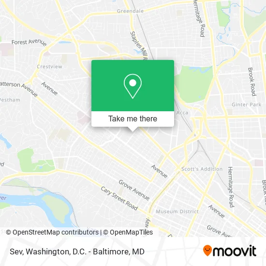
See Sev, Richmond, on the map
Public Transit to Sev in Richmond
Wondering how to get to Sev in Richmond? Moovit helps you find the best way to get to Sev with step-by-step directions from the nearest public transit station.
Moovit provides free maps and live directions to help you navigate through your city. View schedules, routes, timetables, and find out how long does it take to get to Sev in real time.
Looking for the nearest stop or station to Sev? Check out this list of stops closest to your destination: Staples Mill & Radford; Broad + Staples Mill; Staples Mill Westbound Station; Richmond Staples Mill Road Amtrak Station.
Bus: 18, BRT, 19, 76, 79, 50, 91.Train: CAROLINIAN, FLORIDIAN, NORTHEAST REGIONAL, PALMETTO, SILVER METEOR.
Want to see if there’s another route that gets you there at an earlier time? Moovit helps you find alternative routes or times. Get directions from and directions to Sev easily from the Moovit App or Website.
We make riding to Sev easy, which is why over 1.5 million users, including users in Richmond, trust Moovit as the best app for public transit. You don’t need to download an individual bus app or train app, Moovit is your all-in-one transit app that helps you find the best bus time or train time available.
For information on prices of bus and train, costs and ride fares to Sev, please check the Moovit app.
Use the app to navigate to popular places including to the airport, hospital, stadium, grocery store, mall, coffee shop, school, college, and university.
Sev Address: 4901 Fitzhugh Ave Richmond, VA 23230 street in Richmond
- Mackinaw Mattress Co.,
- Bikini Bar,
- River City Driving School,
- Diamonds in the Rough Youth and Family Services,
- Home Watch Care Givers of Richmond,
- Cognisa,
- Supported Employment of Virginia,
- Solid Select Staffing & Healthcare Services,
- Symbol Mattress,
- Richmond Road Runners Club,
- Airway Breathing Co.,
- Veterans Outreach,
- Kelly Brown Interiors,
- Vet Center,
- Columbia Underwriters,
- MTG Process Servers,
- Caliper,
- George J Kokorelis Attorney at Law,
- Unique Holistic Care,
- Accent Personnel
Places Near Sev (Richmond)
- The Anthem, Washington,
- Georgetown, Washington,
- Washington National Cathedral, Washington,
- Camden Yards, Baltimore,
- National Zoo, Washington,
- Rock Creek Tennis Center, Washington,
- Washington DC VA Medical Center, Washington,
- Westfield Montgomery Mall, Montgomery County,
- Marriott Marquis Washington, DC, Washington,
- Amazon Hq2, Arlington County,
- Pennsylvania Ave NW (3rd st and pennsylvania), Washington,
- Basilica of the National Shrine, Washington,
- PG Mall, Prince George's County,
- National Mall, Washington,
- Capital One Arena, Washington,
- Sibley Memorial Hospital, Washington,
- Museum Of The Bible, Washington,
- National Museum of African American History and Culture, Washington,
- M&T Bank Stadium, Baltimore,
- Warner Theatre, Washington
How to get to popular places in Washington, D.C. - Baltimore, MD with public transit
Get around Richmond by public transit!
Traveling around Richmond has never been so easy. See step by step directions as you travel to any attraction, street or major public transit station. View bus and train schedules, arrival times, service alerts and detailed routes on a map, so you know exactly how to get to anywhere in Richmond.
When traveling to any destination around Richmond use Moovit's Live Directions with Get Off Notifications to know exactly where and how far to walk, how long to wait for your line, and how many stops are left. Moovit will alert you when it's time to get off — no need to constantly re-check whether yours is the next stop.
Wondering how to use public transit in Richmond or how to pay for public transit in Richmond? Moovit public transit app can help you navigate your way with public transit easily, and at minimum cost. It includes public transit fees, ticket prices, and costs. Looking for a map of Richmond public transit lines? Moovit public transit app shows all public transit maps in Richmond with all Bus, Train, Metro, Light Rail and Ferry routes and stops on an interactive map.
Washington, D.C. - Baltimore, MD has 5 transit type(s), including: Bus, Train, Metro, Light Rail and Ferry, operated by several transit agencies, including WMATA, Montgomery County Ride On, Fairfax Connector, TheBus, PRTC, DASH - Alexandria, Arlington Transit (ART), RTA of Central Maryland, MDOT MTA, MDOT MTA Light RailLink, MDOT MTA Commuter Bus, MDOT MTA Local Bus, FXBGO!, Virginia Railway Express (VRE) and MARC