Directions to Sharks Pool Club (Queens) with public transportation
The following transit lines have routes that pass near Sharks Pool Club
 Bus: Q101, Q32, Q66, Q104.
- Train: BABYLON BRANCH, FAR ROCKAWAY BRANCH, LONG BEACH BRANCH, PORT WASHINGTON BRANCH, RONKONKOMA BRANCH.
- Subway: M, R, N, W, E.
How to get to Sharks Pool Club by bus?
Click on the bus route to see step by step directions with maps, line arrival times and updated time schedules.
From Bayonne Golf Club Ferry, Manhattan
78 minFrom Carnegie Hall, Manhattan
51 minFrom Statue of Liberty Ferry, Manhattan
80 minFrom 1910 monterey avenue, Bronx
85 minFrom Film Forum, Manhattan
80 minFrom Hotel Riu Plaza New York Times Square, Manhattan
56 minFrom Guggenheim Museum, Manhattan
90 minFrom 163-03 Horace Harding Expressway, Queens
66 minFrom Walmart, North Bergen
113 min
How to get to Sharks Pool Club by train?
Click on the train route to see step by step directions with maps, line arrival times and updated time schedules.
How to get to Sharks Pool Club by subway?
Click on the subway route to see step by step directions with maps, line arrival times and updated time schedules.
Bus stops near Sharks Pool Club in Queens
Bus lines to Sharks Pool Club in Queens
What are the closest stations to Sharks Pool Club?
The closest stations to Sharks Pool Club are:
- Steinway St/35 Av is 209 yards away, 3 min walk.
- Broadway/Steinway St is 367 yards away, 5 min walk.
- 35 Av/Steinway St is 370 yards away, 5 min walk.
- Broadway is 892 yards away, 11 min walk.
- 36 St is 1001 yards away, 12 min walk.
Which bus lines stop near Sharks Pool Club?
These bus lines stop near Sharks Pool Club: Q101, Q32, Q66.
Which train lines stop near Sharks Pool Club?
These train lines stop near Sharks Pool Club: BABYLON BRANCH, FAR ROCKAWAY BRANCH, LONG BEACH BRANCH, PORT WASHINGTON BRANCH, RONKONKOMA BRANCH.
Which subway lines stop near Sharks Pool Club?
These subway lines stop near Sharks Pool Club: M, R.
What’s the nearest subway station to Sharks Pool Club in Queens?
The nearest subway station to Sharks Pool Club in Queens is Broadway. It’s a 11 min walk away.
What’s the nearest bus station to Sharks Pool Club in Queens?
The nearest bus station to Sharks Pool Club in Queens is Steinway St/35 Av. It’s a 3 min walk away.
What time is the first subway to Sharks Pool Club in Queens?
The E is the first subway that goes to Sharks Pool Club in Queens. It stops nearby at 3:00 AM.
What time is the last subway to Sharks Pool Club in Queens?
The F is the last subway that goes to Sharks Pool Club in Queens. It stops nearby at 3:48 AM.
What time is the first bus to Sharks Pool Club in Queens?
The Q101 is the first bus that goes to Sharks Pool Club in Queens. It stops nearby at 3:11 AM.
What time is the last bus to Sharks Pool Club in Queens?
The Q66 is the last bus that goes to Sharks Pool Club in Queens. It stops nearby at 3:17 AM.
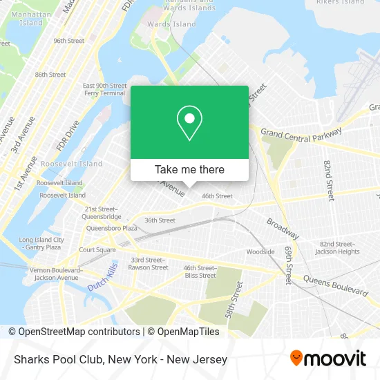
See Sharks Pool Club, Queens, on the map
Public Transit to Sharks Pool Club in Queens
Wondering how to get to Sharks Pool Club in Queens? Moovit helps you find the best way to get to Sharks Pool Club with step-by-step directions from the nearest public transit station.
Moovit provides free maps and live directions to help you navigate through your city. View schedules, routes, timetables, and find out how long does it take to get to Sharks Pool Club in real time.
Looking for the nearest stop or station to Sharks Pool Club? Check out this list of stops closest to your destination: Steinway St/35 Av; Broadway/Steinway St; 35 Av/Steinway St; Broadway; 36 St.
Bus: Q101, Q32, Q66, Q104.Train: BABYLON BRANCH, FAR ROCKAWAY BRANCH, LONG BEACH BRANCH, PORT WASHINGTON BRANCH, RONKONKOMA BRANCH.Subway: M, R, N, W, E, F.
Want to see if there’s another route that gets you there at an earlier time? Moovit helps you find alternative routes or times. Get directions from and directions to Sharks Pool Club easily from the Moovit App or Website.
We make riding to Sharks Pool Club easy, which is why over 1.5 million users, including users in Queens, trust Moovit as the best app for public transit. You don’t need to download an individual bus app or train app, Moovit is your all-in-one transit app that helps you find the best bus time or train time available.
For information on prices of subway, bus and train, costs and ride fares to Sharks Pool Club, please check the Moovit app.
Use the app to navigate to popular places including to the airport, hospital, stadium, grocery store, mall, coffee shop, school, college, and university.
Sharks Pool Club Address: 34-05 Steinway St street in Queens
- Antonina Avendano Pmu,
- Green Aura Spa,
- Svl Souvlaki Bar- Steinway Street,
- Novatae Risk Group,
- Mta-Steinway St,
- Bud's Ale House,
- The Salvation Army Thrift Store, Astoria, NY,
- 34th 34th Ave and Steinway St,
- David's Financial,
- 34th Ave (34th steinway),
- Pinnacle Realty Of New York,
- Pizza Hut,
- Satori Laser,
- Pv Parking Astoria,
- Western Union,
- M and R Train Steinway Street Station,
- Prime No 7,
- Mahmoud's Corner Halal Food Cart,
- American Modern Furniture,
- Cba Consultants
Places Near Sharks Pool Club (Queens)
- 66 John Street, Manhattan,
- 911 Memorial, Manhattan,
- 26 Federal Plaza, Manhattan,
- San Gennaro Feast, Manhattan,
- Bellevue Hospital, Manhattan,
- Hudson Yards, Manhattan,
- Katz's Deli, Manhattan,
- Pier 83, Manhattan,
- SoHo, Manhattan,
- Times Square, Manhattan,
- Rockefeller Center, Manhattan,
- 1 Police Plaza, Manhattan,
- Queens Center Mall, Queens,
- Wall Street, Manhattan,
- qqqq, Manhattan,
- 111 Centre New York City Supreme Court, Manhattan,
- 376 Hudson Street, Manhattan,
- Mountainside Hospital, Glen Ridge,
- 3 Stone St, Manhattan,
- Chinatown, Manhattan
How to get to popular places in New York - New Jersey with public transit
Get around Queens by public transit!
Traveling around Queens has never been so easy. See step by step directions as you travel to any attraction, street or major public transit station. View bus and train schedules, arrival times, service alerts and detailed routes on a map, so you know exactly how to get to anywhere in Queens.
When traveling to any destination around Queens use Moovit's Live Directions with Get Off Notifications to know exactly where and how far to walk, how long to wait for your line, and how many stops are left. Moovit will alert you when it's time to get off — no need to constantly re-check whether yours is the next stop.
Wondering how to use public transit in Queens or how to pay for public transit in Queens? Moovit public transit app can help you navigate your way with public transit easily, and at minimum cost. It includes public transit fees, ticket prices, and costs. Looking for a map of Queens public transit lines? Moovit public transit app shows all public transit maps in Queens with all Bus, Train, Subway, Light Rail, Ferry and Cable Car routes and stops on an interactive map.
New York - New Jersey has 6 transit type(s), including: Bus, Train, Subway, Light Rail, Ferry and Cable Car, operated by several transit agencies, including MTA Subway, Metro-North Railroad, LIRR, PATH, MTA New York City Transit - Express routes, MTA Bus, NJ Transit, NYC Ferry, NICE bus, Bee-Line Bus, NJ Transit Rail, Norwalk Transit District, Hartford Line, River Valley Transit and HART