How to get to Shaw Community Center by bus?
Click on the bus route to see step by step directions with maps, line arrival times and updated time schedules.
From Washington Nationals Youth Baseball Academy, Washington
66 minFrom I-295 Exit 1 - Naval Research Lab, Washington
81 minFrom Wheaton Mall, Montgomery County
56 minFrom Wegmans, Washington
46 minFrom Del Ray, Alexandria
65 minFrom Iverson Mall, Prince George's County
91 minFrom Joint Base Anacostia-Bolling, Washington
62 minFrom Knollwood, Washington
62 minFrom College Park Marriott Hotel & Conference Center, Prince George's County
90 minFrom Martin Luther King Jr Ave SE, Washington
63 min
How to get to Shaw Community Center by train?
Click on the train route to see step by step directions with maps, line arrival times and updated time schedules.
How to get to Shaw Community Center by metro?
Click on the metro route to see step by step directions with maps, line arrival times and updated time schedules.
Bus stops near Shaw Community Center in Washington
Metro stations near Shaw Community Center in Washington
Bus lines to Shaw Community Center in Washington
What are the closest stations to Shaw Community Center?
The closest stations to Shaw Community Center are:
- P St Nw+9 St NW is 115 yards away, 2 min walk.
- Rhode Island Av Nw+9 St NW is 207 yards away, 3 min walk.
- 11 St Nw+S St NW is 314 yards away, 4 min walk.
- Mcpherson Sq Metro Station is 771 yards away, 10 min walk.
- U Street is 808 yards away, 10 min walk.
- Farragut North - NE Corner Connecticut Ave. &Amp; K St., NW (Elevator) is 1719 yards away, 21 min walk.
Which bus lines stop near Shaw Community Center?
These bus lines stop near Shaw Community Center: C51, D44, D4X, D50.
Which train line stops near Shaw Community Center?
MARC (Outbound - Washington)
Which metro lines stop near Shaw Community Center?
These metro lines stop near Shaw Community Center: GREEN, YELLOW.
What’s the nearest metro station to Shaw Community Center in Washington?
The nearest metro stations to Shaw Community Center in Washington are Mcpherson Sq Metro Station and U Street. The closest one is a 10 min walk away.
What’s the nearest bus station to Shaw Community Center in Washington?
The nearest bus station to Shaw Community Center in Washington is P St Nw+9 St NW. It’s a 2 min walk away.
What time is the first metro to Shaw Community Center in Washington?
The GREEN is the first metro that goes to Shaw Community Center in Washington. It stops nearby at 5:18 AM.
What time is the last metro to Shaw Community Center in Washington?
The GREEN is the last metro that goes to Shaw Community Center in Washington. It stops nearby at 12:23 AM.
What time is the first bus to Shaw Community Center in Washington?
The D32 is the first bus that goes to Shaw Community Center in Washington. It stops nearby at 5:39 AM.
What time is the last bus to Shaw Community Center in Washington?
The C91 is the last bus that goes to Shaw Community Center in Washington. It stops nearby at 12:21 AM.
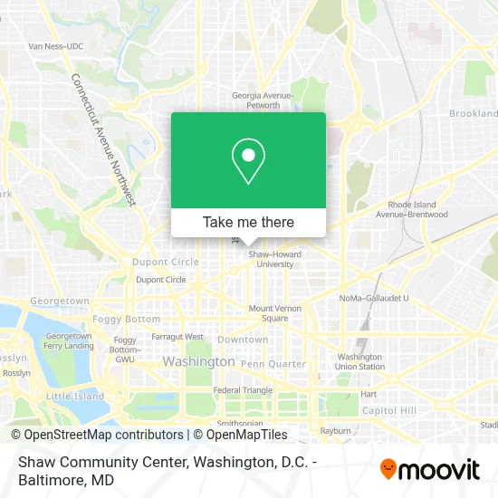
See Shaw Community Center, Washington, on the map
Public Transit to Shaw Community Center in Washington
Wondering how to get to Shaw Community Center in Washington? Moovit helps you find the best way to get to Shaw Community Center with step-by-step directions from the nearest public transit station.
Moovit provides free maps and live directions to help you navigate through your city. View schedules, routes, timetables, and find out how long does it take to get to Shaw Community Center in real time.
Looking for the nearest stop or station to Shaw Community Center? Check out this list of stops closest to your destination: P St Nw+9 St NW; Rhode Island Av Nw+9 St NW; 11 St Nw+S St NW; Mcpherson Sq Metro Station; U Street; Farragut North - NE Corner Connecticut Ave. &Amp; K St..
Bus: C51, D44, D4X, D50, C91, D32.Train: MARC.Metro: GREEN, YELLOW, BLUE, ORANGE, SILVER, RED.
Want to see if there’s another route that gets you there at an earlier time? Moovit helps you find alternative routes or times. Get directions from and directions to Shaw Community Center easily from the Moovit App or Website.
We make riding to Shaw Community Center easy, which is why over 1.7 million users, including users in Washington, trust Moovit as the best app for public transit. You don’t need to download an individual bus app or train app, Moovit is your all-in-one transit app that helps you find the best bus time or train time available.
For information on prices of bus, metro and train, costs and ride fares to Shaw Community Center, please check the Moovit app.
Use the app to navigate to popular places including to the airport, hospital, stadium, grocery store, mall, coffee shop, school, college, and university.
Shaw Community Center Address: 1701 11th St NW street in Washington
- Champion Carpets And Rugs Cleaner,
- Intelligent Energy Light And Power,
- Shaw Skatepark,
- Howard University Hospital,
- Kennedy Glass,
- Logan Circle - Scott Circle - Dupont Circle,
- Inner Caucus Entertainment, Washington Dc,
- Virginia Williams Family Resource Center,
- Western Union,
- The Roasted Boon Company,
- Dc Language Immersion Project,
- The Shaw Bijou,
- Dog Daze Social Club,
- Sidney R. Yates Building,
- National Council Of Negro Womens Headquaters,
- Xiidc,
- Shiloh Baptist Church (Shiloh Senior Citizens Center),
- Shop Bzb,
- First National Bank Atm,
- Benitos Place (Benitos Honduran Restaurant)
Places Near Shaw Community Center (Washington)
- Rock Creek Tennis Center, Washington,
- Pennsylvania Ave NW (3rd st and pennsylvania), Washington,
- Capital One Arena, Washington,
- The Anthem, Washington,
- Washington DC VA Medical Center, Washington,
- Basilica of the National Shrine, Washington,
- Camden Yards, Baltimore,
- Sibley Memorial Hospital, Washington,
- Washington National Cathedral, Washington,
- National Theatre, Washington,
- Warner Theatre, Washington,
- National Museum of African American History and Culture, Washington,
- Westfield Montgomery Mall, Montgomery County,
- M&T Bank Stadium, Baltimore,
- PG Mall, Prince George's County,
- Marriott Marquis Washington, DC, Washington,
- Amazon Hq2, Arlington County,
- Georgetown, Washington,
- National Zoo, Washington,
- Museum Of The Bible, Washington
How to get to popular places in Washington, D.C. - Baltimore, MD with public transit
Get around Washington by public transit!
Traveling around Washington has never been so easy. See step by step directions as you travel to any attraction, street or major public transit station. View bus and train schedules, arrival times, service alerts and detailed routes on a map, so you know exactly how to get to anywhere in Washington.
When traveling to any destination around Washington use Moovit's Live Directions with Get Off Notifications to know exactly where and how far to walk, how long to wait for your line, and how many stops are left. Moovit will alert you when it's time to get off — no need to constantly re-check whether yours is the next stop.
Wondering how to use public transit in Washington or how to pay for public transit in Washington? Moovit public transit app can help you navigate your way with public transit easily, and at minimum cost. It includes public transit fees, ticket prices, and costs. Looking for a map of Washington public transit lines? Moovit public transit app shows all public transit maps in Washington with all Bus, Train, Metro, Light Rail and Ferry routes and stops on an interactive map.
Washington, D.C. - Baltimore, MD has 5 transit type(s), including: Bus, Train, Metro, Light Rail and Ferry, operated by several transit agencies, including WMATA, Montgomery County Ride On, Fairfax Connector, TheBus, PRTC, DASH - Alexandria, Arlington Transit (ART), RTA of Central Maryland, MDOT MTA, MDOT MTA Light RailLink, MDOT MTA Commuter Bus, MDOT MTA Local Bus, FXBGO!, Virginia Railway Express (VRE) and MARC