How to get to Sheila B Cheek by bus?
Click on the bus route to see step by step directions with maps, line arrival times and updated time schedules.
From Eastern High School, Washington
39 minFrom Sheraton Suites Old Town Alexandria, Alexandria
39 minFrom U.S. Department of Homeland Security (DHS) - Nebraska Avenue Complex, Washington
35 minFrom The Mall at Prince Georges, Prince George's County
87 minFrom Hilton Alexandria Mark Center, Alexandria
55 minFrom Avalon Theatre, Washington
39 minFrom PG Mall, Prince George's County
75 minFrom American University, Washington
31 minFrom Courtyard Alexandria Pentagon South, Alexandria
44 minFrom Chef Geoff's, Washington
29 min
How to get to Sheila B Cheek by metro?
Click on the metro route to see step by step directions with maps, line arrival times and updated time schedules.
From Eastern High School, Washington
36 minFrom Sheraton Suites Old Town Alexandria, Alexandria
41 minFrom U.S. Department of Homeland Security (DHS) - Nebraska Avenue Complex, Washington
31 minFrom The Mall at Prince Georges, Prince George's County
41 minFrom Avalon Theatre, Washington
29 minFrom PG Mall, Prince George's County
35 minFrom American University, Washington
35 min
Bus stops near Sheila B Cheek in Washington
- 16 St Nw+L St NW, 2 min walk,VIEW
- Connecticut Av Nw+L St NW, 2 min walk,VIEW
- K St & 16th St NW FS Eb, 2 min walk,VIEW
- 17th St Nw (East) & I St Nw, 2 min walk,VIEW
- K St NW & 16th St NW (Main), 3 min walk,VIEW
- I St Nw+17 St NW, 3 min walk,VIEW
- K St & 17th St NW Eb, 3 min walk,VIEW
- K St NW & 17th St NW (Main) West, 3 min walk,VIEW
- I St & Connecticut Ave, 4 min walk,VIEW
Metro station near Sheila B Cheek in Washington
- Entrance B - 11th And G Sts., 3 min walk,VIEW
Bus lines to Sheila B Cheek in Washington
- D60, South To Franklin Sq,VIEW
- D70, South To Farragut Sq,VIEW
- D72, North To Mt Pleasant,VIEW
- 220, 220/4 Washington Dc,VIEW
- 240, 240/4 Kent Island,VIEW
- 260, 260/7 Severna Park,VIEW
- 315, 315/2 Washington Dc,VIEW
- 325, 325/2 Washington Dc / Metro Center,VIEW
- 620, 620/3 Washington Dc,VIEW
- 640, 640/5 Washington Dc,VIEW
- 650, 650/8 La Plata,VIEW
- D20, West To Farragut Sq,VIEW
- A58, East To Farragut Sq,VIEW
- A49, East To Metro Center,VIEW
- D10, West To Foggy Bottom,VIEW
- F19, North To Potomac Park,VIEW
- D80, North To Friendship Hts,VIEW
- D94, West To Sibley Hospital,VIEW
- 715, 715/3 Washington Dc,VIEW
- 725, 725/1 Washington Dc,VIEW
What are the closest stations to Sheila B Cheek?
The closest stations to Sheila B Cheek are:
- 16 St Nw+L St NW is 55 yards away, 2 min walk.
- Connecticut Av Nw+L St NW is 106 yards away, 2 min walk.
- K St & 16th St NW FS Eb is 120 yards away, 2 min walk.
- 17th St Nw (East) & I St Nw is 127 yards away, 2 min walk.
- K St NW & 16th St NW (Main) is 197 yards away, 3 min walk.
- I St Nw+17 St NW is 198 yards away, 3 min walk.
- Entrance B - 11th And G Sts. is 203 yards away, 3 min walk.
- K St & 17th St NW Eb is 223 yards away, 3 min walk.
- K St NW & 17th St NW (Main) West is 241 yards away, 3 min walk.
- I St & Connecticut Ave is 252 yards away, 4 min walk.
Which bus lines stop near Sheila B Cheek?
These bus lines stop near Sheila B Cheek: 315, 971, 981, D20, D6X, D70, D90, F19.
Which metro lines stop near Sheila B Cheek?
These metro lines stop near Sheila B Cheek: BLUE, RED.
What’s the nearest metro station to Sheila B Cheek in Washington?
The nearest metro station to Sheila B Cheek in Washington is Entrance B - 11th And G Sts.. It’s a 3 min walk away.
What’s the nearest bus station to Sheila B Cheek in Washington?
The nearest bus stations to Sheila B Cheek in Washington are 16 St Nw+L St NW, Connecticut Av Nw+L St NW, K St & 16th St NW FS Eb and 17th St Nw (East) & I St Nw. The closest one is a 2 min walk away.
What time is the first metro to Sheila B Cheek in Washington?
The BLUE is the first metro that goes to Sheila B Cheek in Washington. It stops nearby at 5:21 AM.
What time is the last metro to Sheila B Cheek in Washington?
The RED is the last metro that goes to Sheila B Cheek in Washington. It stops nearby at 12:10 AM.
What time is the first bus to Sheila B Cheek in Washington?
The D80 is the first bus that goes to Sheila B Cheek in Washington. It stops nearby at 3:02 AM.
What time is the last bus to Sheila B Cheek in Washington?
The D10 is the last bus that goes to Sheila B Cheek in Washington. It stops nearby at 3:16 AM.
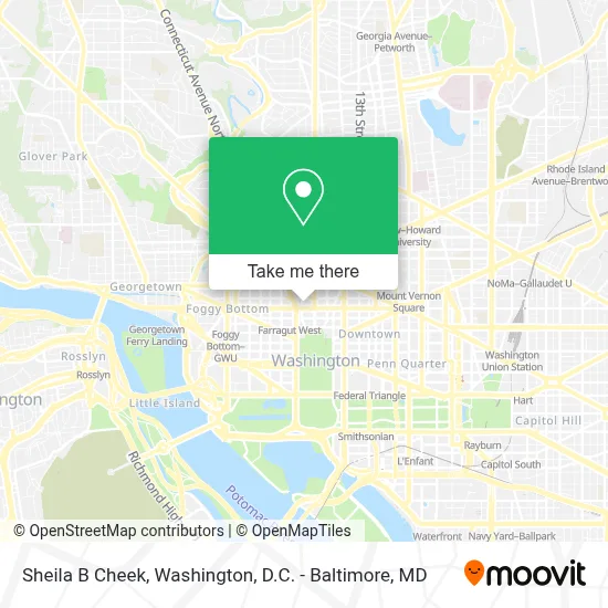
See Sheila B Cheek, Washington, on the map
Public Transit to Sheila B Cheek in Washington
Wondering how to get to Sheila B Cheek in Washington? Moovit helps you find the best way to get to Sheila B Cheek with step-by-step directions from the nearest public transit station.
Moovit provides free maps and live directions to help you navigate through your city. View schedules, routes, timetables, and find out how long does it take to get to Sheila B Cheek in real time.
Looking for the nearest stop or station to Sheila B Cheek? Check out this list of stops closest to your destination: 16 St Nw+L St NW; Connecticut Av Nw+L St NW; K St & 16th St NW FS Eb; 17th St Nw (East) & I St Nw; K St NW & 16th St NW (Main); I St Nw+17 St NW; Entrance B - 11th And G Sts.; K St & 17th St NW Eb; K St NW & 17th St NW (Main) West; I St & Connecticut Ave.
Bus: 315, 971, 981, D20, D6X, D70, D90, F19, D60, D72, A58, 220, 240, 260, 325, A49.Metro: BLUE, RED, ORANGE, SILVER.
Want to see if there’s another route that gets you there at an earlier time? Moovit helps you find alternative routes or times. Get directions from and directions to Sheila B Cheek easily from the Moovit App or Website.
We make riding to Sheila B Cheek easy, which is why over 1.7 million users, including users in Washington, trust Moovit as the best app for public transit. You don’t need to download an individual bus app or train app, Moovit is your all-in-one transit app that helps you find the best bus time or train time available.
For information on prices of metro and bus, costs and ride fares to Sheila B Cheek, please check the Moovit app.
Use the app to navigate to popular places including to the airport, hospital, stadium, grocery store, mall, coffee shop, school, college, and university.
Sheila B Cheek Address: 1667 K St NW Suite #260 street in Washington
- Kktc Washington Temsilciliği - Trnc Washington Representative Office,
- Keith Watters And Associates,
- The F.L. Wolters Group,
- Leadership Conference On Civil and Human Rights,
- Artdriver,
- Donald Gross Law,
- Dwight D Eisenhower Memorial,
- The V-Law Group, Pllc,
- Starfura,
- Knexis,
- The National Puerto Rican Chamber Of Commerce,
- Hawa Transportation,
- Furniture Assembly Team,
- Raj Ferber Pllc,
- Openeyes Technologies Inc.,
- Women's Truth & Justice Foundation,
- The Childress Firm Pllc,
- Blue Whale Materials,
- Mfl,
- Georgetown Reuse
Places Near Sheila B Cheek (Washington)
- National Zoo, Washington,
- National Museum of African American History and Culture, Washington,
- Marriott Marquis Washington, DC, Washington,
- Rock Creek Tennis Center, Washington,
- Washington DC VA Medical Center, Washington,
- National Theatre, Washington,
- Warner Theatre, Washington,
- PG Mall, Prince George's County,
- The Anthem, Washington,
- Sibley Memorial Hospital, Washington,
- Basilica of the National Shrine, Washington,
- Georgetown, Washington,
- Pennsylvania Ave NW (3rd st and pennsylvania), Washington,
- Camden Yards, Baltimore,
- Capital One Arena, Washington,
- Westfield Montgomery Mall, Montgomery County,
- Museum Of The Bible, Washington,
- Amazon Hq2, Arlington County,
- M&T Bank Stadium, Baltimore,
- Washington National Cathedral, Washington
How to get to popular places in Washington, D.C. - Baltimore, MD with public transit
Get around Washington by public transit!
Traveling around Washington has never been so easy. See step by step directions as you travel to any attraction, street or major public transit station. View bus and train schedules, arrival times, service alerts and detailed routes on a map, so you know exactly how to get to anywhere in Washington.
When traveling to any destination around Washington use Moovit's Live Directions with Get Off Notifications to know exactly where and how far to walk, how long to wait for your line, and how many stops are left. Moovit will alert you when it's time to get off — no need to constantly re-check whether yours is the next stop.
Wondering how to use public transit in Washington or how to pay for public transit in Washington? Moovit public transit app can help you navigate your way with public transit easily, and at minimum cost. It includes public transit fees, ticket prices, and costs. Looking for a map of Washington public transit lines? Moovit public transit app shows all public transit maps in Washington with all Bus, Train, Metro, Light Rail and Ferry routes and stops on an interactive map.
Washington, D.C. - Baltimore, MD has 5 transit type(s), including: Bus, Train, Metro, Light Rail and Ferry, operated by several transit agencies, including WMATA, Montgomery County Ride On, Fairfax Connector, TheBus, PRTC, DASH - Alexandria, Arlington Transit (ART), RTA of Central Maryland, MDOT MTA, MDOT MTA Light RailLink, MDOT MTA Commuter Bus, MDOT MTA Local Bus, FXBGO!, Virginia Railway Express (VRE) and MARC