Directions to Shell (Boulder City) with public transportation
The following transit lines have routes that pass near Shell
 Bus: 221.
How to get to Shell by bus?
Click on the bus route to see step by step directions with maps, line arrival times and updated time schedules.
From Railroad Pass Hotel & Casino, Henderson
12 minFrom Clark County Museum, Henderson
61 minFrom Basic High School (Basic Academy of International Studies), Henderson
53 minFrom CSN Henderson Campus @ CSN Henderson Campus (S), Henderson
31 minFrom Pinecrest Academy, Henderson
40 minFrom Bark Park At Heritage Park, Henderson
80 minFrom Foothill High School, Henderson
31 minFrom College Of Southern Nevada Baseball Field, Henderson
34 min
Bus stop near Shell in Boulder City
- Wb Nevada After Birch, 7 min walk,VIEW
Bus lines to Shell in Boulder City
- 221, 221 Toward Boulder City,VIEW
What are the closest stations to Shell?
The closest stations to Shell are:
- Wb Nevada After Birch is 534 yards away, 7 min walk.
Which bus line stops near Shell?
221 (221 Cactus / Horizon Ridge Eastbound Toward Boulder City)
What’s the nearest bus station to Shell in Boulder City?
The nearest bus station to Shell in Boulder City is Wb Nevada After Birch. It’s a 7 min walk away.
What time is the first bus to Shell in Boulder City?
The 221 is the first bus that goes to Shell in Boulder City. It stops nearby at 4:53 AM.
What time is the last bus to Shell in Boulder City?
The 221 is the last bus that goes to Shell in Boulder City. It stops nearby at 11:44 PM.
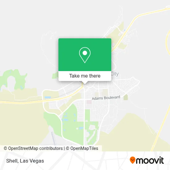
See Shell, Boulder City, on the map
Public Transit to Shell in Boulder City
Wondering how to get to Shell in Boulder City? Moovit helps you find the best way to get to Shell with step-by-step directions from the nearest public transit station.
Moovit provides free maps and live directions to help you navigate through your city. View schedules, routes, timetables, and find out how long does it take to get to Shell in real time.
Looking for the nearest stop or station to Shell? Check out this list of stops closest to your destination: Wb Nevada After Birch.
Bus: 221.
Want to see if there’s another route that gets you there at an earlier time? Moovit helps you find alternative routes or times. Get directions from and directions to Shell easily from the Moovit App or Website.
We make riding to Shell easy, which is why over 1.7 million users, including users in Boulder City, trust Moovit as the best app for public transit. You don’t need to download an individual bus app or train app, Moovit is your all-in-one transit app that helps you find the best bus time or train time available.
For information on prices of bus, costs and ride fares to Shell, please check the Moovit app.
Use the app to navigate to popular places including to the airport, hospital, stadium, grocery store, mall, coffee shop, school, college, and university.
Shell Address: 1004 Nevada Hwy street in Boulder City
- Silver Rider,
- Amazon Locker-Pedal,
- Boulder City Hoover Dam Museum,
- Douglas Huber DDS,
- Nevada State Railroad Museum, Boulder City,
- Boulder City, NV,
- USPS Collection Box - Blue Box,
- Avon Representative,
- Railroad Pass Hotel & Casino,
- Railroad Pass Casino Rd/S,
- Clark County Museum,
- Exit 19/College Drive/N,
- Goodwill,
- Pinecrest Academy,
- Foothill High School,
- CSN Henderson Campus @ CSN Henderson Campus ,
- Exit 19,
- College Of Southern Nevada Baseball Field,
- Heritage Park Soccer Fields,
- College Dr / S Boulder Hwy
Places Near Shell (Boulder City)
- The Palms Casino Resort, Paradise,
- Trump International Hotel Las Vegas, Paradise,
- The Neon Museum, Las Vegas,
- Omega Mart, Las Vegas,
- The Deuce Bus Stop at Fremont St, Las Vegas,
- Welcome To Fabulous Las Vegas Sign, Paradise,
- Las Vegas South Premium Outlets, Enterprise,
- Koolsville Tattoos, Las Vegas,
- Allegiant Stadium, Paradise,
- Gold & Silver Pawn Shop, Las Vegas,
- Town Square, Enterprise,
- Las Vegas North Premium Outlets, Las Vegas,
- Area15, Las Vegas,
- Lee Canyon, Las Vegas,
- Zak Bagans Haunted Museum, Las Vegas,
- Las Vegas Premium Outlets-North, Enterprise,
- Walmart Supercenter, Las Vegas,
- Arte Museum Las Vegas, Paradise,
- Meow Wolf - Las Vegas (Meow Wolf's Omega Mart), Las Vegas,
- Walmart, Las Vegas
How to get to popular places in Las Vegas with public transit
Get around Boulder City by public transit!
Traveling around Boulder City has never been so easy. See step by step directions as you travel to any attraction, street or major public transit station. View bus and train schedules, arrival times, service alerts and detailed routes on a map, so you know exactly how to get to anywhere in Boulder City.
When traveling to any destination around Boulder City use Moovit's Live Directions with Get Off Notifications to know exactly where and how far to walk, how long to wait for your line, and how many stops are left. Moovit will alert you when it's time to get off — no need to constantly re-check whether yours is the next stop.
Wondering how to use public transit in Boulder City or how to pay for public transit in Boulder City? Moovit public transit app can help you navigate your way with public transit easily, and at minimum cost. It includes public transit fees, ticket prices, and costs. Looking for a map of Boulder City public transit lines? Moovit public transit app shows all public transit maps in Boulder City with all Bus and Monorail routes and stops on an interactive map.
Las Vegas has 2 transit type(s), including: Bus and Monorail, operated by several transit agencies, including RTCSNV, City of Las Vegas, Alvand Transportation, Vegas Airporter, Las Vegas Monorail, FlixBus-us and Greyhound-us