How to get to Shell by bus?
Click on the bus route to see step by step directions with maps, line arrival times and updated time schedules.
From Huli Huli 'n Dakine Grill BBQ, Paradise
58 minFrom Vegas Valley Drive & South Hollywood Boulevard, Sunrise Manor
56 minFrom E Sunset Rd / S Pecos Rd, Paradise
50 minFrom MB Market, Paradise
59 minFrom Hollywood Car Museum, Paradise
71 minFrom Sunset Park, Paradise
52 minFrom Fall of Atlantis at Caesars Palace Forum Shops, Paradise
49 minFrom Amazon Fulfillment Center-LAS2, North Las Vegas
57 minFrom Tropicana And Boulder Highway, Whitney
42 min
Bus stops near Shell in Las Vegas
Monorail station near Shell in Las Vegas
- Las Vegas Convention Center Station, 34 min walk,VIEW
Bus lines to Shell in Las Vegas
What are the closest stations to Shell?
The closest stations to Shell are:
- Wb Charleston After Gass is 138 yards away, 2 min walk.
- Eb Bonneville Before 10th is 323 yards away, 4 min walk.
- Las Vegas Convention Center Station is 2790 yards away, 34 min walk.
Which bus lines stop near Shell?
These bus lines stop near Shell: 109, 206.
What’s the nearest bus station to Shell in Las Vegas?
The nearest bus station to Shell in Las Vegas is Wb Charleston After Gass. It’s a 2 min walk away.
What time is the first bus to Shell in Las Vegas?
The 109 is the first bus that goes to Shell in Las Vegas. It stops nearby at 3:02 AM.
What time is the last bus to Shell in Las Vegas?
The 206 is the last bus that goes to Shell in Las Vegas. It stops nearby at 3:25 AM.
What time is the first Monorail to Shell in Las Vegas?
The LVM is the first Monorail that goes to Shell in Las Vegas. It stops nearby at 7:00 AM.
What time is the last Monorail to Shell in Las Vegas?
The LVM is the last Monorail that goes to Shell in Las Vegas. It stops nearby at 12:02 AM.
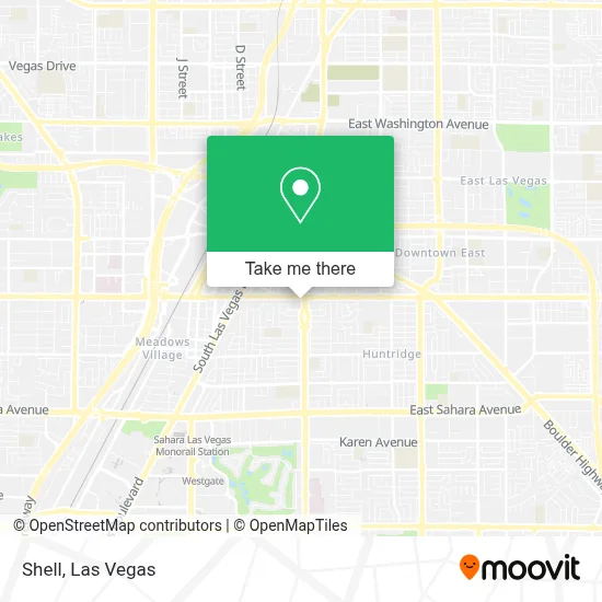
See Shell, Las Vegas, on the map
Public Transit to Shell in Las Vegas
Wondering how to get to Shell in Las Vegas? Moovit helps you find the best way to get to Shell with step-by-step directions from the nearest public transit station.
Moovit provides free maps and live directions to help you navigate through your city. View schedules, routes, timetables, and find out how long does it take to get to Shell in real time.
Looking for the nearest stop or station to Shell? Check out this list of stops closest to your destination: Wb Charleston After Gass; Eb Bonneville Before 10th; Las Vegas Convention Center Station.
Bus: 109, 206, 208.Monorail: LVM.
Want to see if there’s another route that gets you there at an earlier time? Moovit helps you find alternative routes or times. Get directions from and directions to Shell easily from the Moovit App or Website.
We make riding to Shell easy, which is why over 1.7 million users, including users in Las Vegas, trust Moovit as the best app for public transit. You don’t need to download an individual bus app or train app, Moovit is your all-in-one transit app that helps you find the best bus time or train time available.
For information on prices of bus, costs and ride fares to Shell, please check the Moovit app.
Use the app to navigate to popular places including to the airport, hospital, stadium, grocery store, mall, coffee shop, school, college, and university.
Shell Address: 1140 E Charleston Blvd street in Las Vegas
- Doña Norma Restaurante Nicaraguense,
- Maryland and Charleston,
- E Charleston Blvd / S Maryland Pkwy,
- Huntridge Shopping Center,
- Savers,
- Las Vegas Academy,
- Harvey William F,
- Results Realty Of Las Vegas,
- Michael J. Amador And Associates,
- Extra Space Storage,
- American Realty Llc,
- M&M's Behavioral Management,
- Veronica L. Burris Valentine Law Offices,
- 24/7 Attorneys,
- Strickland Lawn & Maintenance,
- Encompassfi,
- Revolutionary Law - G. Oliver Melgar, Llc,
- The Ramos Law Firm,
- Las Vegas Freemason Business Association (Lvfba),
- Masonic Temple
Places Near Shell (Las Vegas)
- Las Vegas South Premium Outlets, Enterprise,
- Welcome To Fabulous Las Vegas Sign, Paradise,
- The Neon Museum, Las Vegas,
- Omega Mart, Las Vegas,
- Lee Canyon, Las Vegas,
- The Deuce Bus Stop at Fremont St, Las Vegas,
- Walmart, Las Vegas,
- Las Vegas Premium Outlets-North, Enterprise,
- Gold & Silver Pawn Shop, Las Vegas,
- Trump International Hotel Las Vegas, Paradise,
- Allegiant Stadium, Paradise,
- The Palms Casino Resort, Paradise,
- Koolsville Tattoos, Las Vegas,
- Meow Wolf - Las Vegas (Meow Wolf's Omega Mart), Las Vegas,
- Area15, Las Vegas,
- Town Square, Enterprise,
- Arte Museum Las Vegas, Paradise,
- Zak Bagans Haunted Museum, Las Vegas,
- Walmart Supercenter, Las Vegas,
- Las Vegas North Premium Outlets, Las Vegas
How to get to popular places in Las Vegas with public transit
Get around Las Vegas by public transit!
Traveling around Las Vegas has never been so easy. See step by step directions as you travel to any attraction, street or major public transit station. View bus and train schedules, arrival times, service alerts and detailed routes on a map, so you know exactly how to get to anywhere in Las Vegas.
When traveling to any destination around Las Vegas use Moovit's Live Directions with Get Off Notifications to know exactly where and how far to walk, how long to wait for your line, and how many stops are left. Moovit will alert you when it's time to get off — no need to constantly re-check whether yours is the next stop.
Wondering how to use public transit in Las Vegas or how to pay for public transit in Las Vegas? Moovit public transit app can help you navigate your way with public transit easily, and at minimum cost. It includes public transit fees, ticket prices, and costs. Looking for a map of Las Vegas public transit lines? Moovit public transit app shows all public transit maps in Las Vegas with all Bus and Monorail routes and stops on an interactive map.
Las Vegas has 2 transit type(s), including: Bus and Monorail, operated by several transit agencies, including RTCSNV, City of Las Vegas, Alvand Transportation, Vegas Airporter, Las Vegas Monorail, FlixBus-us and Greyhound-us