How to get to Shell by bus?
Click on the bus route to see step by step directions with maps, line arrival times and updated time schedules.
From W Craig Rd / N Commerce St, North Las Vegas
23 minFrom WING STOP, North Las Vegas
45 minFrom Advanced Technologies Academy, Las Vegas
47 minFrom The Expo at World Market Center Las Vegas, Las Vegas
55 minFrom Foremaster Lane & North Las Vegas Boulevard, Las Vegas
62 minFrom Wegoba, Las Vegas
30 minFrom Palomino Club, North Las Vegas
61 minFrom Arizona Charlie's Decatur, Las Vegas
48 minFrom Losee Rd / E Ann Rd, North Las Vegas
43 minFrom Palm Downtown Mortuary & Cemetery, Las Vegas
58 min
Bus stops near Shell in Las Vegas
Bus lines to Shell in Las Vegas
What are the closest stations to Shell?
The closest stations to Shell are:
- Nb Rancho After Craig is 198 yards away, 3 min walk.
- Eb Craig After Rancho is 480 yards away, 6 min walk.
Which bus lines stop near Shell?
These bus lines stop near Shell: 102, 106, 219.
What’s the nearest bus station to Shell in Las Vegas?
The nearest bus station to Shell in Las Vegas is Nb Rancho After Craig. It’s a 3 min walk away.
What time is the first bus to Shell in Las Vegas?
The 106 is the first bus that goes to Shell in Las Vegas. It stops nearby at 4:01 AM.
What time is the last bus to Shell in Las Vegas?
The 106 is the last bus that goes to Shell in Las Vegas. It stops nearby at 2:25 AM.
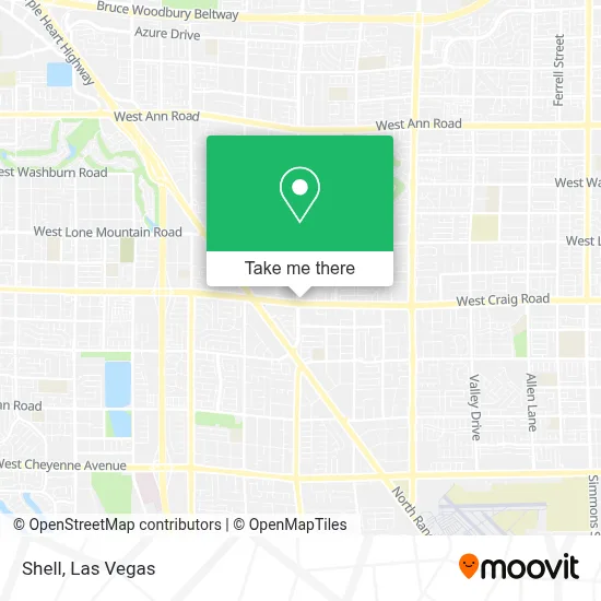
See Shell, Las Vegas, on the map
Public Transit to Shell in Las Vegas
Wondering how to get to Shell in Las Vegas? Moovit helps you find the best way to get to Shell with step-by-step directions from the nearest public transit station.
Moovit provides free maps and live directions to help you navigate through your city. View schedules, routes, timetables, and find out how long does it take to get to Shell in real time.
Looking for the nearest stop or station to Shell? Check out this list of stops closest to your destination: Nb Rancho After Craig; Eb Craig After Rancho.
Bus: 102, 106, 219.
Want to see if there’s another route that gets you there at an earlier time? Moovit helps you find alternative routes or times. Get directions from and directions to Shell easily from the Moovit App or Website.
We make riding to Shell easy, which is why over 1.7 million users, including users in Las Vegas, trust Moovit as the best app for public transit. You don’t need to download an individual bus app or train app, Moovit is your all-in-one transit app that helps you find the best bus time or train time available.
For information on prices of bus, costs and ride fares to Shell, please check the Moovit app.
Use the app to navigate to popular places including to the airport, hospital, stadium, grocery store, mall, coffee shop, school, college, and university.
Shell Address: 4400 N Jones Blvd street in Las Vegas
- McDonald's,
- Eos Fitness,
- University Medical Center,
- UMC Quick Care | Urgent Care,
- 7-11,
- Planet Fitness,
- Larry&Jennie's Bar&Grill,
- Boxer Puppies For Adoption In Nevada,
- Luzsblooms,
- Mattress Firm Best In the West,
- Bladedbyred,
- Thorns & All,
- Dollar Tree,
- Shepherd Of Bethel Llc,
- Veterinary Emergency + Critical Care North Rainbow,
- Vp Racing Fuel / Funny's,
- Rockitcoin Bitcoin Atm,
- Casa Mckenzie,
- Centennial Hills Seventh Day Adventist Church,
- Village Starfish
Places Near Shell (Las Vegas)
- Lee Canyon, Las Vegas,
- The Neon Museum, Las Vegas,
- Welcome To Fabulous Las Vegas Sign, Paradise,
- Meow Wolf - Las Vegas (Meow Wolf's Omega Mart), Las Vegas,
- The Palms Casino Resort, Paradise,
- Las Vegas North Premium Outlets, Las Vegas,
- The Deuce Bus Stop at Fremont St, Las Vegas,
- Las Vegas Premium Outlets-North, Enterprise,
- Zak Bagans Haunted Museum, Las Vegas,
- Gold & Silver Pawn Shop, Las Vegas,
- Las Vegas South Premium Outlets, Enterprise,
- Walmart Supercenter, Las Vegas,
- Trump International Hotel Las Vegas, Paradise,
- Arte Museum Las Vegas, Paradise,
- Area15, Las Vegas,
- Koolsville Tattoos, Las Vegas,
- Omega Mart, Las Vegas,
- Allegiant Stadium, Paradise,
- Walmart, Las Vegas,
- Town Square, Enterprise
How to get to popular places in Las Vegas with public transit
Get around Las Vegas by public transit!
Traveling around Las Vegas has never been so easy. See step by step directions as you travel to any attraction, street or major public transit station. View bus and train schedules, arrival times, service alerts and detailed routes on a map, so you know exactly how to get to anywhere in Las Vegas.
When traveling to any destination around Las Vegas use Moovit's Live Directions with Get Off Notifications to know exactly where and how far to walk, how long to wait for your line, and how many stops are left. Moovit will alert you when it's time to get off — no need to constantly re-check whether yours is the next stop.
Wondering how to use public transit in Las Vegas or how to pay for public transit in Las Vegas? Moovit public transit app can help you navigate your way with public transit easily, and at minimum cost. It includes public transit fees, ticket prices, and costs. Looking for a map of Las Vegas public transit lines? Moovit public transit app shows all public transit maps in Las Vegas with all Bus and Monorail routes and stops on an interactive map.
Las Vegas has 2 transit type(s), including: Bus and Monorail, operated by several transit agencies, including RTCSNV, City of Las Vegas, Alvand Transportation, Vegas Airporter, Las Vegas Monorail, FlixBus-us and Greyhound-us