Directions to Shell (Cape Coral) with public transportation
The following transit lines have routes that pass near Shell
 Bus: 40.
How to get to Shell by bus?
Click on the bus route to see step by step directions with maps, line arrival times and updated time schedules.
From Mobility Medic, Cape Coral
27 minFrom Iglesia Renacerinc.Aic, Cape Coral
30 minFrom Tower Strong Services, Palmona Park
62 minFrom Cape Coral Pkwy & Santa Barbara Blvd, Cape Coral
23 minFrom Amanda M Bradbury Pa - Lee Physician Group, Cape Coral
26 minFrom Billy Bobs Car Wash, Cape Coral
40 minFrom Lee County Government, Uncommon Friends, Waste Water Collection Lines Service & Repairs, Fort Myers
105 minFrom Johnson Engineering, Inc., Fort Myers
101 minFrom Fifth Third Mortgage - Todd Hughes, Cape Coral
65 minFrom J's Vision, Cape Coral
46 min
Bus stop near Shell in Cape Coral
- Santa Barb Blvd @ Pine Island Rd, 2 min walk,VIEW
Bus lines to Shell in Cape Coral
- 40, Cape Coral Transfer Center,VIEW
What are the closest stations to Shell?
The closest stations to Shell are:
- Santa Barb Blvd @ Pine Island Rd is 117 yards away, 2 min walk.
Which bus line stops near Shell?
40 (Cape Coral Transfer Center→Cape Coral Hospital @ SE 6th St)
What’s the nearest bus station to Shell in Cape Coral?
The nearest bus station to Shell in Cape Coral is Santa Barb Blvd @ Pine Island Rd. It’s a 2 min walk away.
What time is the first bus to Shell in Cape Coral?
The 40 is the first bus that goes to Shell in Cape Coral. It stops nearby at 6:20 AM.
What time is the last bus to Shell in Cape Coral?
The 40 is the last bus that goes to Shell in Cape Coral. It stops nearby at 8:24 PM.
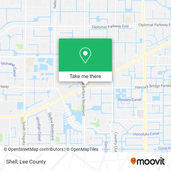
See Shell, Cape Coral, on the map
Public Transit to Shell in Cape Coral
Wondering how to get to Shell in Cape Coral? Moovit helps you find the best way to get to Shell with step-by-step directions from the nearest public transit station.
Moovit provides free maps and live directions to help you navigate through your city. View schedules, routes, timetables, and find out how long does it take to get to Shell in real time.
Looking for the nearest stop or station to Shell? Check out this list of stops closest to your destination: Santa Barb Blvd @ Pine Island Rd.
Bus: 40.
Want to see if there’s another route that gets you there at an earlier time? Moovit helps you find alternative routes or times. Get directions from and directions to Shell easily from the Moovit App or Website.
We make riding to Shell easy, which is why over 1.5 million users, including users in Cape Coral, trust Moovit as the best app for public transit. You don’t need to download an individual bus app or train app, Moovit is your all-in-one transit app that helps you find the best bus time or train time available.
For information on prices of bus, costs and ride fares to Shell, please check the Moovit app.
Use the app to navigate to popular places including to the airport, hospital, stadium, grocery store, mall, coffee shop, school, college, and university.
Shell Address: 3 NE Pine Island Rd Cape Coral, FL 33909 street in Cape Coral
- TEXACO,
- Covering the Cape,
- Adams Food,
- Professional Carpet Cleaning,
- Coral Cape Locksmith,
- 7-Eleven (711),
- 12 NE Pine Island Rd Parking,
- TACO BELL,
- Fun Central Action News,
- Phở Bowl Vietnamese Cuisine Cape Coral,
- Santa Barbara Blvd / Hancock Bridge Pkwy W,
- Penske Truck Rental,
- Mattress Cleaner & Carpet Cleaning,
- Quan Ngon,
- Moose Lodge,
- Citanos Cafeteria,
- Community Bank,
- FISERV SOLUTIONS LLC,
- Sunshine Painting,
- Bravo Supermarket
Places Near Shell (Cape Coral)
- Bonita Beach, Bonita Springs,
- Amazon Warehouse Rsw5,
- Pelican Landing Beach Shuttle, Bonita Springs,
- Edison Mall, Fort Myers,
- Matlacha Nude Beach, Matlacha Isles-Matlacha Shores,
- Miromar Outlets, Estero,
- Seminole Casino Hotel Immokalee,
- Bonita Bay Private Beach Club, Bonita Springs,
- Lehigh Acres, FL, Lehigh Acres,
- I-75 & MLK (Exit 138), Fort Myers,
- Lee County Tax Collector, Cape Coral,
- I-75 & Colonial (Exit 136), Fort Myers,
- U.S.-41 / Colonial Blvd. Intersection, Fort Myers,
- Rosa Parks Transportation Center, Fort Myers,
- Flixbus, Fort Myers,
- Ft Myers Airport RSW,
- Bonita Springs, FL, Bonita Springs,
- US-41, Fort Myers,
- All About U Naples Escorts, Pine Ridge,
- Walmart Supercenter, Fort Myers
How to get to popular places in Lee County with public transit
Get around Cape Coral by public transit!
Traveling around Cape Coral has never been so easy. See step by step directions as you travel to any attraction, street or major public transit station. View bus and train schedules, arrival times, service alerts and detailed routes on a map, so you know exactly how to get to anywhere in Cape Coral.
When traveling to any destination around Cape Coral use Moovit's Live Directions with Get Off Notifications to know exactly where and how far to walk, how long to wait for your line, and how many stops are left. Moovit will alert you when it's time to get off — no need to constantly re-check whether yours is the next stop.
Wondering how to use public transit in Cape Coral or how to pay for public transit in Cape Coral? Moovit public transit app can help you navigate your way with public transit easily, and at minimum cost. It includes public transit fees, ticket prices, and costs. Looking for a map of Cape Coral public transit lines? Moovit public transit app shows all public transit maps in Cape Coral with all bus routes and stops on an interactive map.
Lee County has 1 transit type(s), including: bus, operated by several transit agencies, including LeeTran, CAT and FlixBus-us