How to get to Shell by bus?
Click on the bus route to see step by step directions with maps, line arrival times and updated time schedules.
From Ives Dairy Road & 441, Miami
77 minFrom Target Midtown, Miami
66 minFrom Costco, Miami
65 minFrom Orange Bowl Stadium, Miami
71 minFrom Northwest 12th Avenue & Northwest 12th Street, Miami
63 minFrom Sawgrass Mills Mall, Miami
60 minFrom METRORail-Miami International Airport, Miami
58 minFrom Happy Endings Massage Parlor, Miami
57 minFrom Lotus House Women's Shelter, Miami
72 minFrom University Of Miami Hospital, Miami
63 min
How to get to Shell by train?
Click on the train route to see step by step directions with maps, line arrival times and updated time schedules.
Bus stops near Shell in Miami
Train stations near Shell in Miami
Bus lines to Shell in Miami
What are the closest stations to Shell?
The closest stations to Shell are:
- Nw 27 Av & Nw 108 St is 320 yards away, 4 min walk.
- Nw 103 St & 27 Av is 756 yards away, 10 min walk.
- Nw 27 Av & Nw 113 St is 902 yards away, 11 min walk.
- Nw 22 Av & Nw 107 St is 1003 yards away, 12 min walk.
- Northside is 3010 yards away, 36 min walk.
- Miami Amtrak Station is 4569 yards away, 54 min walk.
- Opa-Locka Station is 4674 yards away, 55 min walk.
- Metrorail Transfer Station is 5132 yards away, 60 min walk.
Which bus lines stop near Shell?
These bus lines stop near Shell: 103, 22, 27, 32.
Which train line stops near Shell?
GREEN (Dadeland South Stat.rail Northbound→Palmetto Station Rail Northbound)
What’s the nearest bus station to Shell in Miami?
The nearest bus station to Shell in Miami is Nw 27 Av & Nw 108 St. It’s a 4 min walk away.
What time is the first train to Shell in Miami?
The TRIRAIL is the first train that goes to Shell in Miami. It stops nearby at 3:56 AM.
What time is the last train to Shell in Miami?
The FLORIDIAN is the last train that goes to Shell in Miami. It stops nearby at 5:48 PM.
What time is the first bus to Shell in Miami?
The 27 is the first bus that goes to Shell in Miami. It stops nearby at 3:06 AM.
What time is the last bus to Shell in Miami?
The 27 is the last bus that goes to Shell in Miami. It stops nearby at 3:09 AM.
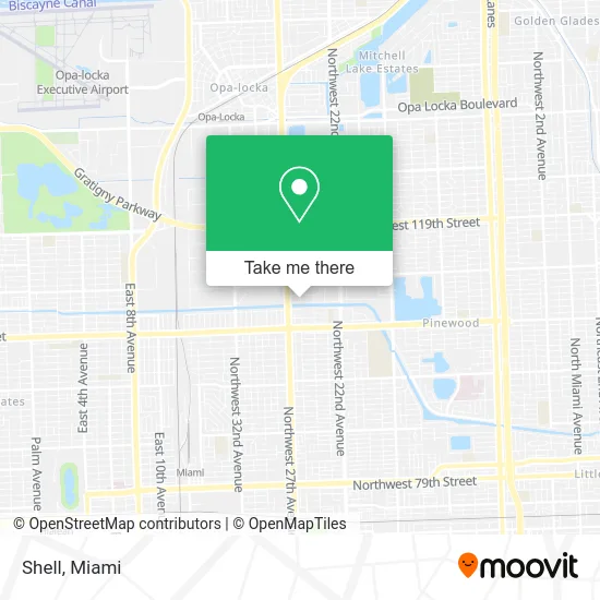
See Shell, Miami, on the map
Public Transit to Shell in Miami
Wondering how to get to Shell in Miami? Moovit helps you find the best way to get to Shell with step-by-step directions from the nearest public transit station.
Moovit provides free maps and live directions to help you navigate through your city. View schedules, routes, timetables, and find out how long does it take to get to Shell in real time.
Looking for the nearest stop or station to Shell? Check out this list of stops closest to your destination: Nw 27 Av & Nw 108 St; Nw 103 St & 27 Av; Nw 27 Av & Nw 113 St; Nw 22 Av & Nw 107 St; Northside; Miami Amtrak Station; Opa-Locka Station; Metrorail Transfer Station.
Bus: 103, 22, 27, 32.Train: GREEN, FLORIDIAN, SILVER METEOR, TRIRAIL, TRIRAIL.
Want to see if there’s another route that gets you there at an earlier time? Moovit helps you find alternative routes or times. Get directions from and directions to Shell easily from the Moovit App or Website.
We make riding to Shell easy, which is why over 1.5 million users, including users in Miami, trust Moovit as the best app for public transit. You don’t need to download an individual bus app or train app, Moovit is your all-in-one transit app that helps you find the best bus time or train time available.
For information on prices of bus and train, costs and ride fares to Shell, please check the Moovit app.
Use the app to navigate to popular places including to the airport, hospital, stadium, grocery store, mall, coffee shop, school, college, and university.
Shell Address: 10700 NW 25th Ave Miami, FL 33167 street in Miami
- Nimel Medical Center,
- LCG Taxshop,
- Alfa Y Omega la Hermosa,
- Wingway,
- Mr Greens Produce,
- Lic. Julio César Valdez,
- Locksmiths Upfront Prices,
- NW 27th Ave / NW 103rd St,
- TL Welding,
- Island Fresh Grill,
- BMP Grocery Store,
- Ayizan Blossom Boutique Salon,
- Lois Spot,
- Nathaniel 'Traz' Powell Stadium,
- William D Pawley Creative Arts,
- Miami Hype,
- Exploration Station,
- School for Advanced Studies (Westview Junior High School),
- Auto Mayella,
- Racetrac
Places Near Shell (Miami)
- Aventura Mall, Miami,
- Miami Freedom Park, Miami,
- Dolphin Mall, Miami,
- Sawgrass Mall, Miami,
- Little Havana, Miami,
- Marlins Park, Miami,
- Wynwood, Miami,
- Zoo Miami, Miami,
- Brickell City Centre, Miami,
- Miami-Dade County Courthouse, Miami,
- Bayside Marketplace, Miami,
- Richard E. Gerstein Justice Building, Miami,
- Dolphin Mall Bus, Miami,
- Keiser University Flagship Campus, West Palm Beach,
- Hard Rock Stadium, Miami Gardens,
- Miami VA Hospital, Miami,
- Sawgrass mall ( FL ), Miami Beach,
- Aventura Mall, Miami Beach,
- Miami Design District, Miami,
- Port of Miami Cruise Terminal, Miami
How to get to popular places in Miami with public transit
Get around Miami by public transit!
Traveling around Miami has never been so easy. See step by step directions as you travel to any attraction, street or major public transit station. View bus and train schedules, arrival times, service alerts and detailed routes on a map, so you know exactly how to get to anywhere in Miami.
When traveling to any destination around Miami use Moovit's Live Directions with Get Off Notifications to know exactly where and how far to walk, how long to wait for your line, and how many stops are left. Moovit will alert you when it's time to get off — no need to constantly re-check whether yours is the next stop.
Wondering how to use public transit in Miami or how to pay for public transit in Miami? Moovit public transit app can help you navigate your way with public transit easily, and at minimum cost. It includes public transit fees, ticket prices, and costs. Looking for a map of Miami public transit lines? Moovit public transit app shows all public transit maps in Miami with all Bus, Train, Light Rail and Ferry routes and stops on an interactive map.
Miami has 4 transit type(s), including: Bus, Train, Light Rail and Ferry, operated by several transit agencies, including Broward County Transit, Miami-Dade Transit, Metrorail, Palm Tran, Tri-Rail, Brightline, MARTY, City of Homestead Trolley, Key West Transit, Treasure Coast Connector, GoLine IRT, Amtrak, Greyhound-us, FlixBus-us and Aventura Express Shuttle Bus