How to get to Shell by bus?
Click on the bus route to see step by step directions with maps, line arrival times and updated time schedules.
From Medieval Times Dinner & Tournament, Lyndhurst
41 minFrom Paramus, NJ, Paramus
49 minFrom Fort Lee, NJ, Fort Lee
62 minFrom North Bergen, NJ, North Bergen
69 minFrom Sojo Spa Club, Edgewater
84 minFrom King Spa & Sauna, Palisades Park
76 minFrom Nutley, NJ, Nutley
43 minFrom MetLife Stadium, East Rutherford
51 minFrom Secaucus, NJ, Secaucus
51 minFrom Mitsuwa Marketplace, Edgewater
84 min
Bus stops near Shell in Lodi
Bus lines to Shell in Lodi
What are the closest stations to Shell?
The closest stations to Shell are:
- Memorial Dr at Washington St is 274 yards away, 4 min walk.
- Harrison Ave at Elizabeth St# is 740 yards away, 10 min walk.
- Us-46 at Money St is 1219 yards away, 15 min walk.
- Garfield is 1337 yards away, 16 min walk.
- Hackensack - Essex is 4353 yards away, 52 min walk.
Which bus lines stop near Shell?
These bus lines stop near Shell: 161, 709, 780.
What’s the nearest train station to Shell in Lodi?
The nearest train station to Shell in Lodi is Garfield. It’s a 16 min walk away.
What’s the nearest bus station to Shell in Lodi?
The nearest bus station to Shell in Lodi is Memorial Dr at Washington St. It’s a 4 min walk away.
What time is the first train to Shell in Lodi?
The PJL is the first train that goes to Shell in Lodi. It stops nearby at 5:40 AM.
What time is the last train to Shell in Lodi?
The PJL is the last train that goes to Shell in Lodi. It stops nearby at 1:08 AM.
What time is the first bus to Shell in Lodi?
The 161 is the first bus that goes to Shell in Lodi. It stops nearby at 4:23 AM.
What time is the last bus to Shell in Lodi?
The 161 is the last bus that goes to Shell in Lodi. It stops nearby at 1:45 AM.
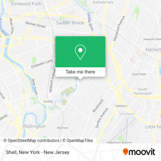
See Shell, Lodi, on the map
Public Transit to Shell in Lodi
Wondering how to get to Shell in Lodi? Moovit helps you find the best way to get to Shell with step-by-step directions from the nearest public transit station.
Moovit provides free maps and live directions to help you navigate through your city. View schedules, routes, timetables, and find out how long does it take to get to Shell in real time.
Looking for the nearest stop or station to Shell? Check out this list of stops closest to your destination: Memorial Dr at Washington St; Harrison Ave at Elizabeth St#; Us-46 at Money St; Garfield; Hackensack - Essex.
Bus: 161, 709, 780, 707, 151.Train: BERG, PASC.
Want to see if there’s another route that gets you there at an earlier time? Moovit helps you find alternative routes or times. Get directions from and directions to Shell easily from the Moovit App or Website.
We make riding to Shell easy, which is why over 1.5 million users, including users in Lodi, trust Moovit as the best app for public transit. You don’t need to download an individual bus app or train app, Moovit is your all-in-one transit app that helps you find the best bus time or train time available.
For information on prices of bus, costs and ride fares to Shell, please check the Moovit app.
Use the app to navigate to popular places including to the airport, hospital, stadium, grocery store, mall, coffee shop, school, college, and university.
Shell Address: 2 Memorial Dr Lodi, NJ 07644 street in Lodi
- Amazon Fresh-Hoboken,
- Afc Urgent Care Lodi,
- Rush Bowls,
- Amazon Fresh,
- American Family Care Lodi,
- Kids Empire Lodi,
- Shell Recharge,
- Kmart,
- Ovlan,
- Daryl Laglia State Farm Insurance,
- Woo Dental Implant Center Lodi,
- Lidl,
- Rise Lodi,
- Kessler Rehabilitation Center - Lodi,
- Posh Princess Couture Baby Accessories,
- New York Minute: Your Nightlife Information Network,
- The Water Spot,
- Pizzi Cotto,
- St. Joseph Religious Education,
- Nj1
Places Near Shell (Lodi)
- Bellevue Hospital, Manhattan,
- Queens Center Mall, Queens,
- 1 Police Plaza, Manhattan,
- SoHo, Manhattan,
- Mountainside Hospital, Glen Ridge,
- Pier 83, Manhattan,
- 3 Stone St, Manhattan,
- 26 Federal Plaza, Manhattan,
- 911 Memorial, Manhattan,
- qqqq, Manhattan,
- San Gennaro Feast, Manhattan,
- Times Square, Manhattan,
- Chinatown, Manhattan,
- Rockefeller Center, Manhattan,
- Katz's Deli, Manhattan,
- 111 Centre New York City Supreme Court, Manhattan,
- Hudson Yards, Manhattan,
- 376 Hudson Street, Manhattan,
- 66 John Street, Manhattan,
- Wall Street, Manhattan
How to get to popular places in New York - New Jersey with public transit
Get around Lodi by public transit!
Traveling around Lodi has never been so easy. See step by step directions as you travel to any attraction, street or major public transit station. View bus and train schedules, arrival times, service alerts and detailed routes on a map, so you know exactly how to get to anywhere in Lodi.
When traveling to any destination around Lodi use Moovit's Live Directions with Get Off Notifications to know exactly where and how far to walk, how long to wait for your line, and how many stops are left. Moovit will alert you when it's time to get off — no need to constantly re-check whether yours is the next stop.
Wondering how to use public transit in Lodi or how to pay for public transit in Lodi? Moovit public transit app can help you navigate your way with public transit easily, and at minimum cost. It includes public transit fees, ticket prices, and costs. Looking for a map of Lodi public transit lines? Moovit public transit app shows all public transit maps in Lodi with all Bus, Train, Subway, Light Rail, Ferry and Cable Car routes and stops on an interactive map.
New York - New Jersey has 6 transit type(s), including: Bus, Train, Subway, Light Rail, Ferry and Cable Car, operated by several transit agencies, including MTA Subway, Metro-North Railroad, LIRR, PATH, MTA New York City Transit - Express routes, MTA Bus, NJ Transit, NYC Ferry, NICE bus, Bee-Line Bus, NJ Transit Rail, Norwalk Transit District, Hartford Line, River Valley Transit and HART