How to get to Shell by bus?
Click on the bus route to see step by step directions with maps, line arrival times and updated time schedules.
From The Royal Room, Seattle
63 minFrom Blue Origin, Kent
48 minFrom Fairfield Inn by Marriott-Sea-Tac Int'l (Seattle Fairfield Inn), Seatac
46 minFrom Cedarbrook Lodge, Seatac
49 minFrom Alaska Airlines Baggage Office, Seatac
34 minFrom Burien Transit Center, Burien
40 minFrom Trader Joe's, Burien
52 minFrom Safeway, Seattle
60 minFrom Blue Origin, Kent
56 minFrom Surestay Hotel by Best Western Seatac Airport North (Clarion Hotel Seattle Airport), Seatac
33 min
Bus stops near Shell in Renton
Bus lines to Shell in Renton
What are the closest stations to Shell?
The closest stations to Shell are:
- Logan Ave N & N 6th St is 296 yards away, 4 min walk.
- Park Ave N & N 4th St is 342 yards away, 5 min walk.
- Park Ave N & N 8th St is 413 yards away, 6 min walk.
Which bus lines stop near Shell?
These bus lines stop near Shell: 560, 566, F LINE.
What’s the nearest bus station to Shell in Renton?
The nearest bus station to Shell in Renton is Logan Ave N & N 6th St. It’s a 4 min walk away.
What time is the first bus to Shell in Renton?
The 566 is the first bus that goes to Shell in Renton. It stops nearby at 4:59 AM.
What time is the last bus to Shell in Renton?
The F LINE is the last bus that goes to Shell in Renton. It stops nearby at 12:46 AM.
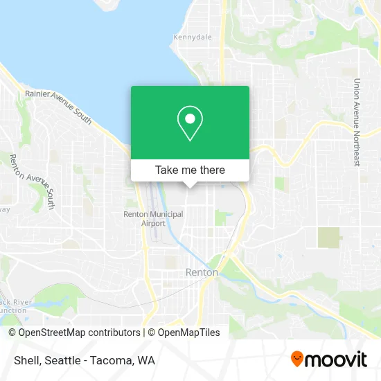
See Shell, Renton, on the map
Public Transit to Shell in Renton
Wondering how to get to Shell in Renton? Moovit helps you find the best way to get to Shell with step-by-step directions from the nearest public transit station.
Moovit provides free maps and live directions to help you navigate through your city. View schedules, routes, timetables, and find out how long does it take to get to Shell in real time.
Looking for the nearest stop or station to Shell? Check out this list of stops closest to your destination: Logan Ave N & N 6th St; Park Ave N & N 4th St; Park Ave N & N 8th St.
Bus: 560, 566, F LINE, 240.
Want to see if there’s another route that gets you there at an earlier time? Moovit helps you find alternative routes or times. Get directions from and directions to Shell easily from the Moovit App or Website.
We make riding to Shell easy, which is why over 1.7 million users, including users in Renton, trust Moovit as the best app for public transit. You don’t need to download an individual bus app or train app, Moovit is your all-in-one transit app that helps you find the best bus time or train time available.
For information on prices of bus, costs and ride fares to Shell, please check the Moovit app.
Use the app to navigate to popular places including to the airport, hospital, stadium, grocery store, mall, coffee shop, school, college, and university.
Shell Address: 780 Logan Ave N Renton, WA 98057 street in Renton
- Top Golf Renton 68,
- Boeing Renton,
- Logan Ave N & N 8th St,
- Topgolf,
- LA Fitness,
- Boeing 10-20,
- Boeing Badge Office - Renton Plant,
- Ross Dress for Less,
- Boeing 10-20 Building,
- Boeing Renton Factory,
- Boeing 10-18 Parking Garage,
- Boeing Co.,
- The Landing Parking Garage Entrance,
- The Landing,
- The Landing In Renton,
- Boeing 10-16 fitness center,
- UW Medicine Valley Medical Care Renton Landing Urgent Care,
- Target,
- The Landing Shopping Center,
- Boeing 4-81
Places Near Shell (Renton)
- Microsoft Connector Bus, Redmond,
- Harborview Medical Center, Seattle,
- Amazon.com SEA33 - Blackfoot, Seattle,
- Southcenter Mall, Tukwila,
- Space Needle, Seattle,
- Pier 91 Cruise Ship Terminal, Seattle,
- Amazon - Blackfoot (SEA33), Seattle,
- Cal Anderson Park, Seattle,
- Woodland Park Zoo, Seattle,
- Bellevue Square Mall, Bellevue,
- Space Needle, Seattle,
- Lumen Field, Seattle,
- T-Mobile Park, Seattle,
- Hyatt Regency-Seattle , Seattle,
- Seattle Art Museum, Seattle,
- Pike Place Market, Seattle,
- Seattle Aquarium, Seattle,
- Pier 66, Seattle,
- Paramount Theatre, Seattle,
- Seattle Ferry Terminal, Seattle
How to get to popular places in Seattle - Tacoma, WA with public transit
Get around Renton by public transit!
Traveling around Renton has never been so easy. See step by step directions as you travel to any attraction, street or major public transit station. View bus and train schedules, arrival times, service alerts and detailed routes on a map, so you know exactly how to get to anywhere in Renton.
When traveling to any destination around Renton use Moovit's Live Directions with Get Off Notifications to know exactly where and how far to walk, how long to wait for your line, and how many stops are left. Moovit will alert you when it's time to get off — no need to constantly re-check whether yours is the next stop.
Wondering how to use public transit in Renton or how to pay for public transit in Renton? Moovit public transit app can help you navigate your way with public transit easily, and at minimum cost. It includes public transit fees, ticket prices, and costs. Looking for a map of Renton public transit lines? Moovit public transit app shows all public transit maps in Renton with all Bus, Train, Light Rail and Ferry routes and stops on an interactive map.
Seattle - Tacoma, WA has 4 transit type(s), including: Bus, Train, Light Rail and Ferry, operated by several transit agencies, including Sound Transit, Seattle Streetcar, Metro Transit, Whatcom Transportation Authority, Mason Transit Authority, Snoqualmie Valley Transportation (SVT), Snoqualmie Valley Transportation, Amtrak, Island Transit, Kitsap Transit, Intercity Transit, Everett Transit, Community Transit, Skagit Transit and Pierce Transit