Directions to Shell (Roanoke) with public transportation
The following transit lines have routes that pass near Shell
 Bus: 15, GREYHOUND US0600, 16.
- Train: NORTHEAST REGIONAL.
How to get to Shell by bus?
Click on the bus route to see step by step directions with maps, line arrival times and updated time schedules.
How to get to Shell by train?
Click on the train route to see step by step directions with maps, line arrival times and updated time schedules.
Train station near Shell in Roanoke
- Roanoke, 19 min walk,VIEW
Bus lines to Shell in Roanoke
What are the closest stations to Shell?
The closest stations to Shell are:
- 10th Sb at Hunt is 236 yards away, 4 min walk.
- Hunt Wb at 10th is 248 yards away, 4 min walk.
- Roanoke is 1523 yards away, 19 min walk.
Which bus lines stop near Shell?
These bus lines stop near Shell: 15, GREYHOUND US0600.
Which train line stops near Shell?
NORTHEAST REGIONAL (Roanoke)
What’s the nearest train station to Shell in Roanoke?
The nearest train station to Shell in Roanoke is Roanoke. It’s a 19 min walk away.
What’s the nearest bus station to Shell in Roanoke?
The nearest bus stations to Shell in Roanoke are 10th Sb at Hunt and Hunt Wb at 10th. The closest one is a 4 min walk away.
What time is the first train to Shell in Roanoke?
The NORTHEAST REGIONAL is the first train that goes to Shell in Roanoke. It stops nearby at 9:35 AM.
What time is the last train to Shell in Roanoke?
The NORTHEAST REGIONAL is the last train that goes to Shell in Roanoke. It stops nearby at 10:13 PM.
What time is the first bus to Shell in Roanoke?
The 16 is the first bus that goes to Shell in Roanoke. It stops nearby at 5:55 AM.
What time is the last bus to Shell in Roanoke?
The 15 is the last bus that goes to Shell in Roanoke. It stops nearby at 8:23 PM.
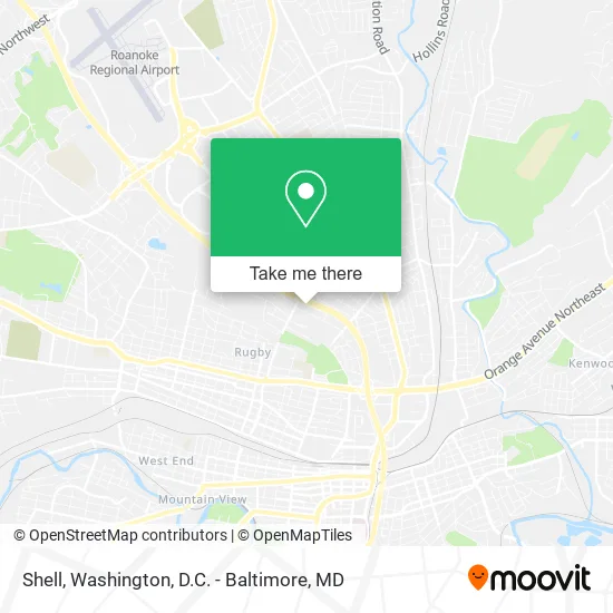
See Shell, Roanoke, on the map
Public Transit to Shell in Roanoke
Wondering how to get to Shell in Roanoke? Moovit helps you find the best way to get to Shell with step-by-step directions from the nearest public transit station.
Moovit provides free maps and live directions to help you navigate through your city. View schedules, routes, timetables, and find out how long does it take to get to Shell in real time.
Looking for the nearest stop or station to Shell? Check out this list of stops closest to your destination: 10th Sb at Hunt; Hunt Wb at 10th; Roanoke.
Bus: 15, GREYHOUND US0600, 16.Train: NORTHEAST REGIONAL.
Want to see if there’s another route that gets you there at an earlier time? Moovit helps you find alternative routes or times. Get directions from and directions to Shell easily from the Moovit App or Website.
We make riding to Shell easy, which is why over 1.5 million users, including users in Roanoke, trust Moovit as the best app for public transit. You don’t need to download an individual bus app or train app, Moovit is your all-in-one transit app that helps you find the best bus time or train time available.
For information on prices of bus and train, costs and ride fares to Shell, please check the Moovit app.
Use the app to navigate to popular places including to the airport, hospital, stadium, grocery store, mall, coffee shop, school, college, and university.
Shell Address: 1919 10th St NW Roanoke, VA 24012 street in Roanoke
- Chester's Chicken,
- General Truck Body Company,
- Meadowland,
- Consistency Cleaners,
- H P Mason Jr Woodcrafters,
- Martinez Lawn Care & Painting,
- Hunt Ave NW Building 809,
- Pham Hanh,
- Roanoke Redevelopment and Housing Authority Public Housing Programs,
- Roanoke Notary & Paralegal Services,
- Shadeland,
- Survival Hour,
- Turdbusters,
- Lick Run Community Development,
- Noel Custom Cleaning Services,
- Afton Gardens Apartments,
- Steve Cabaniss Painting,
- Sparkle Polish and Shine Cleaning Services,
- Central Wholesale Supply,
- Springwood Cemetery
Places Near Shell (Roanoke)
- Pennsylvania Ave NW (3rd st and pennsylvania), Washington,
- Amazon Hq2, Arlington County,
- PG Mall, Prince George's County,
- Rock Creek Tennis Center, Washington,
- Warner Theatre, Washington,
- Sibley Memorial Hospital, Washington,
- Washington DC VA Medical Center, Washington,
- Washington National Cathedral, Washington,
- National Museum of African American History and Culture, Washington,
- Camden Yards, Baltimore,
- Marriott Marquis Washington, DC, Washington,
- Westfield Montgomery Mall, Montgomery County,
- Capital One Arena, Washington,
- M&T Bank Stadium, Baltimore,
- Basilica of the National Shrine, Washington,
- Georgetown, Washington,
- National Zoo, Washington,
- Museum Of The Bible, Washington,
- The Anthem, Washington,
- National Theatre, Washington
How to get to popular places in Washington, D.C. - Baltimore, MD with public transit
Get around Roanoke by public transit!
Traveling around Roanoke has never been so easy. See step by step directions as you travel to any attraction, street or major public transit station. View bus and train schedules, arrival times, service alerts and detailed routes on a map, so you know exactly how to get to anywhere in Roanoke.
When traveling to any destination around Roanoke use Moovit's Live Directions with Get Off Notifications to know exactly where and how far to walk, how long to wait for your line, and how many stops are left. Moovit will alert you when it's time to get off — no need to constantly re-check whether yours is the next stop.
Wondering how to use public transit in Roanoke or how to pay for public transit in Roanoke? Moovit public transit app can help you navigate your way with public transit easily, and at minimum cost. It includes public transit fees, ticket prices, and costs. Looking for a map of Roanoke public transit lines? Moovit public transit app shows all public transit maps in Roanoke with all Bus, Train, Metro, Light Rail and Ferry routes and stops on an interactive map.
Washington, D.C. - Baltimore, MD has 5 transit type(s), including: Bus, Train, Metro, Light Rail and Ferry, operated by several transit agencies, including WMATA, Montgomery County Ride On, Fairfax Connector, TheBus, PRTC, DASH - Alexandria, Arlington Transit (ART), RTA of Central Maryland, MDOT MTA, MDOT MTA Light RailLink, MDOT MTA Commuter Bus, MDOT MTA Local Bus, FXBGO!, Virginia Railway Express (VRE) and MARC