How to get to Shell by bus?
Click on the bus route to see step by step directions with maps, line arrival times and updated time schedules.
From Clarksburg Premium Outlets, Montgomery County
75 minFrom Olney MD USA, Montgomery County
59 minFrom Adventist HealthCare Shady Grove Medical Center, Montgomery County
60 minFrom Intercounty Connector (ICC)/MD 200, Montgomery County
85 minFrom Kentlands, Montgomery County
42 minFrom Germantown, Maryland, Montgomery County
65 minFrom Georgia Ave & Icc Park & Ride Lot, Montgomery County
90 minFrom Montgomery College-Rockville, Montgomery County
53 minFrom Rockville, MD, Montgomery County
60 minFrom Clarksburg Premium Outlets, Montgomery County
64 min
Bus stops near Shell in Montgomery County
What are the closest stations to Shell?
The closest stations to Shell are:
- Rothbury Dr & Goshen Rd is 258 yards away, 4 min walk.
- Montgomery Village Ave & Wightman Rd is 603 yards away, 8 min walk.
Which bus lines stop near Shell?
These bus lines stop near Shell: 58, 64.
What’s the nearest bus station to Shell in Montgomery County?
The nearest bus station to Shell in Montgomery County is Rothbury Dr & Goshen Rd. It’s a 4 min walk away.
What time is the first bus to Shell in Montgomery County?
The 64 is the first bus that goes to Shell in Montgomery County. It stops nearby at 4:57 AM.
What time is the last bus to Shell in Montgomery County?
The 64 is the last bus that goes to Shell in Montgomery County. It stops nearby at 11:17 PM.
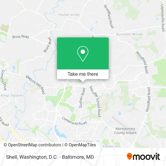
See Shell, Montgomery County, on the map
Public Transit to Shell in Montgomery County
Wondering how to get to Shell in Montgomery County? Moovit helps you find the best way to get to Shell with step-by-step directions from the nearest public transit station.
Moovit provides free maps and live directions to help you navigate through your city. View schedules, routes, timetables, and find out how long does it take to get to Shell in real time.
Looking for the nearest stop or station to Shell? Check out this list of stops closest to your destination: Rothbury Dr & Goshen Rd; Montgomery Village Ave & Wightman Rd.
Bus: 58, 64.
Want to see if there’s another route that gets you there at an earlier time? Moovit helps you find alternative routes or times. Get directions from and directions to Shell easily from the Moovit App or Website.
We make riding to Shell easy, which is why over 1.5 million users, including users in Montgomery County, trust Moovit as the best app for public transit. You don’t need to download an individual bus app or train app, Moovit is your all-in-one transit app that helps you find the best bus time or train time available.
For information on prices of bus and metro, costs and ride fares to Shell, please check the Moovit app.
Use the app to navigate to popular places including to the airport, hospital, stadium, grocery store, mall, coffee shop, school, college, and university.
Shell Address: 20044 Goshen Rd Montgomery Village, MD 20879 street in Montgomery County
- Keyme Locksmiths,
- Coinstar - Bitcoin ATM,
- Redbox,
- Montgomery County Liquor & Wine - Goshen Crossing,
- VN Nails (V & N Nails),
- Shell Recharge,
- A Direct Dish Satellite TV,
- Pack & Ship Guarantee,
- Shred Nations,
- MXL Taxi,
- Truist Bank,
- Montgomery Decks,
- Korean Martial Arts,
- Smoke World,
- Lucia Romero,
- Goshen Plaza,
- Amazon Locker-Walk,
- USA Furniture Office Technology and Solutions,
- Johan Real Estate Project MGT,
- Zanshin Fitness Club
Places Near Shell (Montgomery County)
- Georgetown, Washington,
- Sibley Memorial Hospital, Washington,
- The Anthem, Washington,
- Westfield Montgomery Mall, Montgomery County,
- PG Mall, Prince George's County,
- Amazon Hq2, Arlington County,
- National Museum of African American History and Culture, Washington,
- Marriott Marquis Washington, DC, Washington,
- Warner Theatre, Washington,
- Capital One Arena, Washington,
- National Zoo, Washington,
- Washington National Cathedral, Washington,
- Basilica of the National Shrine, Washington,
- Washington DC VA Medical Center, Washington,
- M&T Bank Stadium, Baltimore,
- Pennsylvania Ave NW (3rd st and pennsylvania), Washington,
- National Mall, Washington,
- Rock Creek Tennis Center, Washington,
- Camden Yards, Baltimore,
- Museum Of The Bible, Washington
How to get to popular places in Washington, D.C. - Baltimore, MD with public transit
Get around Montgomery County by public transit!
Traveling around Montgomery County has never been so easy. See step by step directions as you travel to any attraction, street or major public transit station. View bus and train schedules, arrival times, service alerts and detailed routes on a map, so you know exactly how to get to anywhere in Montgomery County.
When traveling to any destination around Montgomery County use Moovit's Live Directions with Get Off Notifications to know exactly where and how far to walk, how long to wait for your line, and how many stops are left. Moovit will alert you when it's time to get off — no need to constantly re-check whether yours is the next stop.
Wondering how to use public transit in Montgomery County or how to pay for public transit in Montgomery County? Moovit public transit app can help you navigate your way with public transit easily, and at minimum cost. It includes public transit fees, ticket prices, and costs. Looking for a map of Montgomery County public transit lines? Moovit public transit app shows all public transit maps in Montgomery County with all Bus, Train, Metro, Light Rail and Ferry routes and stops on an interactive map.
Washington, D.C. - Baltimore, MD has 5 transit type(s), including: Bus, Train, Metro, Light Rail and Ferry, operated by several transit agencies, including WMATA, Montgomery County Ride On, Fairfax Connector, TheBus, PRTC, DASH - Alexandria, Arlington Transit (ART), RTA of Central Maryland, MDOT MTA, MDOT MTA Light RailLink, MDOT MTA Commuter Bus, MDOT MTA Local Bus, FXBGO!, Virginia Railway Express (VRE) and MARC