How to get to Shell by bus?
Click on the bus route to see step by step directions with maps, line arrival times and updated time schedules.
From Largo, Maryland, Prince George's County
176 minFrom Motor Vehicle Administration (Mva) Largo, Prince George's County
326 minFrom Joint Base Andrews, Prince George's County
206 minFrom Prince George's Community College, Prince George's County
315 minFrom Kaiser Permanente - Largo Medical Center, Prince George's County
319 minFrom Upper Marlboro Courthouse, Prince George's County
263 minFrom Bowie Town Center, Prince George's County
192 minFrom Marlboro Pike, Prince George's County
198 minFrom PGCC, Prince George's County
315 min
Bus stops near Shell in Anne Arundel County
What are the closest stations to Shell?
The closest stations to Shell are:
- Bristol P&R Md 4 & Md258 AM is 1556 yards away, 19 min walk.
- Bristol P&R Md 4 & Md258 PM is 1596 yards away, 19 min walk.
Which bus lines stop near Shell?
These bus lines stop near Shell: 820, 850.
What time is the first bus to Shell in Anne Arundel County?
The 810 is the first bus that goes to Shell in Anne Arundel County. It stops nearby at 5:10 AM.
What time is the last bus to Shell in Anne Arundel County?
The 820 is the last bus that goes to Shell in Anne Arundel County. It stops nearby at 7:05 PM.
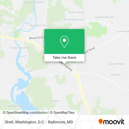
See Shell, Anne Arundel County, on the map
Public Transit to Shell in Anne Arundel County
Wondering how to get to Shell in Anne Arundel County? Moovit helps you find the best way to get to Shell with step-by-step directions from the nearest public transit station.
Moovit provides free maps and live directions to help you navigate through your city. View schedules, routes, timetables, and find out how long does it take to get to Shell in real time.
Looking for the nearest stop or station to Shell? Check out this list of stops closest to your destination: Bristol P&R Md 4 & Md258 AM; Bristol P&R Md 4 & Md258 PM.
Bus: 820, 850, 810.
Want to see if there’s another route that gets you there at an earlier time? Moovit helps you find alternative routes or times. Get directions from and directions to Shell easily from the Moovit App or Website.
We make riding to Shell easy, which is why over 1.7 million users, including users in Anne Arundel County, trust Moovit as the best app for public transit. You don’t need to download an individual bus app or train app, Moovit is your all-in-one transit app that helps you find the best bus time or train time available.
For information on prices of bus and metro, costs and ride fares to Shell, please check the Moovit app.
Use the app to navigate to popular places including to the airport, hospital, stadium, grocery store, mall, coffee shop, school, college, and university.
Shell Address: Route 2 & 408 street in Anne Arundel County
- Wayson's Corner MD 4 Near MD 408,
- Wayson's Corner Park And Ride,
- Waysons Corner,
- Waysons corner bingo,
- Shell,
- Anne Arundel County / Prince George's County Border,
- Sunday Market,
- Butterfly Fields Bed and Breakfast,
- Weis,
- Dollar General,
- MD-258,
- Brooks Woods Rd,
- Brooks Woods Rd MD-258,
- 5999 Brooks Woods Rd,
- 5706 Willow Run,
- 184 Portland Manor Farm Dr,
- 139 Mt Zion Marlboro Rd,
- Stone Rd and Roots and Tides Bywy,
- Stocketts Excavating & Hauling,
- Jas Trucking
Places Near Shell (Anne Arundel County)
- Marriott Marquis Washington, DC, Washington,
- Washington National Cathedral, Washington,
- Capital One Arena, Washington,
- Pennsylvania Ave NW (3rd st and pennsylvania), Washington,
- Westfield Montgomery Mall, Montgomery County,
- M&T Bank Stadium, Baltimore,
- The Anthem, Washington,
- Museum Of The Bible, Washington,
- National Museum of African American History and Culture, Washington,
- Georgetown, Washington,
- Amazon Hq2, Arlington County,
- Rock Creek Tennis Center, Washington,
- National Theatre, Washington,
- Basilica of the National Shrine, Washington,
- Camden Yards, Baltimore,
- Sibley Memorial Hospital, Washington,
- National Zoo, Washington,
- Washington DC VA Medical Center, Washington,
- Warner Theatre, Washington,
- PG Mall, Prince George's County
How to get to popular places in Washington, D.C. - Baltimore, MD with public transit
Get around Anne Arundel County by public transit!
Traveling around Anne Arundel County has never been so easy. See step by step directions as you travel to any attraction, street or major public transit station. View bus and train schedules, arrival times, service alerts and detailed routes on a map, so you know exactly how to get to anywhere in Anne Arundel County.
When traveling to any destination around Anne Arundel County use Moovit's Live Directions with Get Off Notifications to know exactly where and how far to walk, how long to wait for your line, and how many stops are left. Moovit will alert you when it's time to get off — no need to constantly re-check whether yours is the next stop.
Wondering how to use public transit in Anne Arundel County or how to pay for public transit in Anne Arundel County? Moovit public transit app can help you navigate your way with public transit easily, and at minimum cost. It includes public transit fees, ticket prices, and costs. Looking for a map of Anne Arundel County public transit lines? Moovit public transit app shows all public transit maps in Anne Arundel County with all Bus, Train, Metro, Light Rail and Ferry routes and stops on an interactive map.
Washington, D.C. - Baltimore, MD has 5 transit type(s), including: Bus, Train, Metro, Light Rail and Ferry, operated by several transit agencies, including WMATA, Montgomery County Ride On, Fairfax Connector, TheBus, PRTC, DASH - Alexandria, Arlington Transit (ART), RTA of Central Maryland, MDOT MTA, MDOT MTA Light RailLink, MDOT MTA Commuter Bus, MDOT MTA Local Bus, FXBGO!, Virginia Railway Express (VRE) and MARC