How to get to Shell Oil Company by bus?
Click on the bus route to see step by step directions with maps, line arrival times and updated time schedules.
From Linden, NJ, Linden
77 minFrom Staten Island Mall, Staten Island
149 minFrom Baps Shri Swaminarayan Mandir, Edison, NJ, USA, Edison
126 minFrom South Ave, Staten Island
151 minFrom DMV, Staten Island
180 minFrom Elizabeth, NJ, Elizabeth
82 minFrom Staten Island, NY, Staten Island
176 minFrom Highland Park, NJ, Highland Park
111 minFrom Edison NJ, Edison
131 minFrom Walmart, Linden
77 min
How to get to Shell Oil Company by train?
Click on the train route to see step by step directions with maps, line arrival times and updated time schedules.
Train station near Shell Oil Company in Woodbridge
- Perth Amboy, 17 min walk,VIEW
What are the closest stations to Shell Oil Company?
The closest stations to Shell Oil Company are:
- Perth Amboy is 1395 yards away, 17 min walk.
Which bus lines stop near Shell Oil Company?
These bus lines stop near Shell Oil Company: 116, 48, 803.
Which train line stops near Shell Oil Company?
NJCL (Bay Head)
What’s the nearest train station to Shell Oil Company in Woodbridge?
The nearest train station to Shell Oil Company in Woodbridge is Perth Amboy. It’s a 17 min walk away.
What time is the first train to Shell Oil Company in Woodbridge?
The NJCL is the first train that goes to Shell Oil Company in Woodbridge. It stops nearby at 4:37 AM.
What time is the last train to Shell Oil Company in Woodbridge?
The NJCL is the last train that goes to Shell Oil Company in Woodbridge. It stops nearby at 1:52 AM.
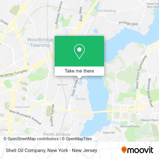
See Shell Oil Company, Woodbridge, on the map
Public Transit to Shell Oil Company in Woodbridge
Wondering how to get to Shell Oil Company in Woodbridge? Moovit helps you find the best way to get to Shell Oil Company with step-by-step directions from the nearest public transit station.
Moovit provides free maps and live directions to help you navigate through your city. View schedules, routes, timetables, and find out how long does it take to get to Shell Oil Company in real time.
Looking for the nearest stop or station to Shell Oil Company? Check out this list of stops closest to your destination: Perth Amboy.
Bus: 116, 48, 803.Train: NJCL.
Want to see if there’s another route that gets you there at an earlier time? Moovit helps you find alternative routes or times. Get directions from and directions to Shell Oil Company easily from the Moovit App or Website.
We make riding to Shell Oil Company easy, which is why over 1.5 million users, including users in Woodbridge, trust Moovit as the best app for public transit. You don’t need to download an individual bus app or train app, Moovit is your all-in-one transit app that helps you find the best bus time or train time available.
For information on prices of bus, train and subway, costs and ride fares to Shell Oil Company, please check the Moovit app.
Use the app to navigate to popular places including to the airport, hospital, stadium, grocery store, mall, coffee shop, school, college, and university.
Shell Oil Company Address: 111 State St street in Woodbridge
- Motiva,
- North American Aggregates,
- Process Instrumentation & Computer Services,
- Buckeye Partners,
- Buckeye Terminal Perth Amboy NJ,
- Libertyx Bitcoin Atm,
- Moby Dick's Restaurant Lounge,
- Sewaren Waterfront,
- K T Marine Inc,
- River Walk,
- Mjbuysjunkcars,
- Generated Ltd,
- Excalibur Group, Llc,
- Matrix,
- Outernest,
- Tinacus - Tina Custom Handmade Shoes,
- Bunzl,
- Randive, Inc.,
- Brandt Crane Company - NJ,
- The Best After School and Summer Camp Program
Places Near Shell Oil Company (Woodbridge)
- 26 Federal Plaza, Manhattan,
- Hudson Yards, Manhattan,
- Wall Street, Manhattan,
- 3 Stone St, Manhattan,
- 911 Memorial, Manhattan,
- Pier 83, Manhattan,
- Rockefeller Center, Manhattan,
- San Gennaro Feast, Manhattan,
- qqqq, Manhattan,
- 376 Hudson Street, Manhattan,
- Mountainside Hospital, Glen Ridge,
- 111 Centre New York City Supreme Court, Manhattan,
- Times Square, Manhattan,
- Katz's Deli, Manhattan,
- SoHo, Manhattan,
- Bellevue Hospital, Manhattan,
- 66 John Street, Manhattan,
- Chinatown, Manhattan,
- Queens Center Mall, Queens,
- 1 Police Plaza, Manhattan
How to get to popular places in New York - New Jersey with public transit
Get around Woodbridge by public transit!
Traveling around Woodbridge has never been so easy. See step by step directions as you travel to any attraction, street or major public transit station. View bus and train schedules, arrival times, service alerts and detailed routes on a map, so you know exactly how to get to anywhere in Woodbridge.
When traveling to any destination around Woodbridge use Moovit's Live Directions with Get Off Notifications to know exactly where and how far to walk, how long to wait for your line, and how many stops are left. Moovit will alert you when it's time to get off — no need to constantly re-check whether yours is the next stop.
Wondering how to use public transit in Woodbridge or how to pay for public transit in Woodbridge? Moovit public transit app can help you navigate your way with public transit easily, and at minimum cost. It includes public transit fees, ticket prices, and costs. Looking for a map of Woodbridge public transit lines? Moovit public transit app shows all public transit maps in Woodbridge with all Bus, Train, Subway, Light Rail, Ferry and Cable Car routes and stops on an interactive map.
New York - New Jersey has 6 transit type(s), including: Bus, Train, Subway, Light Rail, Ferry and Cable Car, operated by several transit agencies, including MTA Subway, Metro-North Railroad, LIRR, PATH, MTA New York City Transit - Express routes, MTA Bus, NJ Transit, NYC Ferry, NICE bus, Bee-Line Bus, NJ Transit Rail, Norwalk Transit District, Hartford Line, River Valley Transit and HART