Bus stop near Shelton Solutions in Isle Of Wight County
- Windsor Food Lion, 40 min walk,VIEW
Bus lines to Shelton Solutions in Isle Of Wight County
- SWC, Outbound,VIEW
- Ennis Pond,
- Shirley T. Holland Intermodal Park,
- Tyler Cemetery,
- Cost Plus World Market,
- Georgie Tyler Middle School,
- Safco Products Co.,
- Keurig Dr. Pepper,
- The Pruden Center For Industry And Technology,
- Idlewood,
- Kenyon,
- Lot 3 Spec Building,
- Nexcom Distribution Center,
- Lot 12 Spec Building,
- West Suffolk Baptist Church,
- Paul D. Camp Community College - Hobbs Suffolk Campus,
- Lakeland High School,
- Lutersville,
- Luter Pond,
- Oak Ridge Estates,
- Pilot
Places Near Shelton Solutions (Isle Of Wight County)
- Georgetown, Washington,
- M&T Bank Stadium, Baltimore,
- Capital One Arena, Washington,
- Pennsylvania Ave NW (3rd st and pennsylvania), Washington,
- Marriott Marquis Washington, DC, Washington,
- Museum Of The Bible, Washington,
- Amazon Hq2, Arlington County,
- PG Mall, Prince George's County,
- Westfield Montgomery Mall, Montgomery County,
- The Anthem, Washington,
- National Zoo, Washington,
- National Museum of African American History and Culture, Washington,
- Camden Yards, Baltimore,
- Basilica of the National Shrine, Washington,
- Washington National Cathedral, Washington,
- Warner Theatre, Washington,
- National Theatre, Washington,
- Washington DC VA Medical Center, Washington,
- Sibley Memorial Hospital, Washington,
- Rock Creek Tennis Center, Washington
How to get to popular places in Washington, D.C. - Baltimore, MD with public transit
What are the closest stations to Shelton Solutions?
The closest stations to Shelton Solutions are:
- Windsor Food Lion is 3397 yards away, 40 min walk.
What time is the first bus to Shelton Solutions in Isle Of Wight County?
The SWC is the first bus that goes to Shelton Solutions in Isle Of Wight County. It stops nearby at 5:57 AM.
What time is the last bus to Shelton Solutions in Isle Of Wight County?
The SWC is the last bus that goes to Shelton Solutions in Isle Of Wight County. It stops nearby at 5:57 PM.
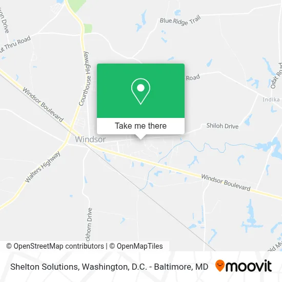
See Shelton Solutions, Isle Of Wight County, on the map
Public Transit to Shelton Solutions in Isle Of Wight County
Wondering how to get to Shelton Solutions in Isle Of Wight County? Moovit helps you find the best way to get to Shelton Solutions with step-by-step directions from the nearest public transit station.
Moovit provides free maps and live directions to help you navigate through your city. View schedules, routes, timetables, and find out how long does it take to get to Shelton Solutions in real time.
Looking for the nearest stop or station to Shelton Solutions? Check out this list of stops closest to your destination: Windsor Food Lion.
Want to see if there’s another route that gets you there at an earlier time? Moovit helps you find alternative routes or times. Get directions from and directions to Shelton Solutions easily from the Moovit App or Website.
We make riding to Shelton Solutions easy, which is why over 1.7 million users, including users in Isle Of Wight County, trust Moovit as the best app for public transit. You don’t need to download an individual bus app or train app, Moovit is your all-in-one transit app that helps you find the best bus time or train time available.
Use the app to navigate to popular places including to the airport, hospital, stadium, grocery store, mall, coffee shop, school, college, and university.
Shelton Solutions Address: 11368 Shiloh Drive, Windsor, VA 23487 street in Isle Of Wight County
Get around Isle Of Wight County by public transit!
Traveling around Isle Of Wight County has never been so easy. See step by step directions as you travel to any attraction, street or major public transit station. View bus and train schedules, arrival times, service alerts and detailed routes on a map, so you know exactly how to get to anywhere in Isle Of Wight County.
When traveling to any destination around Isle Of Wight County use Moovit's Live Directions with Get Off Notifications to know exactly where and how far to walk, how long to wait for your line, and how many stops are left. Moovit will alert you when it's time to get off — no need to constantly re-check whether yours is the next stop.
Wondering how to use public transit in Isle Of Wight County or how to pay for public transit in Isle Of Wight County? Moovit public transit app can help you navigate your way with public transit easily, and at minimum cost. It includes public transit fees, ticket prices, and costs. Looking for a map of Isle Of Wight County public transit lines? Moovit public transit app shows all public transit maps in Isle Of Wight County with all Bus, Train, Metro, Light Rail and Ferry routes and stops on an interactive map.
Washington, D.C. - Baltimore, MD has 5 transit type(s), including: Bus, Train, Metro, Light Rail and Ferry, operated by several transit agencies, including WMATA, Montgomery County Ride On, Fairfax Connector, TheBus, PRTC, DASH - Alexandria, Arlington Transit (ART), RTA of Central Maryland, MDOT MTA, MDOT MTA Light RailLink, MDOT MTA Commuter Bus, MDOT MTA Local Bus, FXBGO!, Virginia Railway Express (VRE) and MARC