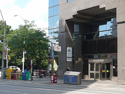
Directions to Sherbourne (Toronto) with public transportation
The following transit lines have routes that pass near Sherbourne
 Bus: 26, 62, 75, 94, 97C.
- Train: LE, LW, UP.
- Subway: 1, 2.
- Streetcar: 506.
How to get to Sherbourne by bus?
Click on the bus route to see step by step directions with maps, line arrival times and updated time schedules.
How to get to Sherbourne by train?
Click on the train route to see step by step directions with maps, line arrival times and updated time schedules.
How to get to Sherbourne by subway?
Click on the subway route to see step by step directions with maps, line arrival times and updated time schedules.
Streetcar stations near Sherbourne in Toronto
- Carlton St at Jarvis St, 1 min walk,
Bus stops near Sherbourne in Toronto
- Carlton St at Jarvis St East Side, 1 min walk,
- Sherbourne St at Carlton St, 4 min walk,
- Parliament St at Winchester St, 6 min walk,
- Wellesley St East at Jarvis St, 6 min walk,
Bus lines to Sherbourne in Toronto
- 94, East - 94 Wellesley Towards Castle Frank Station,
- 75, South - 75 Sherbourne Towards Queens Quay Via South Drive,
- 65, South - 65 Parliament Towards Queens Quay And Sherbourne,
- 365, South - 365 Parliament Towards Queens Quay And Sherbourne,
- 94A, West - 94a Wellesley Towards Ossington Station,
- 94B, West - 94b Wellesley Towards Wellesley Station,
What are the closest stations to Sherbourne?
The closest stations to Sherbourne are:
- Carlton St at Jarvis St station is 0 meters away, 1 min walk.
- Carlton St at Jarvis St East Side stop is 49 meters away, 1 min walk.
- Sherbourne St at Carlton St stop is 298 meters away, 4 min walk.
- Parliament St at Winchester St stop is 367 meters away, 6 min walk.
- Wellesley St East at Jarvis St stop is 439 meters away, 6 min walk.
Which bus lines stop near Sherbourne?
These bus lines stop near Sherbourne: 26, 62, 75, 94, 97C.
Which train lines stop near Sherbourne?
These train lines stop near Sherbourne: LE, LW, UP.
Which subway lines stop near Sherbourne?
These subway lines stop near Sherbourne: 1, 2.
Which Streetcar line stops near Sherbourne?
506 (East - 506 Carlton Towards Main Street Station)
What’s the nearest Streetcar station to Sherbourne in Toronto?
The nearest Streetcar station to Sherbourne in Toronto is Carlton St at Jarvis St. It’s a 1 min walk away.
What’s the nearest bus station to Sherbourne in Toronto?
The nearest bus station to Sherbourne in Toronto is Carlton St at Jarvis St East Side. It’s a 1 min walk away.
What time is the first Streetcar to Sherbourne in Toronto?
The 306 is the first Streetcar that goes to Sherbourne in Toronto. It stops nearby at 3:02 AM.
What time is the last Streetcar to Sherbourne in Toronto?
The 306 is the last Streetcar that goes to Sherbourne in Toronto. It stops nearby at 3:27 AM.
What time is the first bus to Sherbourne in Toronto?
The 365 is the first bus that goes to Sherbourne in Toronto. It stops nearby at 3:04 AM.
What time is the last bus to Sherbourne in Toronto?
The 365 is the last bus that goes to Sherbourne in Toronto. It stops nearby at 2:55 AM.
See Sherbourne, Toronto, on the map
Public Transit to Sherbourne in Toronto
Wondering how to get to Sherbourne in Toronto? Moovit helps you find the best way to get to Sherbourne with step-by-step directions from the nearest public transit station.
Moovit provides free maps and live directions to help you navigate through your city. View schedules, routes, timetables, and find out how long does it take to get to Sherbourne in real time.
Looking for the nearest stop or station to Sherbourne? Check out this list of stops closest to your destination: Carlton St at Jarvis St; Carlton St at Jarvis St East Side; Sherbourne St at Carlton St; Parliament St at Winchester St; Wellesley St East at Jarvis St.
Bus: 26, 62, 75, 94, 97C, 65, 365, 94A, 94B.Train: LE, LW, UP.Subway: 1, 2.Streetcar: 506.
Want to see if there’s another route that gets you there at an earlier time? Moovit helps you find alternative routes or times. Get directions from and directions to Sherbourne easily from the Moovit App or Website.
We make riding to Sherbourne easy, which is why over 1.7 billion users, including users in Toronto, trust Moovit as the best app for public transit. You don’t need to download an individual bus app or train app, Moovit is your all-in-one transit app that helps you find the best bus time or train time available.
For information on prices of bus, subway, Streetcar and train, costs and ride fares to Sherbourne, please check the Moovit app.
Use the app to navigate to popular places including to the airport, hospital, stadium, grocery store, mall, coffee shop, school, college, and university.
Sherbourne Address: Bleecker Street street in Toronto
- 85 bleeker street,
- Phoenix Concert Theatre,
- 410 Health Centre (St. Michael's Hospital),
- 410 Sherbourne Street,
- 55 Bleecker St.,
- Sherbourne & Carlton,
- 40 Homewood Avenue,
- Fudger House,
- gerrard and sherbourne,
- Rekai Centre,
- Ontario Street,
- 550 Ontario St,
- Sherbourne & Wellesley,
- 216 Carlton St,
- 225 Wellesley St E Toronto, ON, Canada,
- 77 Maitland Pl,
- 200 Wellesley St. E.,
- 120 Homewood Avenue,
- Jarvis Collegiate Institute,
- National Ballet School
Places Near Sherbourne (Toronto)
- Great Canadian Casino Resort, Toronto,
- Toronto Eaton Centre, Toronto,
- Rogers Centre, Toronto,
- St Lawrence Market, Toronto,
- Exhibition Place, Toronto,
- St. Joseph's Health Centre, Toronto,
- 777 Bay Street, Toronto,
- Toronto General Hospital, Toronto,
- Brandy Melville, Toronto,
- Medieval Times, Toronto,
- St. Michael's Hospital, Toronto,
- Toronto Western Hospital, Toronto,
- Ripley's Aquarium Of Canada, Toronto,
- Sunnybrook Hospital, Toronto,
- BMO Field, Toronto,
- Scarborough Town Centre, Toronto,
- Enercare Centre, Toronto,
- St Michael s Hospital, Toronto,
- Vaughan Mills Shopping Centre, Vaughan,
- Toronto Courthouse, Toronto
How to get to popular places in Toronto with public transit
Get around Toronto by public transit!
Traveling around Toronto has never been so easy. See step by step directions as you travel to any attraction, street or major public transit station. View bus and train schedules, arrival times, service alerts and detailed routes on a map, so you know exactly how to get to anywhere in Toronto.
When traveling to any destination around Toronto use Moovit's Live Directions with Get Off Notifications to know exactly where and how far to walk, how long to wait for your line, and how many stops are left. Moovit will alert you when it's time to get off — no need to constantly re-check whether yours is the next stop.
Wondering how to use public transit in Toronto or how to pay for public transit in Toronto? Moovit public transit app can help you navigate your way with public transit easily, and at minimum cost. It includes public transit fees, ticket prices, and costs. Looking for a map of Toronto public transit lines? Moovit public transit app shows all public transit maps in Toronto with all Bus, Train, Subway, Streetcar and Ferry routes and stops on an interactive map.
Toronto has 5 transit type(s), including: Bus, Train, Subway, Streetcar and Ferry, operated by several transit agencies, including TTC, Toronto Subway, Brampton Transit, MiWay, York Region Transit, GO Transit Bus, GO Transit, Durham Region Transit, UP Express, Grand River Transit, Guelph Transit, Hamilton Street Railway, Burlington Transit, Oakville Transit and pererborough