Sherbourne station - Sunday schedule
| Line | Direction | Time |
|---|---|---|
| KI | Eastbound | 8:04 AM |
| KI | Eastbound | 8:09 AM |
| KI | Eastbound | 8:14 AM |
| KI | Eastbound | 8:19 AM |
| KI | Eastbound | 8:24 AM |
| KI | Westbound | 8:28 AM |
| KI | Eastbound | 8:29 AM |
| KI | Eastbound | 8:34 AM |
| KI | Westbound | 8:37 AM |
| KI | Eastbound | 8:38 AM |
| KI | Westbound | 8:42 AM |
| KI | Eastbound | 8:43 AM |
| KI | Westbound | 8:47 AM |
| KI | Eastbound | 8:48 AM |
| KI | Westbound | 8:52 AM |
| KI | Eastbound | 8:53 AM |
| KI | Westbound | 8:57 AM |
| KI | Eastbound | 8:58 AM |
| KI | Westbound | 9:02 AM |
| KI | Eastbound | 9:03 AM |
| KI | Westbound | 9:07 AM |
| KI | Eastbound | 9:08 AM |
| KI | Westbound | 9:11 AM |
| KI | Eastbound | 9:13 AM |
| KI | Westbound | 9:16 AM |
Directions to Sherbourne station (Toronto) with public transit
The following transit lines have routes that pass near Sherbourne
 Bus: 26, 94, 97C, 75, 300A.
- Train: LW.
- Subway: 2, 1.
How to get to Sherbourne station by bus?
Click on the bus route to see step by step directions with maps, line arrival times and updated time schedules.
How to get to Sherbourne station by train?
Click on the train route to see step by step directions with maps, line arrival times and updated time schedules.
How to get to Sherbourne station by subway?
Click on the subway route to see step by step directions with maps, line arrival times and updated time schedules.
Bus stops near Sherbourne stop in Toronto
- Sherbourne St at Bloor St East South Side - Sherbourne Stati, 2 min walk,
- Bloor St East at Sherbourne St, 2 min walk,
- Parliament St at Bloor St East, 9 min walk,
Streetcar stations near Sherbourne station in Toronto
- Carlton St at Sherbourne St, 3 min walk,
Subway stations near Sherbourne station in Toronto
- Wellesley, 4 min walk,
- Castle Frank, 11 min walk,
Bus lines to Sherbourne station in Toronto
- 75, South - 75 Sherbourne Towards Queens Quay Via South Drive,
- 300A, West - 300a Bloor-Danforth Towards Pearson Airport Via Kipling Stn,
- 300B, East - 300b Bloor-Danforth Towards Kennedy Station,
- 300S, West - 300s Bloor-Danforth Short Turn Towards Keele Stn,
- 65, North - 65 Parliament Towards Castle Frank Station,
- 365, North - 365 Parliament Towards Castle Frank Station,
What are the closest stations to Sherbourne?
The closest stations to Sherbourne are:
- Sherbourne St at Bloor St East South Side - Sherbourne Stati stop is 72 meters away, 2 min walk.
- Bloor St East at Sherbourne St stop is 91 meters away, 2 min walk.
- Carlton St at Sherbourne St station is 217 meters away, 3 min walk.
- Wellesley station is 263 meters away, 4 min walk.
- Parliament St at Bloor St East stop is 693 meters away, 9 min walk.
- Castle Frank station is 784 meters away, 11 min walk.
Which bus lines stop near Sherbourne?
These bus lines stop near Sherbourne: 26, 94, 97C.
Which train line stops near Sherbourne?
LW (Southbound)
Which subway line stops near Sherbourne?
2 (Towards Kennedy)
What’s the nearest Streetcar station to Sherbourne in Toronto?
The nearest Streetcar station to Sherbourne in Toronto is Carlton St at Sherbourne St. It’s a 3 min walk away.
What’s the nearest subway station to Sherbourne in Toronto?
The nearest subway station to Sherbourne in Toronto is Wellesley. It’s a 4 min walk away.
What’s the nearest bus station to Sherbourne in Toronto?
The nearest bus stations to Sherbourne in Toronto are Sherbourne St at Bloor St East South Side - Sherbourne Stati and Bloor St East at Sherbourne St. The closest one is a 2 min walk away.
What time is the first Streetcar to Sherbourne in Toronto?
The 306 is the first Streetcar that goes to Sherbourne in Toronto. It stops nearby at 3:03 AM.
What time is the last Streetcar to Sherbourne in Toronto?
The 306 is the last Streetcar that goes to Sherbourne in Toronto. It stops nearby at 3:26 AM.
What time is the first subway to Sherbourne in Toronto?
The 1 is the first subway that goes to Sherbourne in Toronto. It stops nearby at 5:53 AM.
What time is the last subway to Sherbourne in Toronto?
The 2 is the last subway that goes to Sherbourne in Toronto. It stops nearby at 1:57 AM.
What time is the first bus to Sherbourne in Toronto?
The 300A is the first bus that goes to Sherbourne in Toronto. It stops nearby at 3:00 AM.
What time is the last bus to Sherbourne in Toronto?
The 300A is the last bus that goes to Sherbourne in Toronto. It stops nearby at 3:50 AM.
See Sherbourne station, Toronto, on the map
Public transit to Sherbourne station in Toronto
Looking for directions to Sherbourne in Toronto, Canada?
Download the Moovit App to find the current schedule and step-by-step directions for Subway, Bus, Streetcar or Train routes that pass through Sherbourne.
Looking for the nearest stops closest to Sherbourne ? Check out this list of closest stops to your destination: Sherbourne St at Bloor St East South Side - Sherbourne Stati; Bloor St East at Sherbourne St; Carlton St at Sherbourne St; Wellesley; Parliament St at Bloor St East; Castle Frank.
Bus: 26, 94, 97C, 75, 300A, 300B, 300S, 65, 365.Train: LW.Subway: 2, 1.
We make riding on public transit to Sherbourne easy, which is why over 1.7 billion users, including users in Toronto trust Moovit as the best app for public transit.
Use the app to navigate to popular places including to the airport, hospital, stadium, grocery store, mall, coffee shop, school, college, and university.
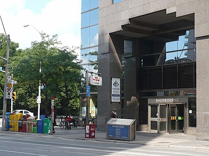
The station has the following entrances: Glen Rd and Bloor St E
The first line to this station is KI, at 8:04 AM, and the last line is KI at 1:55 AM.
429A Bloor St E, Toronto, ON, Canada
This station serves GO Transit’s lines
Popular routes from Sherbourne station, Toronto
- Sherbourne St at Bloor St East South Side - Sherbourne Stati,
- Bloor St East at Sherbourne St,
- Parliament St at Bloor St East
Bus stops near Sherbourne stop
- Carlton St at Sherbourne St
Streetcar station near Sherbourne station
- Wellesley,
- Castle Frank
Subway stations near Sherbourne station
- Yonge St. @ Garden Ave.,
- Dundas St. @ Hwy. 407 Park & Ride,
- Humber College Blvd S/Of Humberline Dr,
- Bayview Av / Redstone Rd,
- Eglinton Ave at Rangoon Rd Walkway,
- Tomken Rd at Timberlea Blvd,
- Otmh West Entrance,
- Hwy 407 Park And Ride,
- Main at Emerson,
- Elm Dr East Of Hurontario St,
- Huron / Fischer-Hallman,
- Bridgeport Rd. / Weber,
- Oshawa Go,
- 16th Av / Red Maple Rd,
- Victoria at Woodlawn Southbound,
- Martin Grove Rd / Highway 7,
- Edgeley Blvd / Langstaff Rd,
- Major Mackenzie Dr. E. @ Hwy. 404,
- Main St. N. @ 16th Ave.
Popular public transit stations in Toronto
Get around Toronto by public transit!
Traveling around Toronto has never been so easy. See step by step directions as you travel to any attraction, street or major public transit station. View bus and train schedules, arrival times, service alerts and detailed routes on a map, so you know exactly how to get to anywhere in Toronto.
When traveling to any destination around Toronto use Moovit's Live Directions with Get Off Notifications to know exactly where and how far to walk, how long to wait for your line, and how many stops are left. Moovit will alert you when it's time to get off — no need to constantly re-check whether yours is the next stop.
Wondering how to use public transit in Toronto or how to pay for public transit in Toronto? Moovit public transit app can help you navigate your way with public transit easily, and at minimum cost. It includes public transit fees, ticket prices, and costs. Looking for a map of Toronto public transit lines? Moovit public transit app shows all public transit maps in Toronto with all Bus, Train, Subway, Streetcar and Ferry routes and stops on an interactive map.
Toronto has 5 transit type(s), including: Bus, Train, Subway, Streetcar and Ferry, operated by several transit agencies, including TTC, Toronto Subway, Brampton Transit, MiWay, York Region Transit, GO Transit Bus, GO Transit, Durham Region Transit, UP Express, Grand River Transit, Guelph Transit, Hamilton Street Railway, Burlington Transit, Oakville Transit and pererborough