How to get to Sherman Kent School For Intelligence Analysis by bus?
Click on the bus route to see step by step directions with maps, line arrival times and updated time schedules.
From Sterling VA USA, Loudoun County
81 minFrom Freddie Mac, Fairfax County
69 minFrom Hilton McLean Tysons Corner, Fairfax County
86 minFrom Chantilly, VA, Fairfax County
59 minFrom Fair Oaks Mall, Fairfax County
52 minFrom Arabx Com Inc, Fairfax County
85 minFrom Navy Federal Credit Union, Fairfax County
86 minFrom Dulles Expo Center, Fairfax County
83 minFrom Fairfax County Government Center, Fairfax County
75 minFrom The Ritz-Carlton, Tysons Corner, Fairfax County
91 min
How to get to Sherman Kent School For Intelligence Analysis by metro?
Click on the metro route to see step by step directions with maps, line arrival times and updated time schedules.
Bus stops near Sherman Kent School For Intelligence Analysis in Fairfax County
Metro station near Sherman Kent School For Intelligence Analysis in Fairfax County
- Reston Town Center, 44 min walk,VIEW
Bus lines to Sherman Kent School For Intelligence Analysis in Fairfax County
- RIBS2, Ribs 2 Herndon Metro,VIEW
- 507, 507 Wiehle Metro,VIEW
- 951, 951 Innovation Center Metro,VIEW
- RIBS1, Ribs 1 Lake Anne - Reston Town Ctr,VIEW
- 557, 557 Reston South - Soapstone Rd,VIEW
- 558, 558 Center Harbor,VIEW
- 559, 559 Wiehle Metro,VIEW
- RIBS3, Ribs 3 Hunters Woods - Reston Town Ctr,VIEW
- 952, 952 Wiehle Metro,VIEW
- 552, 552 Wiehle Metro,VIEW
What are the closest stations to Sherman Kent School For Intelligence Analysis?
The closest stations to Sherman Kent School For Intelligence Analysis are:
- Sunrise Vly @ Campus Commons Dr W is 231 yards away, 3 min walk.
- Sunrise Valley Dr @ Centennial Park is 665 yards away, 8 min walk.
- Wiehle Metro Bay E is 1105 yards away, 14 min walk.
- Wiehle Metro Bay C is 1109 yards away, 14 min walk.
- Wiehle Metro Bay H is 1159 yards away, 14 min walk.
- Wiehle Metro Bay G is 1181 yards away, 15 min walk.
- Reston Town Center is 3707 yards away, 44 min walk.
Which bus lines stop near Sherman Kent School For Intelligence Analysis?
These bus lines stop near Sherman Kent School For Intelligence Analysis: 951, RIBS2.
Which metro line stops near Sherman Kent School For Intelligence Analysis?
SILVER (New Carrollton)
What’s the nearest bus station to Sherman Kent School For Intelligence Analysis in Fairfax County?
The nearest bus station to Sherman Kent School For Intelligence Analysis in Fairfax County is Sunrise Vly @ Campus Commons Dr W. It’s a 3 min walk away.
What time is the first metro to Sherman Kent School For Intelligence Analysis in Fairfax County?
The SILVER is the first metro that goes to Sherman Kent School For Intelligence Analysis in Fairfax County. It stops nearby at 5:00 AM.
What time is the last metro to Sherman Kent School For Intelligence Analysis in Fairfax County?
The SILVER is the last metro that goes to Sherman Kent School For Intelligence Analysis in Fairfax County. It stops nearby at 12:52 AM.
What time is the first bus to Sherman Kent School For Intelligence Analysis in Fairfax County?
The RIBS2 is the first bus that goes to Sherman Kent School For Intelligence Analysis in Fairfax County. It stops nearby at 4:42 AM.
What time is the last bus to Sherman Kent School For Intelligence Analysis in Fairfax County?
The RIBS1 is the last bus that goes to Sherman Kent School For Intelligence Analysis in Fairfax County. It stops nearby at 12:28 AM.
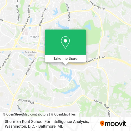
See Sherman Kent School For Intelligence Analysis, Fairfax County, on the map
Public Transit to Sherman Kent School For Intelligence Analysis in Fairfax County
Wondering how to get to Sherman Kent School For Intelligence Analysis in Fairfax County? Moovit helps you find the best way to get to Sherman Kent School For Intelligence Analysis with step-by-step directions from the nearest public transit station.
Moovit provides free maps and live directions to help you navigate through your city. View schedules, routes, timetables, and find out how long does it take to get to Sherman Kent School For Intelligence Analysis in real time.
Looking for the nearest stop or station to Sherman Kent School For Intelligence Analysis? Check out this list of stops closest to your destination: Sunrise Vly @ Campus Commons Dr W; Sunrise Valley Dr @ Centennial Park; Wiehle Metro Bay E; Wiehle Metro Bay C; Wiehle Metro Bay H; Wiehle Metro Bay G; Reston Town Center.
Bus: 951, RIBS2, 507, RIBS1, 557, 558, 559, RIBS3, 952.Metro: SILVER.
Want to see if there’s another route that gets you there at an earlier time? Moovit helps you find alternative routes or times. Get directions from and directions to Sherman Kent School For Intelligence Analysis easily from the Moovit App or Website.
We make riding to Sherman Kent School For Intelligence Analysis easy, which is why over 1.7 million users, including users in Fairfax County, trust Moovit as the best app for public transit. You don’t need to download an individual bus app or train app, Moovit is your all-in-one transit app that helps you find the best bus time or train time available.
For information on prices of bus and metro, costs and ride fares to Sherman Kent School For Intelligence Analysis, please check the Moovit app.
Use the app to navigate to popular places including to the airport, hospital, stadium, grocery store, mall, coffee shop, school, college, and university.
Location: Fairfax County, Washington, D.C. - Baltimore, MD
- Scs Engineers, Reston,
- Frank Schofield, Summit Realtors,
- Rebecca B Hall - Private Wealth Advisor, Ameriprise Financial Services, Llc,
- 9ciphers Llc,
- Vision III Imaging Inc.,
- U-Blox America, Inc.,
- Rushmypassport In Fedex Office,
- Bright Horizons at Commerce Metro Center,
- Emiline Day Spa,
- Hardwood Plywood Manufacturers,
- Heala Psychotherapy,
- Davio's - Reston Row,
- Blink,
- Silverback Strategies,
- Storybook Aba Therapy Virginia,
- Wiehle-Reston East Bus Station,
- Reston Station Dental,
- Iworks Corporation,
- Dr. Andrew Kochuba, Md Facs,
- Apexx Strategies Ltd.
Places Near Sherman Kent School For Intelligence Analysis (Fairfax County)
- Pennsylvania Ave NW (3rd st and pennsylvania), Washington,
- Warner Theatre, Washington,
- M&T Bank Stadium, Baltimore,
- National Zoo, Washington,
- Rock Creek Tennis Center, Washington,
- Georgetown, Washington,
- Westfield Montgomery Mall, Montgomery County,
- National Theatre, Washington,
- Sibley Memorial Hospital, Washington,
- National Museum of African American History and Culture, Washington,
- Camden Yards, Baltimore,
- Museum Of The Bible, Washington,
- Basilica of the National Shrine, Washington,
- Marriott Marquis Washington, DC, Washington,
- Washington National Cathedral, Washington,
- Washington DC VA Medical Center, Washington,
- Capital One Arena, Washington,
- PG Mall, Prince George's County,
- Amazon Hq2, Arlington County,
- The Anthem, Washington
How to get to popular places in Washington, D.C. - Baltimore, MD with public transit
Get around Fairfax County by public transit!
Traveling around Fairfax County has never been so easy. See step by step directions as you travel to any attraction, street or major public transit station. View bus and train schedules, arrival times, service alerts and detailed routes on a map, so you know exactly how to get to anywhere in Fairfax County.
When traveling to any destination around Fairfax County use Moovit's Live Directions with Get Off Notifications to know exactly where and how far to walk, how long to wait for your line, and how many stops are left. Moovit will alert you when it's time to get off — no need to constantly re-check whether yours is the next stop.
Wondering how to use public transit in Fairfax County or how to pay for public transit in Fairfax County? Moovit public transit app can help you navigate your way with public transit easily, and at minimum cost. It includes public transit fees, ticket prices, and costs. Looking for a map of Fairfax County public transit lines? Moovit public transit app shows all public transit maps in Fairfax County with all Bus, Train, Metro, Light Rail and Ferry routes and stops on an interactive map.
Washington, D.C. - Baltimore, MD has 5 transit type(s), including: Bus, Train, Metro, Light Rail and Ferry, operated by several transit agencies, including WMATA, Montgomery County Ride On, Fairfax Connector, TheBus, PRTC, DASH - Alexandria, Arlington Transit (ART), RTA of Central Maryland, MDOT MTA, MDOT MTA Light RailLink, MDOT MTA Commuter Bus, MDOT MTA Local Bus, FXBGO!, Virginia Railway Express (VRE) and MARC