How to get to Shirley Raquel da by bus?
Click on the bus route to see step by step directions with maps, line arrival times and updated time schedules.
From São João de Meriti, Nova Iguaçu
116 minFrom Cabuçu, Nova Iguaçu
149 minFrom Presídio Milton Dias - Japeri, Japeri
122 minFrom UFRRJ Nova Iguaçu, Nova Iguaçu
125 minFrom Seropédica, Seropédica
63 minFrom Miguel Pereira, Miguel Pereira
36 minFrom Vila De Cava, Nova Iguaçu
140 minFrom Hospital da Posse (HGNI), Nova Iguaçu
126 minFrom Sítio Primorosa, Nova Iguaçu
204 min
Bus stop near Shirley Raquel da in Miguel Pereira
- Rj-125, 6 min walk,VIEW
Bus lines to Shirley Raquel da in Miguel Pereira
- MP74, Japeri (Saída De Avelar),VIEW
What are the closest stations to Shirley Raquel da?
The closest stations to Shirley Raquel da are:
- Rj-125 is 469 meters away, 6 min walk.
Which bus lines stop near Shirley Raquel da?
These bus lines stop near Shirley Raquel da: MP11, MP74.
What’s the nearest bus station to Shirley Raquel da in Miguel Pereira?
The nearest bus station to Shirley Raquel da in Miguel Pereira is Rj-125. It’s a 6 min walk away.
What time is the first bus to Shirley Raquel da in Miguel Pereira?
The MP74 is the first bus that goes to Shirley Raquel da in Miguel Pereira. It stops nearby at 4:00 AM.
What time is the last bus to Shirley Raquel da in Miguel Pereira?
The MP74 is the last bus that goes to Shirley Raquel da in Miguel Pereira. It stops nearby at 11:26 PM.
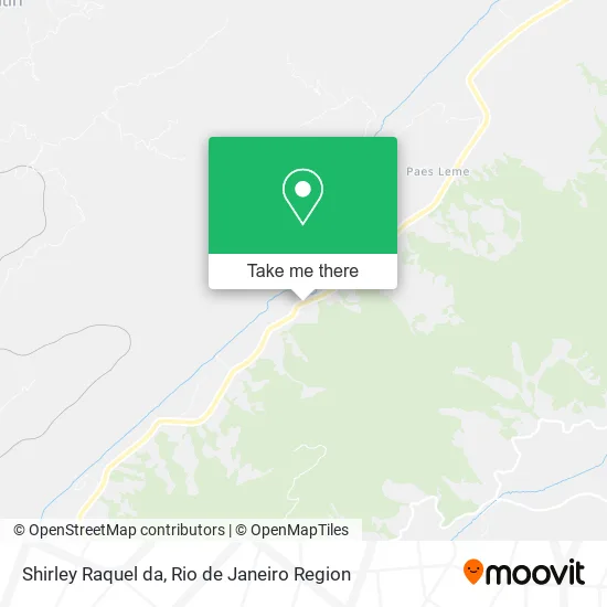
See Shirley Raquel da, Miguel Pereira, on the map
Public Transit to Shirley Raquel da in Miguel Pereira
Wondering how to get to Shirley Raquel da in Miguel Pereira? Moovit helps you find the best way to get to Shirley Raquel da with step-by-step directions from the nearest public transit station.
Moovit provides free maps and live directions to help you navigate through your city. View schedules, routes, timetables, and find out how long does it take to get to Shirley Raquel da in real time.
Looking for the nearest stop or station to Shirley Raquel da? Check out this list of stops closest to your destination: Rj-125.
Bus: MP11, MP74.
Want to see if there’s another route that gets you there at an earlier time? Moovit helps you find alternative routes or times. Get directions from and directions to Shirley Raquel da easily from the Moovit App or Website.
We make riding to Shirley Raquel da easy, which is why over 1.5 million users, including users in Miguel Pereira, trust Moovit as the best app for public transit. You don’t need to download an individual bus app or train app, Moovit is your all-in-one transit app that helps you find the best bus time or train time available.
For information on prices of bus and train, costs and ride fares to Shirley Raquel da, please check the Moovit app.
Use the app to navigate to popular places including to the airport, hospital, stadium, grocery store, mall, coffee shop, school, college, and university.
Shirley Raquel da Address: RJ-125, Paracambi-RJ 26600-000 street in Miguel Pereira
- Quislomtebes,
- Mariaaparecidado,
- Francisca,
- Estrada da Boa Esperança,
- Emanoelmarlondasi,
- Estrada dos Eucaliptos,
- Estrada Pedra Lisa, 343,
- Estrada Ary Schiavo,
- Roza Wall Pet's,
- Beira-Rio,
- Chacrinha,
- Campo do Pedra Lisa,
- Carlarodrigues,
- Kairos,
- Em Carlos Alberto Pereira dos Santos,
- Rua Antônio Schiavo,
- Rafamultimarcas,
- Ministério Fonte do Amor,
- Igreja Assembleia de Deus (CAMPO DE PARACAMBI),
- Comunidade Evangélica Cristã de Pedra Lisa
Places Near Shirley Raquel da (Miguel Pereira)
- Hospital Pedro Ernesto, Vila Isabel,
- Hospital Federal Do Andaraí, Andaraí,
- Rio De Janeiro,
- Rodoviária Novo Rio (Rodoviária do Rio de Janeiro), Santo Cristo,
- Praia do Arpoador, Ipanema,
- Rua Ulysses Guimarães 16, Cidade Nova,
- Feirão De Malhas, Duque De Caxias,
- Shopping Downtown, Barra Da Tijuca,
- Shopping Nova América, Del Castilho,
- Norte Shopping, Cachambi,
- Avenida Rio Branco, Centro,
- Hospital Federal Cardoso Fontes, Jacarepaguá,
- Rua Licínio Cardoso, São Francisco Xavier,
- Museu Do Amanhã, Centro,
- Niterói, Niterói,
- Feira Livre da Gloria, Glória,
- Hospital Municipal Ronaldo Gazolla, Acari,
- Shopping Rio Sul, Botafogo,
- Avenida Venezuela 134, Saúde,
- Shopping RioSul, Botafogo
How to get to popular places in Rio de Janeiro Region with public transit
Get around Miguel Pereira by public transit!
Traveling around Miguel Pereira has never been so easy. See step by step directions as you travel to any attraction, street or major public transit station. View bus and train schedules, arrival times, service alerts and detailed routes on a map, so you know exactly how to get to anywhere in Miguel Pereira.
When traveling to any destination around Miguel Pereira use Moovit's Live Directions with Get Off Notifications to know exactly where and how far to walk, how long to wait for your line, and how many stops are left. Moovit will alert you when it's time to get off — no need to constantly re-check whether yours is the next stop.
Wondering how to use public transit in Miguel Pereira or how to pay for public transit in Miguel Pereira? Moovit public transit app can help you navigate your way with public transit easily, and at minimum cost. It includes public transit fees, ticket prices, and costs. Looking for a map of Miguel Pereira public transit lines? Moovit public transit app shows all public transit maps in Miguel Pereira with all Bus, Train, Metro, Light Rail, Ferry, Cable Car, Gondola and Funicular routes and stops on an interactive map.
Rio de Janeiro Region has 8 transit type(s), including: Bus, Train, Metro, Light Rail, Ferry, Cable Car, Gondola and Funicular, operated by several transit agencies, including TrensRJ, Metrô Rio, VLT Carioca, Barcas Rio, BRT MOBI-Rio, Auto Viação Alpha, Auto Viação Tijuca, Gire Transportes, Transurb, Viação Nossa Senhora das Graças, Consórcio INTERSUL, Braso Lisboa (Municipal), Caprichosa Auto Ônibus, Auto Viação Três Amigos and Rodoviária Âncora Matias