Directions to Shockoe Slip Triangle (Richmond) with public transportation
The following transit lines have routes that pass near Shockoe Slip Triangle
 Bus: 1B, FLIXBUS N2471, FLIXBUS N2601, GREYHOUND US0670, 1A.
- Train: NORTHEAST REGIONAL.
How to get to Shockoe Slip Triangle by bus?
Click on the bus route to see step by step directions with maps, line arrival times and updated time schedules.
From Rose Gaming Resort, Prince William County
212 minFrom Hampton University, Hampton
287 minFrom Busch Gardens Williamsburg (Employee Parking Lot), James City County
134 minFrom Lorton, VA, Fairfax County
197 minFrom Potomac Mills Mall, Prince William County
187 minFrom Lorton, VA - Amtrak Auto Train Station (LOR), Fairfax County
202 minFrom UVA Hospital Medical Center, Charlottesville
297 minFrom Amazon Fulfillment Center-Ric3, Richmond
62 minFrom Woodbridge, VA, Prince William County
132 min
How to get to Shockoe Slip Triangle by train?
Click on the train route to see step by step directions with maps, line arrival times and updated time schedules.
Bus stops near Shockoe Slip Triangle in Richmond
Train station near Shockoe Slip Triangle in Richmond
- Pathrichmond Main Street Amtrak Station, 16 min walk,VIEW
Bus lines to Shockoe Slip Triangle in Richmond
- 1A, Midlothian/Hull/Transfer Station,VIEW
- 1B, Hull/Warwick Via Southside Plaza,VIEW
- 1C, Elkhart/Hull/Transfer Station,VIEW
- 14, Hermitage/Azalea,VIEW
- 29, 29x Gaskins Express(Hrc),VIEW
- 64, 64x Stony Point Express (Ric),VIEW
- 82, 82x Commonwealth 20 (Chf) Downtown (Chf),VIEW
- 95, 95x Richmond-Petersburg Express (Pbg),VIEW
- BRT, Main/Broad/Willow Lawn,VIEW
- GREYHOUND US0670, Raleigh Bus Station,VIEW
- GREYHOUND US0700, Charlotte Bus Station,VIEW
- FLIXBUS N2471, Atlanta Bus Station,VIEW
- FLIXBUS N2472, New York City Chinatown (28 Allen St),VIEW
- FLIXBUS N2601, Richmond (Main St Station Plaza),VIEW
- FLIXBUS 2605, New York Midtown (31st St & 8th Ave),VIEW
- FLIXBUS N2605, Brookline,VIEW
- 2A, Forest Hill/North Ave,VIEW
- 2B, Jahnke/Forest Hill/North Ave,VIEW
- 2C, Midlothian/Semmes/North Ave,VIEW
What are the closest stations to Shockoe Slip Triangle?
The closest stations to Shockoe Slip Triangle are:
- 14th + Dock is 215 yards away, 3 min walk.
- Main + 13th is 318 yards away, 4 min walk.
- Main Street Station Westbound Station is 492 yards away, 6 min walk.
- Richmond (Main St Station Plaza) is 566 yards away, 7 min walk.
- Pathrichmond Main Street Amtrak Station is 1306 yards away, 16 min walk.
- 9th + Byrd is 1434 yards away, 17 min walk.
Which bus lines stop near Shockoe Slip Triangle?
These bus lines stop near Shockoe Slip Triangle: 1B, FLIXBUS N2471, FLIXBUS N2601, GREYHOUND US0670.
Which train line stops near Shockoe Slip Triangle?
NORTHEAST REGIONAL (Newport News)
What’s the nearest train station to Shockoe Slip Triangle in Richmond?
The nearest train station to Shockoe Slip Triangle in Richmond is Pathrichmond Main Street Amtrak Station. It’s a 16 min walk away.
What’s the nearest bus station to Shockoe Slip Triangle in Richmond?
The nearest bus station to Shockoe Slip Triangle in Richmond is 14th + Dock. It’s a 3 min walk away.
What time is the first train to Shockoe Slip Triangle in Richmond?
The NORTHEAST REGIONAL is the first train that goes to Shockoe Slip Triangle in Richmond. It stops nearby at 5:19 AM.
What time is the last train to Shockoe Slip Triangle in Richmond?
The NORTHEAST REGIONAL is the last train that goes to Shockoe Slip Triangle in Richmond. It stops nearby at 6:52 PM.
What time is the first bus to Shockoe Slip Triangle in Richmond?
The GREYHOUND US0700 is the first bus that goes to Shockoe Slip Triangle in Richmond. It stops nearby at 3:35 AM.
What time is the last bus to Shockoe Slip Triangle in Richmond?
The GREYHOUND US0670 is the last bus that goes to Shockoe Slip Triangle in Richmond. It stops nearby at 2:10 PM.
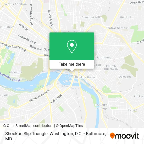
See Shockoe Slip Triangle, Richmond, on the map
Public Transit to Shockoe Slip Triangle in Richmond
Wondering how to get to Shockoe Slip Triangle in Richmond? Moovit helps you find the best way to get to Shockoe Slip Triangle with step-by-step directions from the nearest public transit station.
Moovit provides free maps and live directions to help you navigate through your city. View schedules, routes, timetables, and find out how long does it take to get to Shockoe Slip Triangle in real time.
Looking for the nearest stop or station to Shockoe Slip Triangle? Check out this list of stops closest to your destination: 14th + Dock; Main + 13th; Main Street Station Westbound Station; Richmond (Main St Station Plaza); Pathrichmond Main Street Amtrak Station; 9th + Byrd.
Bus: 1B, FLIXBUS N2471, FLIXBUS N2601, GREYHOUND US0670, 1A, 1C, 14, 29, 64, 82, 95, BRT, GREYHOUND US0700, FLIXBUS N2472.Train: NORTHEAST REGIONAL.
Want to see if there’s another route that gets you there at an earlier time? Moovit helps you find alternative routes or times. Get directions from and directions to Shockoe Slip Triangle easily from the Moovit App or Website.
We make riding to Shockoe Slip Triangle easy, which is why over 1.5 million users, including users in Richmond, trust Moovit as the best app for public transit. You don’t need to download an individual bus app or train app, Moovit is your all-in-one transit app that helps you find the best bus time or train time available.
For information on prices of bus and train, costs and ride fares to Shockoe Slip Triangle, please check the Moovit app.
Use the app to navigate to popular places including to the airport, hospital, stadium, grocery store, mall, coffee shop, school, college, and university.
Shockoe Slip Triangle Address: E Canal St Richmond, VA 23219 street in Richmond
- Heliumstudio,
- Mann Armistead & Epperson,
- Nationwide Retailers,
- Clachan Properties,
- Law Offices of Vincent L Robertson,
- Muriel Gellatly Travel,
- The Martin Agency,
- Martin Agency,
- Martin Local Led Generation,
- Hochheiser Ross C,
- Sit Happens Rva,
- Fiverr Work,
- Ross Hochheiser Design Group,
- Independent Appraisals and Consultants,
- Interactive Financial Acceptance,
- Comfort Medical Supply - Fredericksburg, VA,
- Morgan Fountain,
- Shockoe Espresso & Roastery,
- Streamline Metrics,
- Charles Ryan Associates
Places Near Shockoe Slip Triangle (Richmond)
- The Anthem, Washington,
- Rock Creek Tennis Center, Washington,
- National Zoo, Washington,
- Westfield Montgomery Mall, Montgomery County,
- Sibley Memorial Hospital, Washington,
- M&T Bank Stadium, Baltimore,
- Amazon Hq2, Arlington County,
- Capital One Arena, Washington,
- Basilica of the National Shrine, Washington,
- Museum Of The Bible, Washington,
- Pennsylvania Ave NW (3rd st and pennsylvania), Washington,
- Georgetown, Washington,
- Washington DC VA Medical Center, Washington,
- PG Mall, Prince George's County,
- Washington National Cathedral, Washington,
- National Museum of African American History and Culture, Washington,
- Camden Yards, Baltimore,
- National Theatre, Washington,
- Marriott Marquis Washington, DC, Washington,
- Warner Theatre, Washington
How to get to popular places in Washington, D.C. - Baltimore, MD with public transit
Get around Richmond by public transit!
Traveling around Richmond has never been so easy. See step by step directions as you travel to any attraction, street or major public transit station. View bus and train schedules, arrival times, service alerts and detailed routes on a map, so you know exactly how to get to anywhere in Richmond.
When traveling to any destination around Richmond use Moovit's Live Directions with Get Off Notifications to know exactly where and how far to walk, how long to wait for your line, and how many stops are left. Moovit will alert you when it's time to get off — no need to constantly re-check whether yours is the next stop.
Wondering how to use public transit in Richmond or how to pay for public transit in Richmond? Moovit public transit app can help you navigate your way with public transit easily, and at minimum cost. It includes public transit fees, ticket prices, and costs. Looking for a map of Richmond public transit lines? Moovit public transit app shows all public transit maps in Richmond with all Bus, Train, Metro, Light Rail and Ferry routes and stops on an interactive map.
Washington, D.C. - Baltimore, MD has 5 transit type(s), including: Bus, Train, Metro, Light Rail and Ferry, operated by several transit agencies, including WMATA, Montgomery County Ride On, Fairfax Connector, TheBus, PRTC, DASH - Alexandria, Arlington Transit (ART), RTA of Central Maryland, MDOT MTA, MDOT MTA Light RailLink, MDOT MTA Commuter Bus, MDOT MTA Local Bus, FXBGO!, Virginia Railway Express (VRE) and MARC