Directions to Sholom Learning Center (Queens) with public transportation
The following transit lines have routes that pass near Sholom Learning Center
 Bus: Q10, Q54, Q80, QM18.
- Train: BABYLON BRANCH, FAR ROCKAWAY BRANCH, LONG BEACH BRANCH, CITY TERMINAL ZONE, HEMPSTEAD BRANCH.
- Subway: E, J, F, FX, Z.
How to get to Sholom Learning Center by bus?
Click on the bus route to see step by step directions with maps, line arrival times and updated time schedules.
From Jackson Ave, Queens
68 minFrom 31st St (astoria blvd & 31st street), Queens
84 minFrom Queens County Farm Museum, Queens
57 minFrom Knockdown Center, Queens
48 minFrom Ridgewood, NY, Queens
50 minFrom LaGuardia Community College, Queens
67 minFrom Queens Village, Queens
47 minFrom Astoria, Queens
83 min
How to get to Sholom Learning Center by train?
Click on the train route to see step by step directions with maps, line arrival times and updated time schedules.
How to get to Sholom Learning Center by subway?
Click on the subway route to see step by step directions with maps, line arrival times and updated time schedules.
Bus stops near Sholom Learning Center in Queens
Subway stations near Sholom Learning Center in Queens
Train station near Sholom Learning Center in Queens
- Kew Gardens, 17 min walk,VIEW
Bus lines to Sholom Learning Center in Queens
What are the closest stations to Sholom Learning Center?
The closest stations to Sholom Learning Center are:
- Lefferts Blvd/83 Av is 157 yards away, 3 min walk.
- Lefferts Blvd/Metropolitan Av is 197 yards away, 3 min walk.
- Briarwood is 231 yards away, 3 min walk.
- Metropolitan Av/Lefferts Blvd is 288 yards away, 4 min walk.
- 111 St is 363 yards away, 5 min walk.
- Park Ln South/Abingdon Rd is 571 yards away, 7 min walk.
- 121 St is 1195 yards away, 15 min walk.
- Kew Gardens is 1403 yards away, 17 min walk.
Which bus lines stop near Sholom Learning Center?
These bus lines stop near Sholom Learning Center: Q10, Q54, Q80.
Which train lines stop near Sholom Learning Center?
These train lines stop near Sholom Learning Center: BABYLON BRANCH, FAR ROCKAWAY BRANCH, LONG BEACH BRANCH.
Which subway lines stop near Sholom Learning Center?
These subway lines stop near Sholom Learning Center: E, J.
What’s the nearest subway station to Sholom Learning Center in Queens?
The nearest subway station to Sholom Learning Center in Queens is Briarwood. It’s a 3 min walk away.
What’s the nearest train station to Sholom Learning Center in Queens?
The nearest train station to Sholom Learning Center in Queens is Kew Gardens. It’s a 17 min walk away.
What’s the nearest bus station to Sholom Learning Center in Queens?
The nearest bus stations to Sholom Learning Center in Queens are Lefferts Blvd/83 Av and Lefferts Blvd/Metropolitan Av. The closest one is a 3 min walk away.
What time is the first subway to Sholom Learning Center in Queens?
The J is the first subway that goes to Sholom Learning Center in Queens. It stops nearby at 3:03 AM.
What time is the last subway to Sholom Learning Center in Queens?
The F is the last subway that goes to Sholom Learning Center in Queens. It stops nearby at 4:08 AM.
What time is the first train to Sholom Learning Center in Queens?
The BABYLON BRANCH is the first train that goes to Sholom Learning Center in Queens. It stops nearby at 3:02 AM.
What time is the last train to Sholom Learning Center in Queens?
The BABYLON BRANCH is the last train that goes to Sholom Learning Center in Queens. It stops nearby at 3:02 AM.
What time is the first bus to Sholom Learning Center in Queens?
The Q10 is the first bus that goes to Sholom Learning Center in Queens. It stops nearby at 3:01 AM.
What time is the last bus to Sholom Learning Center in Queens?
The Q54 is the last bus that goes to Sholom Learning Center in Queens. It stops nearby at 3:29 AM.
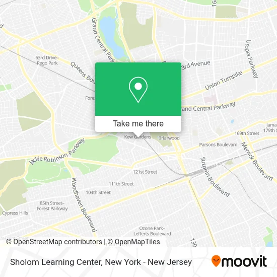
See Sholom Learning Center, Queens, on the map
Public Transit to Sholom Learning Center in Queens
Wondering how to get to Sholom Learning Center in Queens? Moovit helps you find the best way to get to Sholom Learning Center with step-by-step directions from the nearest public transit station.
Moovit provides free maps and live directions to help you navigate through your city. View schedules, routes, timetables, and find out how long does it take to get to Sholom Learning Center in real time.
Looking for the nearest stop or station to Sholom Learning Center? Check out this list of stops closest to your destination: Lefferts Blvd/83 Av; Lefferts Blvd/Metropolitan Av; Briarwood; Metropolitan Av/Lefferts Blvd; 111 St; Park Ln South/Abingdon Rd; 121 St; Kew Gardens.
Bus: Q10, Q54, Q80, QM18.Train: BABYLON BRANCH, FAR ROCKAWAY BRANCH, LONG BEACH BRANCH, CITY TERMINAL ZONE, HEMPSTEAD BRANCH.Subway: E, J, F, FX, Z.
Want to see if there’s another route that gets you there at an earlier time? Moovit helps you find alternative routes or times. Get directions from and directions to Sholom Learning Center easily from the Moovit App or Website.
We make riding to Sholom Learning Center easy, which is why over 1.5 million users, including users in Queens, trust Moovit as the best app for public transit. You don’t need to download an individual bus app or train app, Moovit is your all-in-one transit app that helps you find the best bus time or train time available.
For information on prices of bus, subway and train, costs and ride fares to Sholom Learning Center, please check the Moovit app.
Use the app to navigate to popular places including to the airport, hospital, stadium, grocery store, mall, coffee shop, school, college, and university.
Sholom Learning Center Address: 84-15 Beverly Rd street in Queens
- Yael Shanee,
- Sasha's Of Kew Gardens,
- Ladina Wig Studio,
- Prime Realty,
- Edna Davoudi,
- Prestige Cuts & Styles,
- Medical Waste Pros,
- Real Estate by Yael Shanee - Prime Realty Queens,
- Prime Realty,
- Kew Gardens Pharmacy Apteka,
- Selfie Style Salon,
- Last Call Bar,
- Spotitusa: Strategic Professionals Outsourcing Talent & Innovative Trends,
- Dj Floral Designs,
- Western Union,
- Keyme Locksmiths,
- Champions Martial Arts,
- Shoe Care Services,
- Beverly Hills Salon and Spa,
- Tzvi Meltzer: Allstate Insurance
Places Near Sholom Learning Center (Queens)
- 26 Federal Plaza, Manhattan,
- 3 Stone St, Manhattan,
- qqqq, Manhattan,
- 911 Memorial, Manhattan,
- Pier 83, Manhattan,
- Hudson Yards, Manhattan,
- 111 Centre New York City Supreme Court, Manhattan,
- 376 Hudson Street, Manhattan,
- Queens Center Mall, Queens,
- Chinatown, Manhattan,
- SoHo, Manhattan,
- Katz's Deli, Manhattan,
- Mountainside Hospital, Glen Ridge,
- Times Square, Manhattan,
- Rockefeller Center, Manhattan,
- Bellevue Hospital, Manhattan,
- 1 Police Plaza, Manhattan,
- 66 John Street, Manhattan,
- Wall Street, Manhattan,
- San Gennaro Feast, Manhattan
How to get to popular places in New York - New Jersey with public transit
Get around Queens by public transit!
Traveling around Queens has never been so easy. See step by step directions as you travel to any attraction, street or major public transit station. View bus and train schedules, arrival times, service alerts and detailed routes on a map, so you know exactly how to get to anywhere in Queens.
When traveling to any destination around Queens use Moovit's Live Directions with Get Off Notifications to know exactly where and how far to walk, how long to wait for your line, and how many stops are left. Moovit will alert you when it's time to get off — no need to constantly re-check whether yours is the next stop.
Wondering how to use public transit in Queens or how to pay for public transit in Queens? Moovit public transit app can help you navigate your way with public transit easily, and at minimum cost. It includes public transit fees, ticket prices, and costs. Looking for a map of Queens public transit lines? Moovit public transit app shows all public transit maps in Queens with all Bus, Train, Subway, Light Rail, Ferry and Cable Car routes and stops on an interactive map.
New York - New Jersey has 6 transit type(s), including: Bus, Train, Subway, Light Rail, Ferry and Cable Car, operated by several transit agencies, including MTA Subway, Metro-North Railroad, LIRR, PATH, MTA New York City Transit - Express routes, MTA Bus, NJ Transit, NYC Ferry, NICE bus, Bee-Line Bus, NJ Transit Rail, Norwalk Transit District, Hartford Line, River Valley Transit and HART