How to get to Shop Merrily by bus?
Click on the bus route to see step by step directions with maps, line arrival times and updated time schedules.
From National Reconnaissance Office, Fairfax County
53 minFrom King Spa, Loudoun County
147 minFrom Oakton, Virginia, Fairfax County
73 minFrom Inova Fair Oaks Hospital, Fairfax County
53 minFrom Amazon Iad28, Fairfax County
95 minFrom Fairfax County Government Center, Fairfax County
38 minFrom Manassas, VA, Manassas
242 minFrom EagleBank Arena, Fairfax County
70 min
Bus stops near Shop Merrily in Fairfax County
Bus lines to Shop Merrily in Fairfax County
What are the closest stations to Shop Merrily?
The closest stations to Shop Merrily are:
- Little Rocky Run Cir @ Rockdale Ct is 378 yards away, 6 min walk.
- Rt 29 @ Pickwick Rd is 448 yards away, 6 min walk.
Which bus lines stop near Shop Merrily?
These bus lines stop near Shop Merrily: 610, 630, 660, 901.
What’s the nearest bus station to Shop Merrily in Fairfax County?
The nearest bus stations to Shop Merrily in Fairfax County are Little Rocky Run Cir @ Rockdale Ct and Rt 29 @ Pickwick Rd. The closest one is a 6 min walk away.
What time is the first bus to Shop Merrily in Fairfax County?
The 630 is the first bus that goes to Shop Merrily in Fairfax County. It stops nearby at 5:28 AM.
What time is the last bus to Shop Merrily in Fairfax County?
The 630 is the last bus that goes to Shop Merrily in Fairfax County. It stops nearby at 11:31 PM.
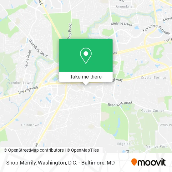
See Shop Merrily, Fairfax County, on the map
Public Transit to Shop Merrily in Fairfax County
Wondering how to get to Shop Merrily in Fairfax County? Moovit helps you find the best way to get to Shop Merrily with step-by-step directions from the nearest public transit station.
Moovit provides free maps and live directions to help you navigate through your city. View schedules, routes, timetables, and find out how long does it take to get to Shop Merrily in real time.
Looking for the nearest stop or station to Shop Merrily? Check out this list of stops closest to your destination: Little Rocky Run Cir @ Rockdale Ct; Rt 29 @ Pickwick Rd.
Bus: 610, 630, 660, 901.
Want to see if there’s another route that gets you there at an earlier time? Moovit helps you find alternative routes or times. Get directions from and directions to Shop Merrily easily from the Moovit App or Website.
We make riding to Shop Merrily easy, which is why over 1.5 million users, including users in Fairfax County, trust Moovit as the best app for public transit. You don’t need to download an individual bus app or train app, Moovit is your all-in-one transit app that helps you find the best bus time or train time available.
For information on prices of bus, metro and train, costs and ride fares to Shop Merrily, please check the Moovit app.
Use the app to navigate to popular places including to the airport, hospital, stadium, grocery store, mall, coffee shop, school, college, and university.
Shop Merrily Address: 13701 Winding Oak Cir Centreville, VA 20121 street in Fairfax County
- Step by Step Remodeling,
- It's Haul Good,
- Sō Korean Barbeque (So Korean BBQ),
- WNB Factory,
- Box Up Packaging,
- Hair 2 Cut,
- Tiger Sugar,
- Locksmith for Home Safe,
- American Lock & Key,
- AMF,
- Daebal House3,
- Amazing Nails Centreville,
- Cafe Bdan,
- Southern Baptist Convention,
- PNC Mortgage,
- Centreville VA,
- Centreville Chiropractor,
- Coinstar,
- Seoul Gool Dae Gee,
- Exxon
Places Near Shop Merrily (Fairfax County)
- National Zoo, Washington,
- National Mall, Washington,
- Basilica of the National Shrine, Washington,
- Amazon Hq2, Arlington County,
- Westfield Montgomery Mall, Montgomery County,
- Warner Theatre, Washington,
- Marriott Marquis Washington, DC, Washington,
- Georgetown, Washington,
- Washington National Cathedral, Washington,
- National Museum of African American History and Culture, Washington,
- PG Mall, Prince George's County,
- The Anthem, Washington,
- Sibley Memorial Hospital, Washington,
- Pennsylvania Ave NW (3rd st and pennsylvania), Washington,
- M&T Bank Stadium, Baltimore,
- Camden Yards, Baltimore,
- Museum Of The Bible, Washington,
- Washington DC VA Medical Center, Washington,
- Rock Creek Tennis Center, Washington,
- Capital One Arena, Washington
How to get to popular places in Washington, D.C. - Baltimore, MD with public transit
Get around Fairfax County by public transit!
Traveling around Fairfax County has never been so easy. See step by step directions as you travel to any attraction, street or major public transit station. View bus and train schedules, arrival times, service alerts and detailed routes on a map, so you know exactly how to get to anywhere in Fairfax County.
When traveling to any destination around Fairfax County use Moovit's Live Directions with Get Off Notifications to know exactly where and how far to walk, how long to wait for your line, and how many stops are left. Moovit will alert you when it's time to get off — no need to constantly re-check whether yours is the next stop.
Wondering how to use public transit in Fairfax County or how to pay for public transit in Fairfax County? Moovit public transit app can help you navigate your way with public transit easily, and at minimum cost. It includes public transit fees, ticket prices, and costs. Looking for a map of Fairfax County public transit lines? Moovit public transit app shows all public transit maps in Fairfax County with all Bus, Train, Metro, Light Rail and Ferry routes and stops on an interactive map.
Washington, D.C. - Baltimore, MD has 5 transit type(s), including: Bus, Train, Metro, Light Rail and Ferry, operated by several transit agencies, including WMATA, Montgomery County Ride On, Fairfax Connector, TheBus, PRTC, DASH - Alexandria, Arlington Transit (ART), RTA of Central Maryland, MDOT MTA, MDOT MTA Light RailLink, MDOT MTA Commuter Bus, MDOT MTA Local Bus, FXBGO!, Virginia Railway Express (VRE) and MARC