How to get to Shoplogistics Gsp by train?
Click on the train route to see step by step directions with maps, line arrival times and updated time schedules.
Bus stops near Shoplogistics Gsp in Weinheim
Train station near Shoplogistics Gsp in Weinheim
- Weinheim, Hauptbahnhof, 9 min walk,VIEW
Bus lines to Shoplogistics Gsp in Weinheim
- 631, Weinheim, Hauptbahnhof,VIEW
- 6903, Weinheim, Hauptbahnhof,VIEW
- 632, Hohensachsen, Anetplatz,VIEW
- 632A, Weinheim, Hauptbahnhof,VIEW
- 6904, Weinheim, Dürreplatz,VIEW
- 635, Weinheim, D.-Bonhoeffer-Schule,VIEW
- 680, Wald-Michelbach, Alter Bahnhof - Weinheim, Hauptbahnhof Bstg 6,VIEW
- 689, Weinheim, Hauptbahnhof Bstg 7 - Fürth, Bahnhof,VIEW
- 633, Weinheim, Hauptbahnhof Bstg 2 - Weinheim, Hauptbahnhof Bstg 2,VIEW
- 634, Weinheim, Hauptbahnhof Bstg 3 - Weinheim, Hauptbahnhof Bstg 3,VIEW
- 681, Gras-Ellenbach, Im Erzfeld - Weinheim, Hauptbahnhof Bstg 6,VIEW
- 682, Weinheim, Hauptbahnhof Bstg 7 - Weinheim, Hauptbahnhof Bstg 4,VIEW
- 6900, Ritschweier - Weinheim, Hauptbahnhof Bstg 1,VIEW
- 6901, Weinheim, Dürreplatz - Wünschmichelbach, Lindenhof,VIEW
- 6902, Weinheim, Dürreplatz - Weinheim, Waidsee / Miramar,VIEW
- RB67, Frankfurt (Main) Hauptbahnhof - Mannheim, Hauptbahnhof,VIEW
- RB68, Frankfurt (Main) Hauptbahnhof - Heidelberg, Hauptbahnhof,VIEW
- RB69, Weinheim, Hauptbahnhof Bstg 6 - Fürth, Bahnhof,VIEW
- RE60, Frankfurt (Main) Hauptbahnhof - Mannheim, Hauptbahnhof,VIEW
- RNV 5, Weinheim, Alter OEG-Bahnhof - Weinheim, Alter OEG-Bahnhof,VIEW
What are the closest stations to Shoplogistics Gsp?
The closest stations to Shoplogistics Gsp are:
- Weinheim, Hirschkopfstraße is 163 meters away, 3 min walk.
- Weinheim, Einkaufsmärkte/Nordst. is 248 meters away, 4 min walk.
- Weinheim, Friedrichschule is 395 meters away, 6 min walk.
- Weinheim, Petersplatz is 593 meters away, 8 min walk.
- Weinheim, Hauptbahnhof is 632 meters away, 9 min walk.
Which bus line stops near Shoplogistics Gsp?
632A (Hemsbach, Wiesensee)
Which train lines stop near Shoplogistics Gsp?
These train lines stop near Shoplogistics Gsp: RB68, RE60.
Which light rail line stops near Shoplogistics Gsp?
RNV 5 (Weinheim, Alter Oeg-Bahnhof)
What’s the nearest train station to Shoplogistics Gsp in Weinheim?
The nearest train station to Shoplogistics Gsp in Weinheim is Weinheim, Hauptbahnhof. It’s a 9 min walk away.
What’s the nearest bus station to Shoplogistics Gsp in Weinheim?
The nearest bus station to Shoplogistics Gsp in Weinheim is Weinheim, Hirschkopfstraße. It’s a 3 min walk away.
What time is the first light rail to Shoplogistics Gsp in Weinheim?
The RNV 5 is the first light rail that goes to Shoplogistics Gsp in Weinheim. It stops nearby at 4:39 AM.
What time is the last light rail to Shoplogistics Gsp in Weinheim?
The RNV 5 is the last light rail that goes to Shoplogistics Gsp in Weinheim. It stops nearby at 1:17 AM.
What time is the first train to Shoplogistics Gsp in Weinheim?
The RB68 is the first train that goes to Shoplogistics Gsp in Weinheim. It stops nearby at 4:45 AM.
What time is the last train to Shoplogistics Gsp in Weinheim?
The RB68 is the last train that goes to Shoplogistics Gsp in Weinheim. It stops nearby at 1:09 AM.
What time is the first bus to Shoplogistics Gsp in Weinheim?
The 682 is the first bus that goes to Shoplogistics Gsp in Weinheim. It stops nearby at 4:02 AM.
What time is the last bus to Shoplogistics Gsp in Weinheim?
The 6901 is the last bus that goes to Shoplogistics Gsp in Weinheim. It stops nearby at 1:55 AM.
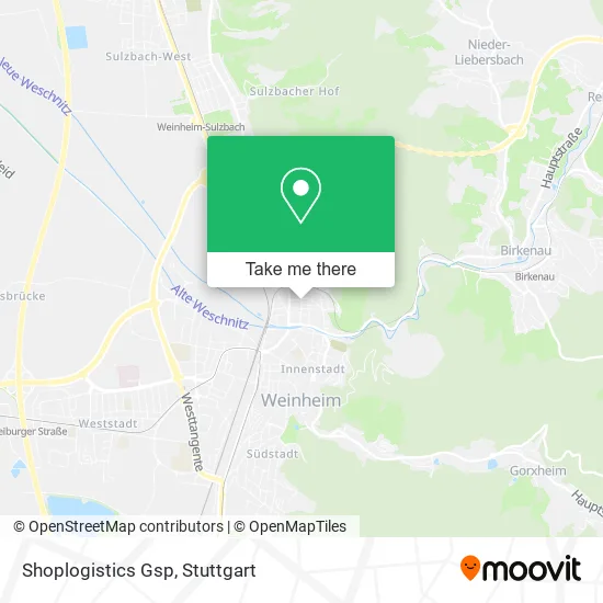
See Shoplogistics Gsp, Weinheim, on the map
Public Transit to Shoplogistics Gsp in Weinheim
Wondering how to get to Shoplogistics Gsp in Weinheim? Moovit helps you find the best way to get to Shoplogistics Gsp with step-by-step directions from the nearest public transit station.
Moovit provides free maps and live directions to help you navigate through your city. View schedules, routes, timetables, and find out how long does it take to get to Shoplogistics Gsp in real time.
Looking for the nearest stop or station to Shoplogistics Gsp? Check out this list of stops closest to your destination: Weinheim, Hirschkopfstraße; Weinheim, Einkaufsmärkte/Nordst.; Weinheim, Friedrichschule; Weinheim, Petersplatz; Weinheim, Hauptbahnhof.
Bus: 632A, 631, 6903, 632, 6904, 635, 680, 689.Train: RB68, RE60, RB67, RB69.Light Rail: RNV 5.
Want to see if there’s another route that gets you there at an earlier time? Moovit helps you find alternative routes or times. Get directions from and directions to Shoplogistics Gsp easily from the Moovit App or Website.
We make riding to Shoplogistics Gsp easy, which is why over 1.7 million users, including users in Weinheim, trust Moovit as the best app for public transit. You don’t need to download an individual bus app or train app, Moovit is your all-in-one transit app that helps you find the best bus time or train time available.
For information on prices of train, light rail and bus, costs and ride fares to Shoplogistics Gsp, please check the Moovit app.
Use the app to navigate to popular places including to the airport, hospital, stadium, grocery store, mall, coffee shop, school, college, and university.
Shoplogistics Gsp Address: Johannisstraße 22 69469 Weinheim street in Weinheim
- FA-Log GmbH & Co.,
- Mobile Maßagepraxis Petra Weingut,
- Mierswa Lutz,
- Kraus Elektro,
- Kadel Dienstleistungen,
- Hair & Beauty Jenny Knauer,
- Wilhelm Kreis,
- Autopflege-Service Inh. W. Kreis,
- Daniela Norgel Frisörteam,
- Gärtner Helmut Polstertechnik Raumausstattung Polsterei,
- Delphi Coaching,
- Helmut Gärtner,
- Wolfgang Kuhn,
- Werner Knapp, Sanitäre Anlagen Inhaber Wolfgang Kuhn,
- Fliesen Pflästerer,
- Engineering-System,
- Evangel. Kindergarten,
- Liebenzeller Gemeinde,
- Tierpietät Weinheim,
- Kindergarten Schatzinsel
Places Near Shoplogistics Gsp (Weinheim)
- Im Wizemann (Halle), Bad Cannstatt,
- Porsche Museum, Zuffenhausen,
- Porsche-Arena, Bad Cannstatt,
- Klinikum Stuttgart - Katharinenhospital, Stuttgart-Mitte,
- Mercedes-Benz Museum, Bad Cannstatt,
- Marmorsaal Im Weissenburgpark, Stuttgart-Süd,
- Hanns-Martin-Schleyer-Halle (Stuttgart Hans-Martin-Schleyerhalle), Bad Cannstatt,
- Hauptbahnhof Stuttgart, Stuttgart-Mitte,
- FlixBus Haltestelle, Stuttgart,
- Pariser Platz Stuttgart, Stuttgart-Mitte,
- Mercedes-Benz Museum (Mercedes Museum Stuttgart), Bad Cannstatt,
- Hanns-Martin-Schleyer-Halle, Bad Cannstatt,
- Gasometer Pforzheim, Pforzheim,
- Schleyerhalle, Bad Cannstatt,
- SI-Centrum, Möhringen,
- Gleis 101/102 (tief), Stuttgart-Mitte,
- Geilhaus Haus 33a, Reutlingen-Betzingen,
- Waldfriedhof, Degerloch,
- Wilhelma (U-Bahn Wilhelma), Bad Cannstatt,
- Mettingen Eros-Center Puff Laufhaus, Esslingen Am Neckar
How to get to popular places in Stuttgart with public transit
Get around Weinheim by public transit!
Traveling around Weinheim has never been so easy. See step by step directions as you travel to any attraction, street or major public transit station. View bus and train schedules, arrival times, service alerts and detailed routes on a map, so you know exactly how to get to anywhere in Weinheim.
When traveling to any destination around Weinheim use Moovit's Live Directions with Get Off Notifications to know exactly where and how far to walk, how long to wait for your line, and how many stops are left. Moovit will alert you when it's time to get off — no need to constantly re-check whether yours is the next stop.
Wondering how to use public transit in Weinheim or how to pay for public transit in Weinheim? Moovit public transit app can help you navigate your way with public transit easily, and at minimum cost. It includes public transit fees, ticket prices, and costs. Looking for a map of Weinheim public transit lines? Moovit public transit app shows all public transit maps in Weinheim with all Bus, Train, Subway, Light Rail, Ferry, S-Bahn and Funicular routes and stops on an interactive map.
Stuttgart has 7 transit type(s), including: Bus, Train, Subway, Light Rail, Ferry, S-Bahn and Funicular, operated by several transit agencies, including SSB - Stadtbahn, SSB, SSB - Seilbahn / Zacke, S-Bahn Stuttgart, Rhein-Neckar-Verkehr GmbH (rnv), Karlsruher Verkehrsverbund, DB AG, DB Regiobus BW, Arverio Baden-Württemberg GmbH, DB RegioNetz Verkehrs GmbH Westfrankenbahn, DB Regio AG Baden-Württemberg, Südwestdeutsche Verkehrs-AG, DB Regio AG Mitte Region Hessen, DB and Bodensee-Oberschwaben-Bahn