Bus stop near Shorestop 204 in Northampton County
- Citadel Of Nassawadox, 15 min walk,VIEW
Bus lines to Shorestop 204 in Northampton County
- David F Jones Dr,
- Barbershop Swag and Beauty Salon LLC,
- Exmore Village Apartments II,
- Young's Pressure Washing,
- Coastal Cleaning Services,
- Bayside Cleaning Services,
- Assurance Electric,
- Barge Point,
- Eastville Station,
- Revel Island Bay,
- Hog Island,
- Revel Island Cove,
- Quinby Inlet,
- Stingaree Point Cove,
- Swash Bay,
- Little Beach,
- Bulls Head,
- Nature Conservancy Bird And Wildlife Observation Station,
- Bulls Head,
- Wachapreague Volunteer Fire Company
Places Near Shorestop 204 (Northampton County)
- Museum Of The Bible, Washington,
- Capital One Arena, Washington,
- Marriott Marquis Washington, DC, Washington,
- Basilica of the National Shrine, Washington,
- Sibley Memorial Hospital, Washington,
- Westfield Montgomery Mall, Montgomery County,
- Rock Creek Tennis Center, Washington,
- Warner Theatre, Washington,
- National Museum of African American History and Culture, Washington,
- M&T Bank Stadium, Baltimore,
- Washington National Cathedral, Washington,
- National Theatre, Washington,
- Amazon Hq2, Arlington County,
- Camden Yards, Baltimore,
- The Anthem, Washington,
- National Zoo, Washington,
- Washington DC VA Medical Center, Washington,
- PG Mall, Prince George's County,
- Pennsylvania Ave NW (3rd st and pennsylvania), Washington,
- Georgetown, Washington
How to get to popular places in Washington, D.C. - Baltimore, MD with public transit
What are the closest stations to Shorestop 204?
The closest stations to Shorestop 204 are:
- Citadel Of Nassawadox is 1275 yards away, 15 min walk.
What’s the nearest bus station to Shorestop 204 in Northampton County?
The nearest bus station to Shorestop 204 in Northampton County is Citadel Of Nassawadox. It’s a 15 min walk away.
What time is the first bus to Shorestop 204 in Northampton County?
The RED is the first bus that goes to Shorestop 204 in Northampton County. It stops nearby at 6:47 AM.
What time is the last bus to Shorestop 204 in Northampton County?
The PURPLE is the last bus that goes to Shorestop 204 in Northampton County. It stops nearby at 5:21 PM.
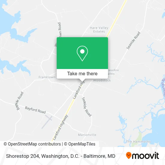
See Shorestop 204, Northampton County, on the map
Public Transit to Shorestop 204 in Northampton County
Wondering how to get to Shorestop 204 in Northampton County? Moovit helps you find the best way to get to Shorestop 204 with step-by-step directions from the nearest public transit station.
Moovit provides free maps and live directions to help you navigate through your city. View schedules, routes, timetables, and find out how long does it take to get to Shorestop 204 in real time.
Looking for the nearest stop or station to Shorestop 204? Check out this list of stops closest to your destination: Citadel Of Nassawadox.
Want to see if there’s another route that gets you there at an earlier time? Moovit helps you find alternative routes or times. Get directions from and directions to Shorestop 204 easily from the Moovit App or Website.
We make riding to Shorestop 204 easy, which is why over 1.7 million users, including users in Northampton County, trust Moovit as the best app for public transit. You don’t need to download an individual bus app or train app, Moovit is your all-in-one transit app that helps you find the best bus time or train time available.
Use the app to navigate to popular places including to the airport, hospital, stadium, grocery store, mall, coffee shop, school, college, and university.
Shorestop 204 Address: 7410 LANKFORD HWY street in Northampton County
Get around Northampton County by public transit!
Traveling around Northampton County has never been so easy. See step by step directions as you travel to any attraction, street or major public transit station. View bus and train schedules, arrival times, service alerts and detailed routes on a map, so you know exactly how to get to anywhere in Northampton County.
When traveling to any destination around Northampton County use Moovit's Live Directions with Get Off Notifications to know exactly where and how far to walk, how long to wait for your line, and how many stops are left. Moovit will alert you when it's time to get off — no need to constantly re-check whether yours is the next stop.
Wondering how to use public transit in Northampton County or how to pay for public transit in Northampton County? Moovit public transit app can help you navigate your way with public transit easily, and at minimum cost. It includes public transit fees, ticket prices, and costs. Looking for a map of Northampton County public transit lines? Moovit public transit app shows all public transit maps in Northampton County with all Bus, Train, Metro, Light Rail and Ferry routes and stops on an interactive map.
Washington, D.C. - Baltimore, MD has 5 transit type(s), including: Bus, Train, Metro, Light Rail and Ferry, operated by several transit agencies, including WMATA, Montgomery County Ride On, Fairfax Connector, TheBus, PRTC, DASH - Alexandria, Arlington Transit (ART), RTA of Central Maryland, MDOT MTA, MDOT MTA Light RailLink, MDOT MTA Commuter Bus, MDOT MTA Local Bus, FXBGO!, Virginia Railway Express (VRE) and MARC