Directions to Shortax & Multiservices (Queens) with public transportation
The following transit lines have routes that pass near Shortax & Multiservices
 Bus: Q1, Q25, Q31, Q44-SBS, Q54.
- Train: CITY TERMINAL ZONE, FAR ROCKAWAY BRANCH, LONG BEACH BRANCH, PORT JEFFERSON BRANCH, AIRTRAIN.
- Subway: E, J, F, FX, Z.
How to get to Shortax & Multiservices by bus?
Click on the bus route to see step by step directions with maps, line arrival times and updated time schedules.
From The Shops At Atlas Park, Queens
35 minFrom Woodside, Queens
64 minFrom Long Island Jewish Hospital, Queens
55 minFrom Costco, Queens
39 minFrom Hobby Lobby, Queens
67 minFrom Belmont Park, Elmont
65 minFrom College Point, NY, Queens
62 minFrom Northwell - Long Island Jewish Medical Center, Queens
55 minFrom Bayside, Queens
52 min
How to get to Shortax & Multiservices by train?
Click on the train route to see step by step directions with maps, line arrival times and updated time schedules.
How to get to Shortax & Multiservices by subway?
Click on the subway route to see step by step directions with maps, line arrival times and updated time schedules.
Bus stops near Shortax & Multiservices in Queens
- Jamaica Av/147 Pl, 2 min walk,VIEW
- Jamaica Av/Sutphin Blvd, 3 min walk,VIEW
- Sutphin Blvd/Jamaica Av, 3 min walk,VIEW
- Sutphin Blvd /Jamaica Av, 3 min walk,VIEW
- Jamaica Av/Sutphin Bl, 3 min walk,VIEW
- Sutphin Blvd/Archer Av, 3 min walk,VIEW
- 150 St/Jamaica Av, 3 min walk,VIEW
- Archer Av/Sutphin Blvd, 3 min walk,VIEW
- Sutphin Blvd/91 Av, 3 min walk,VIEW
Subway stations near Shortax & Multiservices in Queens
Train station near Shortax & Multiservices in Queens
- Jamaica, 32 min walk,VIEW
Bus lines to Shortax & Multiservices in Queens
- Q54, Willamsburg Bridge Plaza,VIEW
- Q56, Broadway Junction Via Jamaica Av,VIEW
- Q1, Bellerose 243 St Via Hillside Av,VIEW
- Q43, Rush Floral Park 268 St Via Hillside Av,VIEW
- Q44-SBS, Select Bus Jamaica Via Main St,VIEW
- Q40, Rush Jamaica Hillside Av,VIEW
- Q30, Little Neck - Jamaica,VIEW
- Q31, Bayside - Jamaica,VIEW
- Q75, Jamaica - QCC,VIEW
- Q9, Rush South Ozone Park,VIEW
- Q8, Jamaica Bus Terminal Via 101 Av,VIEW
- Q41, Jamaica Bus Terminal,VIEW
- Q83, Cambria Heights 227 St,VIEW
- Q20, Jamaica Merrick Blvd,VIEW
- Q24, Jamaica Parsons-Hillside,VIEW
- Q60, Jamaica LIRR Via Queens Bl,VIEW
What are the closest stations to Shortax & Multiservices?
The closest stations to Shortax & Multiservices are:
- Jamaica Av/147 Pl is 77 yards away, 2 min walk.
- Jamaica Av/Sutphin Blvd is 155 yards away, 3 min walk.
- Sutphin Blvd/Jamaica Av is 156 yards away, 3 min walk.
- Sutphin Blvd /Jamaica Av is 170 yards away, 3 min walk.
- Jamaica Av/Sutphin Bl is 209 yards away, 3 min walk.
- Sutphin Blvd/Archer Av is 222 yards away, 3 min walk.
- 150 St/Jamaica Av is 225 yards away, 3 min walk.
- Archer Av/Sutphin Blvd is 227 yards away, 3 min walk.
- Sutphin Blvd/91 Av is 229 yards away, 3 min walk.
- Parsons Blvd is 1757 yards away, 21 min walk.
- Jamaica is 2644 yards away, 32 min walk.
- Sutphin Blvd-Archer Av-Jfk Airport is 2811 yards away, 34 min walk.
Which bus lines stop near Shortax & Multiservices?
These bus lines stop near Shortax & Multiservices: Q1, Q25, Q31, Q44-SBS, Q54, Q60, Q8.
Which train lines stop near Shortax & Multiservices?
These train lines stop near Shortax & Multiservices: CITY TERMINAL ZONE, FAR ROCKAWAY BRANCH, LONG BEACH BRANCH, PORT JEFFERSON BRANCH.
Which subway lines stop near Shortax & Multiservices?
These subway lines stop near Shortax & Multiservices: E, J.
What’s the nearest subway station to Shortax & Multiservices in Queens?
The nearest subway station to Shortax & Multiservices in Queens is Parsons Blvd. It’s a 21 min walk away.
What’s the nearest bus station to Shortax & Multiservices in Queens?
The nearest bus station to Shortax & Multiservices in Queens is Jamaica Av/147 Pl. It’s a 2 min walk away.
What time is the first light rail to Shortax & Multiservices in Queens?
The AIRTRAIN is the first light rail that goes to Shortax & Multiservices in Queens. It stops nearby at 3:00 AM.
What time is the last light rail to Shortax & Multiservices in Queens?
The AIRTRAIN is the last light rail that goes to Shortax & Multiservices in Queens. It stops nearby at 3:06 AM.
What time is the first subway to Shortax & Multiservices in Queens?
The F is the first subway that goes to Shortax & Multiservices in Queens. It stops nearby at 3:00 AM.
What time is the last subway to Shortax & Multiservices in Queens?
The F is the last subway that goes to Shortax & Multiservices in Queens. It stops nearby at 4:19 AM.
What time is the first train to Shortax & Multiservices in Queens?
The BABYLON BRANCH is the first train that goes to Shortax & Multiservices in Queens. It stops nearby at 3:07 AM.
What time is the last train to Shortax & Multiservices in Queens?
The BABYLON BRANCH is the last train that goes to Shortax & Multiservices in Queens. It stops nearby at 3:07 AM.
What time is the first bus to Shortax & Multiservices in Queens?
The Q56 is the first bus that goes to Shortax & Multiservices in Queens. It stops nearby at 3:06 AM.
What time is the last bus to Shortax & Multiservices in Queens?
The Q44-SBS is the last bus that goes to Shortax & Multiservices in Queens. It stops nearby at 3:45 AM.
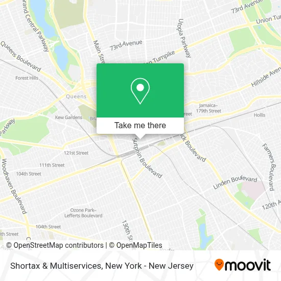
See Shortax & Multiservices, Queens, on the map
Public Transit to Shortax & Multiservices in Queens
Wondering how to get to Shortax & Multiservices in Queens? Moovit helps you find the best way to get to Shortax & Multiservices with step-by-step directions from the nearest public transit station.
Moovit provides free maps and live directions to help you navigate through your city. View schedules, routes, timetables, and find out how long does it take to get to Shortax & Multiservices in real time.
Looking for the nearest stop or station to Shortax & Multiservices? Check out this list of stops closest to your destination: Jamaica Av/147 Pl; Jamaica Av/Sutphin Blvd; Sutphin Blvd/Jamaica Av; Sutphin Blvd /Jamaica Av; Jamaica Av/Sutphin Bl; Sutphin Blvd/Archer Av; 150 St/Jamaica Av; Archer Av/Sutphin Blvd; Sutphin Blvd/91 Av; Parsons Blvd; Jamaica; Sutphin Blvd-Archer Av-Jfk Airport.
Bus: Q1, Q25, Q31, Q44-SBS, Q54, Q60, Q8, Q56, Q43.Train: CITY TERMINAL ZONE, FAR ROCKAWAY BRANCH, LONG BEACH BRANCH, PORT JEFFERSON BRANCH, AIRTRAIN, BABYLON BRANCH, HEMPSTEAD BRANCH.Subway: E, J, F, FX, Z.
Want to see if there’s another route that gets you there at an earlier time? Moovit helps you find alternative routes or times. Get directions from and directions to Shortax & Multiservices easily from the Moovit App or Website.
We make riding to Shortax & Multiservices easy, which is why over 1.5 million users, including users in Queens, trust Moovit as the best app for public transit. You don’t need to download an individual bus app or train app, Moovit is your all-in-one transit app that helps you find the best bus time or train time available.
For information on prices of bus, subway and train, costs and ride fares to Shortax & Multiservices, please check the Moovit app.
Use the app to navigate to popular places including to the airport, hospital, stadium, grocery store, mall, coffee shop, school, college, and university.
Shortax & Multiservices Address: 90-41 148th St street in Queens
- Botánica Tierra Sagrada,
- El Rinconcito Catracho,
- Digital Eye NY Corporation,
- Alex's Barber Shop,
- New York Corner,
- Jamaica Physical Therapy and Occupational Therapy,
- Gregory Stein - Jamaica,
- LB Gifts & Lamps,
- Khloe Natural Hair Products and Supplies,
- 148 St Jamaica Ave,
- Cell Phone Repair,
- Petland Discounts -Sutphin Boulevard,
- 92-13 147th Pl,
- Callistus E. Uwakwe,
- Tmf Moving Solutions,
- Recovery Center - Queens,
- Allen School Of Health Sciences,
- Key Food Supermarket,
- Cpr Cell Phone Repair Jamaica,
- Special Touch Home Care Services
Places Near Shortax & Multiservices (Queens)
- 3 Stone St, Manhattan,
- San Gennaro Feast, Manhattan,
- Pier 83, Manhattan,
- SoHo, Manhattan,
- Rockefeller Center, Manhattan,
- Katz's Deli, Manhattan,
- 66 John Street, Manhattan,
- 111 Centre New York City Supreme Court, Manhattan,
- Hudson Yards, Manhattan,
- Wall Street, Manhattan,
- 911 Memorial, Manhattan,
- Bellevue Hospital, Manhattan,
- Mountainside Hospital, Glen Ridge,
- Chinatown, Manhattan,
- 1 Police Plaza, Manhattan,
- 26 Federal Plaza, Manhattan,
- 376 Hudson Street, Manhattan,
- Times Square, Manhattan,
- Queens Center Mall, Queens,
- qqqq, Manhattan
How to get to popular places in New York - New Jersey with public transit
Get around Queens by public transit!
Traveling around Queens has never been so easy. See step by step directions as you travel to any attraction, street or major public transit station. View bus and train schedules, arrival times, service alerts and detailed routes on a map, so you know exactly how to get to anywhere in Queens.
When traveling to any destination around Queens use Moovit's Live Directions with Get Off Notifications to know exactly where and how far to walk, how long to wait for your line, and how many stops are left. Moovit will alert you when it's time to get off — no need to constantly re-check whether yours is the next stop.
Wondering how to use public transit in Queens or how to pay for public transit in Queens? Moovit public transit app can help you navigate your way with public transit easily, and at minimum cost. It includes public transit fees, ticket prices, and costs. Looking for a map of Queens public transit lines? Moovit public transit app shows all public transit maps in Queens with all Bus, Train, Subway, Light Rail, Ferry and Cable Car routes and stops on an interactive map.
New York - New Jersey has 6 transit type(s), including: Bus, Train, Subway, Light Rail, Ferry and Cable Car, operated by several transit agencies, including MTA Subway, Metro-North Railroad, LIRR, PATH, MTA New York City Transit - Express routes, MTA Bus, NJ Transit, NYC Ferry, NICE bus, Bee-Line Bus, NJ Transit Rail, Norwalk Transit District, Hartford Line, River Valley Transit and HART