How to get to Shout Mouse Press by bus?
Click on the bus route to see step by step directions with maps, line arrival times and updated time schedules.
From U.S. Naval Research Laboratory - NRL, Washington
100 minFrom St Elizabeths Hospital, Washington
74 minFrom Navy Yard, Washington
44 minFrom I-295 Exit 1 - Naval Research Lab, Washington
73 minFrom The Ritz-Carlton Pentagon City, Arlington County
54 minFrom Northwestern High School, Prince George's County
87 minFrom State Dept Annex SA-15, Arlington County
68 minFrom Naval Research Lab, Washington
100 minFrom Comet Ping Pong, Washington
33 minFrom Wheaton Mall, Montgomery County
52 min
How to get to Shout Mouse Press by train?
Click on the train route to see step by step directions with maps, line arrival times and updated time schedules.
How to get to Shout Mouse Press by metro?
Click on the metro route to see step by step directions with maps, line arrival times and updated time schedules.
Bus stops near Shout Mouse Press in Washington
Metro stations near Shout Mouse Press in Washington
Bus lines to Shout Mouse Press in Washington
What are the closest stations to Shout Mouse Press?
The closest stations to Shout Mouse Press are:
- P St Nw+18 St NW is 153 yards away, 2 min walk.
- New Hampshire & Dupont Cir NW Sb is 240 yards away, 3 min walk.
- 16 St Nw+Corcoran St NW is 260 yards away, 4 min walk.
- 16th St & P St NW is 459 yards away, 6 min walk.
- 16th St & P St is 459 yards away, 6 min walk.
- Dupont Circle - Connecticut Ave. &Amp; Q St. NW is 709 yards away, 9 min walk.
- Mcpherson Sq Metro Station is 935 yards away, 12 min walk.
- U Street is 1632 yards away, 20 min walk.
Which bus lines stop near Shout Mouse Press?
These bus lines stop near Shout Mouse Press: C53, D50, D60, D6X, D70.
Which train line stops near Shout Mouse Press?
NORTHEAST REGIONAL (Boston)
Which metro lines stop near Shout Mouse Press?
These metro lines stop near Shout Mouse Press: RED, YELLOW.
What’s the nearest metro station to Shout Mouse Press in Washington?
The nearest metro station to Shout Mouse Press in Washington is Dupont Circle - Connecticut Ave. &Amp; Q St. NW. It’s a 9 min walk away.
What’s the nearest bus station to Shout Mouse Press in Washington?
The nearest bus station to Shout Mouse Press in Washington is P St Nw+18 St NW. It’s a 2 min walk away.
What time is the first metro to Shout Mouse Press in Washington?
The GREEN is the first metro that goes to Shout Mouse Press in Washington. It stops nearby at 5:18 AM.
What time is the last metro to Shout Mouse Press in Washington?
The GREEN is the last metro that goes to Shout Mouse Press in Washington. It stops nearby at 12:23 AM.
What time is the first bus to Shout Mouse Press in Washington?
The D60 is the first bus that goes to Shout Mouse Press in Washington. It stops nearby at 3:00 AM.
What time is the last bus to Shout Mouse Press in Washington?
The D60 is the last bus that goes to Shout Mouse Press in Washington. It stops nearby at 3:06 AM.
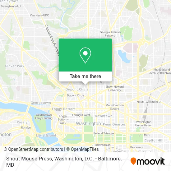
See Shout Mouse Press, Washington, on the map
Public Transit to Shout Mouse Press in Washington
Wondering how to get to Shout Mouse Press in Washington? Moovit helps you find the best way to get to Shout Mouse Press with step-by-step directions from the nearest public transit station.
Moovit provides free maps and live directions to help you navigate through your city. View schedules, routes, timetables, and find out how long does it take to get to Shout Mouse Press in real time.
Looking for the nearest stop or station to Shout Mouse Press? Check out this list of stops closest to your destination: P St Nw+18 St NW; New Hampshire & Dupont Cir NW Sb; 16 St Nw+Corcoran St NW; 16th St & P St NW; 16th St & P St; Dupont Circle - Connecticut Ave. &Amp; Q St. NW; Mcpherson Sq Metro Station; U Street.
Bus: C53, D50, D60, D6X, D70, C91, 305, 325.Train: NORTHEAST REGIONAL.Metro: RED, YELLOW, BLUE, ORANGE, SILVER, GREEN.
Want to see if there’s another route that gets you there at an earlier time? Moovit helps you find alternative routes or times. Get directions from and directions to Shout Mouse Press easily from the Moovit App or Website.
We make riding to Shout Mouse Press easy, which is why over 1.7 million users, including users in Washington, trust Moovit as the best app for public transit. You don’t need to download an individual bus app or train app, Moovit is your all-in-one transit app that helps you find the best bus time or train time available.
For information on prices of bus, metro and train, costs and ride fares to Shout Mouse Press, please check the Moovit app.
Use the app to navigate to popular places including to the airport, hospital, stadium, grocery store, mall, coffee shop, school, college, and university.
Shout Mouse Press Address: 1638 R St NW street in Washington
- Peabody Conservatory of the Johns Hopkins University,
- Floriana,
- Lyle Hotel,
- Lyle's,
- Hank's Oyster Bar,
- Lyle DC Washington,
- Trio's Fox & Hounds,
- Fox & Hounds Neighborhood Sports Bar (Fox and Hounds Lounge),
- Zeta Phi Beta Sorority Inc. International Headquarters,
- Agora,
- Embassy Of Nicaragua,
- Astoria DC,
- Astoria,
- House of the Temple,
- Theater J,
- Edlavitch Jewish Community Center Of Washington, D.C.,
- Duke's Grocery,
- Perry Belmont House,
- Embassy of Zimbabwe DC USA,
- Stead Park
Places Near Shout Mouse Press (Washington)
- Marriott Marquis Washington, DC, Washington,
- Rock Creek Tennis Center, Washington,
- Westfield Montgomery Mall, Montgomery County,
- National Theatre, Washington,
- Amazon Hq2, Arlington County,
- M&T Bank Stadium, Baltimore,
- Basilica of the National Shrine, Washington,
- Warner Theatre, Washington,
- National Museum of African American History and Culture, Washington,
- Washington National Cathedral, Washington,
- Camden Yards, Baltimore,
- Museum Of The Bible, Washington,
- Washington DC VA Medical Center, Washington,
- The Anthem, Washington,
- Capital One Arena, Washington,
- Sibley Memorial Hospital, Washington,
- Georgetown, Washington,
- National Zoo, Washington,
- Pennsylvania Ave NW (3rd st and pennsylvania), Washington,
- PG Mall, Prince George's County
How to get to popular places in Washington, D.C. - Baltimore, MD with public transit
Get around Washington by public transit!
Traveling around Washington has never been so easy. See step by step directions as you travel to any attraction, street or major public transit station. View bus and train schedules, arrival times, service alerts and detailed routes on a map, so you know exactly how to get to anywhere in Washington.
When traveling to any destination around Washington use Moovit's Live Directions with Get Off Notifications to know exactly where and how far to walk, how long to wait for your line, and how many stops are left. Moovit will alert you when it's time to get off — no need to constantly re-check whether yours is the next stop.
Wondering how to use public transit in Washington or how to pay for public transit in Washington? Moovit public transit app can help you navigate your way with public transit easily, and at minimum cost. It includes public transit fees, ticket prices, and costs. Looking for a map of Washington public transit lines? Moovit public transit app shows all public transit maps in Washington with all Bus, Train, Metro, Light Rail and Ferry routes and stops on an interactive map.
Washington, D.C. - Baltimore, MD has 5 transit type(s), including: Bus, Train, Metro, Light Rail and Ferry, operated by several transit agencies, including WMATA, Montgomery County Ride On, Fairfax Connector, TheBus, PRTC, DASH - Alexandria, Arlington Transit (ART), RTA of Central Maryland, MDOT MTA, MDOT MTA Light RailLink, MDOT MTA Commuter Bus, MDOT MTA Local Bus, FXBGO!, Virginia Railway Express (VRE) and MARC