Directions to Shred Nations (Fort Lauderdale) with public transportation
The following transit lines have routes that pass near Shred Nations
 Bus: 01, 40, 101.
- Ferry: WATER TROLLEY.
How to get to Shred Nations by bus?
Click on the bus route to see step by step directions with maps, line arrival times and updated time schedules.
From Memorial Regional Hospital, Hollywood
66 minFrom Cardinal Gibbons High School, Fort Lauderdale
71 minFrom Alligator Alley, Fort Lauderdale
57 minFrom Hollywood, Florida, Hollywood
66 minFrom Crystal River, Fort Lauderdale
65 minFrom Holy Cross Hospital, Fort Lauderdale
60 minFrom City of Oakland Park, Fort Lauderdale
44 minFrom Wilton Manors, Fort Lauderdale
46 minFrom I-95, Fort Lauderdale
62 minFrom 595 Express, Davie
85 min
Bus stops near Shred Nations in Fort Lauderdale
Ferry station near Shred Nations in Fort Lauderdale
- Smoker Park, 36 min walk,VIEW
Bus lines to Shred Nations in Fort Lauderdale
What are the closest stations to Shred Nations?
The closest stations to Shred Nations are:
- Southeast 17th Street/Cordova Road is 409 yards away, 5 min walk.
- US 1/Southeast 19th Street is 736 yards away, 9 min walk.
- Southeast 17th Street & US 1 is 1017 yards away, 12 min walk.
- Smoker Park is 3034 yards away, 36 min walk.
Which bus lines stop near Shred Nations?
These bus lines stop near Shred Nations: 01, 40.
What’s the nearest bus station to Shred Nations in Fort Lauderdale?
The nearest bus station to Shred Nations in Fort Lauderdale is Southeast 17th Street/Cordova Road. It’s a 5 min walk away.
What time is the first bus to Shred Nations in Fort Lauderdale?
The 101 is the first bus that goes to Shred Nations in Fort Lauderdale. It stops nearby at 4:49 AM.
What time is the last bus to Shred Nations in Fort Lauderdale?
The 01 is the last bus that goes to Shred Nations in Fort Lauderdale. It stops nearby at 12:20 AM.
What time is the first ferry to Shred Nations in Fort Lauderdale?
The WATER TROLLEY is the first ferry that goes to Shred Nations in Fort Lauderdale. It stops nearby at 10:00 AM.
What time is the last ferry to Shred Nations in Fort Lauderdale?
The WATER TROLLEY is the last ferry that goes to Shred Nations in Fort Lauderdale. It stops nearby at 10:20 PM.
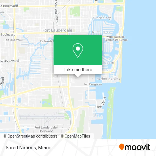
See Shred Nations, Fort Lauderdale, on the map
Public Transit to Shred Nations in Fort Lauderdale
Wondering how to get to Shred Nations in Fort Lauderdale? Moovit helps you find the best way to get to Shred Nations with step-by-step directions from the nearest public transit station.
Moovit provides free maps and live directions to help you navigate through your city. View schedules, routes, timetables, and find out how long does it take to get to Shred Nations in real time.
Looking for the nearest stop or station to Shred Nations? Check out this list of stops closest to your destination: Southeast 17th Street/Cordova Road; US 1/Southeast 19th Street; Southeast 17th Street & US 1; Smoker Park.
Bus: 01, 40, 101.Ferry: WATER TROLLEY.
Want to see if there’s another route that gets you there at an earlier time? Moovit helps you find alternative routes or times. Get directions from and directions to Shred Nations easily from the Moovit App or Website.
We make riding to Shred Nations easy, which is why over 1.5 million users, including users in Fort Lauderdale, trust Moovit as the best app for public transit. You don’t need to download an individual bus app or train app, Moovit is your all-in-one transit app that helps you find the best bus time or train time available.
For information on prices of bus, costs and ride fares to Shred Nations, please check the Moovit app.
Use the app to navigate to popular places including to the airport, hospital, stadium, grocery store, mall, coffee shop, school, college, and university.
Shred Nations Address: 1931 Cordova Rd Fort Lauderdale, FL 33316 street in Fort Lauderdale
- Angelena M Root,
- Tupelo,
- Appliance Repair Fort Lauderdale,
- Mighty Locksmith,
- Integrative Sports Medicines,
- ecco,
- Ritz Wireless,
- Poke Bros.,
- J.Balcazar Design Home & Yacht,
- Marcellas Fashion Boutique,
- Doughfellas,
- Hill Robinson Crew,
- Tvi Construction, Corp,
- Trebbi Custom Construction,
- Ocean Independence,
- Agua Salon Studios,
- Primary Residential Mortgage,
- Emsculpt Fort Lauderdale,
- Florida Yacht Brokers Association,
- Condos & Castles Real Estate
Places Near Shred Nations (Fort Lauderdale)
- Miami Freedom Park, Miami,
- Sawgrass mall ( FL ), Miami Beach,
- Miami VA Hospital, Miami,
- Hard Rock Stadium, Miami Gardens,
- Wynwood, Miami,
- Brickell City Centre, Miami,
- Miami Design District, Miami,
- Richard E. Gerstein Justice Building, Miami,
- Aventura Mall, Miami Beach,
- Little Havana, Miami,
- Dolphin Mall, Miami,
- Bayside Marketplace, Miami,
- Sawgrass Mall, Miami,
- Miami-Dade County Courthouse, Miami,
- Marlins Park, Miami,
- Keiser University Flagship Campus, West Palm Beach,
- Dolphin Mall Bus, Miami,
- Aventura Mall, Miami,
- Port of Miami Cruise Terminal, Miami,
- Zoo Miami, Miami
How to get to popular places in Miami with public transit
Get around Fort Lauderdale by public transit!
Traveling around Fort Lauderdale has never been so easy. See step by step directions as you travel to any attraction, street or major public transit station. View bus and train schedules, arrival times, service alerts and detailed routes on a map, so you know exactly how to get to anywhere in Fort Lauderdale.
When traveling to any destination around Fort Lauderdale use Moovit's Live Directions with Get Off Notifications to know exactly where and how far to walk, how long to wait for your line, and how many stops are left. Moovit will alert you when it's time to get off — no need to constantly re-check whether yours is the next stop.
Wondering how to use public transit in Fort Lauderdale or how to pay for public transit in Fort Lauderdale? Moovit public transit app can help you navigate your way with public transit easily, and at minimum cost. It includes public transit fees, ticket prices, and costs. Looking for a map of Fort Lauderdale public transit lines? Moovit public transit app shows all public transit maps in Fort Lauderdale with all Bus, Train, Light Rail and Ferry routes and stops on an interactive map.
Miami has 4 transit type(s), including: Bus, Train, Light Rail and Ferry, operated by several transit agencies, including Broward County Transit, Miami-Dade Transit, Metrorail, Palm Tran, Tri-Rail, Brightline, MARTY, City of Homestead Trolley, Key West Transit, Treasure Coast Connector, GoLine IRT, Amtrak, Greyhound-us, FlixBus-us and Aventura Express Shuttle Bus